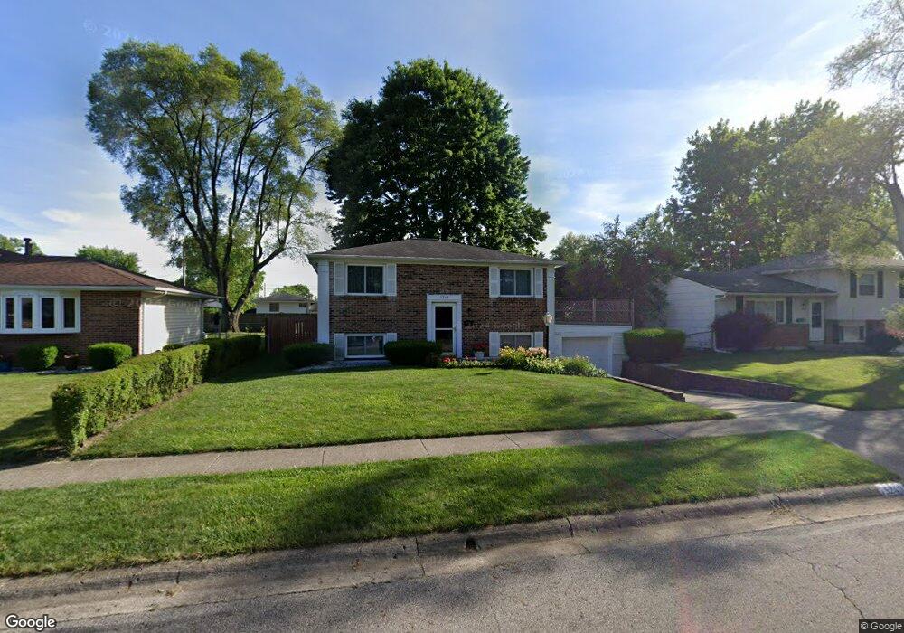
5249 Tuxworth Dr Columbus, OH 43232
East Columbus-White Ash NeighborhoodEstimated Value: $172,893 - $213,000
4
Beds
2
Baths
780
Sq Ft
$252/Sq Ft
Est. Value
About This Home
This home is located at 5249 Tuxworth Dr, Columbus, OH 43232 and is currently estimated at $196,473, approximately $251 per square foot. 5249 Tuxworth Dr is a home located in Franklin County with nearby schools including Groveport Madison High School, A+ Arts Academy, and Eastland Preparatory Academy.
Ownership History
Date
Name
Owned For
Owner Type
Purchase Details
Closed on
Mar 6, 1984
Bought by
Rose Lawrence E
Current Estimated Value
Purchase Details
Closed on
May 1, 1977
Create a Home Valuation Report for This Property
The Home Valuation Report is an in-depth analysis detailing your home's value as well as a comparison with similar homes in the area
Home Values in the Area
Average Home Value in this Area
Purchase History
| Date | Buyer | Sale Price | Title Company |
|---|---|---|---|
| Rose Lawrence E | -- | -- | |
| -- | $34,000 | -- |
Source: Public Records
Tax History Compared to Growth
Tax History
| Year | Tax Paid | Tax Assessment Tax Assessment Total Assessment is a certain percentage of the fair market value that is determined by local assessors to be the total taxable value of land and additions on the property. | Land | Improvement |
|---|---|---|---|---|
| 2024 | $2,529 | $62,030 | $16,280 | $45,750 |
| 2023 | $2,543 | $62,020 | $16,275 | $45,745 |
| 2022 | $1,462 | $32,800 | $6,060 | $26,740 |
| 2021 | $1,503 | $32,800 | $6,060 | $26,740 |
| 2020 | $1,507 | $32,800 | $6,060 | $26,740 |
| 2019 | $1,409 | $28,490 | $5,250 | $23,240 |
| 2018 | $1,316 | $28,490 | $5,250 | $23,240 |
| 2017 | $1,324 | $28,490 | $5,250 | $23,240 |
| 2016 | $1,220 | $23,940 | $3,920 | $20,020 |
| 2015 | $1,215 | $23,940 | $3,920 | $20,020 |
| 2014 | $1,100 | $23,940 | $3,920 | $20,020 |
| 2013 | $570 | $26,600 | $4,340 | $22,260 |
Source: Public Records
Map
Nearby Homes
- 5125 Upton Rd N
- 2998 Osgood Rd E
- 3000 Whitlow Rd
- 3246 Latonia Rd
- 2901 Renfro Rd
- 5373 Spire Ln
- 3387 Retriever Rd
- 5152 Burdett Dr
- 2900 Ronda Rd
- 5401 Spire Ln
- 5397 Jack Russell Way
- 4847 Amber Crossing Dr
- 4784 Nieles Edge Dr
- 4783 Nieles Edge Dr
- 5137 Holbrook Dr
- 5254 Sedalia Dr
- 4906 Refugee Rd
- 5377 Bleaker Ave
- 5522 Newport Ct
- 3289 Kady Ln
- 5261 Tuxworth Dr
- 5241 Tuxworth Dr
- 5233 Tuxworth Dr
- 5262 Sundale Place N
- 5270 Sundale Place N
- 5273 Tuxworth Dr
- 5278 Sundale Place N
- 5252 Tuxworth Dr
- 5225 Tuxworth Dr
- 5244 Tuxworth Dr
- 5281 Tuxworth Dr
- 5290 Sundale Place N
- 5264 Tuxworth Dr
- 3119 Sundale Place W
- 5236 Tuxworth Dr
- 5276 Tuxworth Dr
- 5300 Sundale Place N
- 5228 Tuxworth Dr
- 5293 Tuxworth Dr
- 5271 Sundale Place N