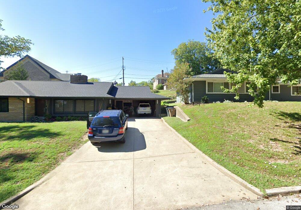
525 Alta Vista Dr Cape Girardeau, MO 63701
Estimated Value: $126,000 - $210,000
3
Beds
1
Bath
2,199
Sq Ft
$74/Sq Ft
Est. Value
About This Home
This home is located at 525 Alta Vista Dr, Cape Girardeau, MO 63701 and is currently estimated at $162,752, approximately $74 per square foot. 525 Alta Vista Dr is a home with nearby schools including Franklin Elementary School, Central Junior High School, and Central Middle School.
Ownership History
Date
Name
Owned For
Owner Type
Purchase Details
Closed on
Aug 20, 2007
Sold by
Federal Home Loan Mortgage Corporation
Bought by
Broach Jason M
Current Estimated Value
Home Financials for this Owner
Home Financials are based on the most recent Mortgage that was taken out on this home.
Original Mortgage
$34,200
Interest Rate
6.38%
Mortgage Type
New Conventional
Purchase Details
Closed on
Apr 19, 2007
Sold by
Martin John D and Martin Beth Ann
Bought by
Federal Home Loan Mortgage Corporation
Create a Home Valuation Report for This Property
The Home Valuation Report is an in-depth analysis detailing your home's value as well as a comparison with similar homes in the area
Home Values in the Area
Average Home Value in this Area
Purchase History
| Date | Buyer | Sale Price | Title Company |
|---|---|---|---|
| Broach Jason M | -- | None Available | |
| Federal Home Loan Mortgage Corporation | -- | None Available |
Source: Public Records
Mortgage History
| Date | Status | Borrower | Loan Amount |
|---|---|---|---|
| Previous Owner | Broach Jason M | $34,200 |
Source: Public Records
Tax History Compared to Growth
Tax History
| Year | Tax Paid | Tax Assessment Tax Assessment Total Assessment is a certain percentage of the fair market value that is determined by local assessors to be the total taxable value of land and additions on the property. | Land | Improvement |
|---|---|---|---|---|
| 2025 | $5 | $9,680 | $750 | $8,930 |
| 2024 | $5 | $9,220 | $720 | $8,500 |
| 2023 | $479 | $9,220 | $720 | $8,500 |
| 2022 | $442 | $8,500 | $660 | $7,840 |
| 2021 | $442 | $8,500 | $660 | $7,840 |
| 2020 | $443 | $8,500 | $660 | $7,840 |
| 2019 | $443 | $8,500 | $0 | $0 |
| 2018 | $442 | $8,500 | $0 | $0 |
| 2017 | $443 | $8,500 | $0 | $0 |
| 2016 | $441 | $8,500 | $0 | $0 |
| 2015 | $441 | $8,500 | $0 | $0 |
| 2014 | $444 | $8,500 | $0 | $0 |
Source: Public Records
Map
Nearby Homes
- 541 S Ellis St
- 631 S Benton St
- 1102 College St
- 701 S Benton St
- 718 Morgan Oak St
- 700 S Ellis St
- 327 S Hanover St
- 730 S Ellis St
- 530 S Frederick St Unit REAR
- 217 S Ellis St
- 803 William St
- 1317 Bloomfield Rd
- 926 William St
- 539 Asher St
- 431 S West End Blvd
- 128 S Pacific St
- 1114 William St
- 427 S Louisiana St
- 1506 Jefferson Ave
- 123 S Park Ave
- 525 S Pacific St
- 519 S Pacific St
- 531 S Pacific St
- 524 S Pacific St
- 535 S Pacific St
- 518 S Pacific St
- 539 S Pacific St
- 536 S Pacific St
- 909 Jefferson Ave
- 512 S Pacific St
- 915 Jefferson Ave
- 540 S Pacific St
- 543 S Pacific St
- 843 Jefferson Ave
- 518 S Benton St
- 925 Jefferson Ave
- 542 S Pacific St
- 530 S Pacific St
- 545 S Pacific St
- 526 S Benton St