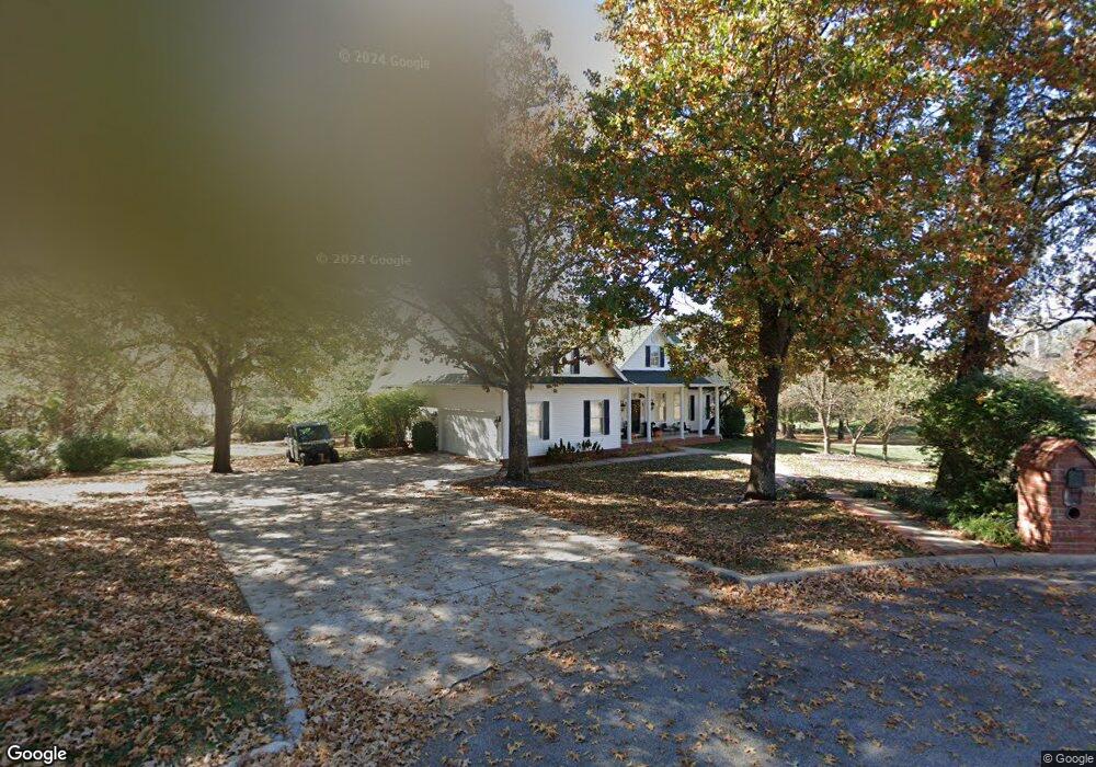
525 Bluebird Ln Lebanon, MO 65536
Estimated Value: $318,000 - $579,386
--
Bed
1
Bath
5,910
Sq Ft
$71/Sq Ft
Est. Value
About This Home
This home is located at 525 Bluebird Ln, Lebanon, MO 65536 and is currently estimated at $421,347, approximately $71 per square foot. 525 Bluebird Ln is a home located in Laclede County with nearby schools including Joe D. Esther Elementary School, Boswell Elementary School, and Maplecrest Elementary School.
Ownership History
Date
Name
Owned For
Owner Type
Purchase Details
Closed on
Dec 21, 2022
Sold by
Wilburn Tyler and Wilburn Tera
Bought by
Goforth Jeremy and Goforth Holly
Current Estimated Value
Purchase Details
Closed on
Dec 13, 2022
Sold by
Saint-Onge Jerilynn
Bought by
Jerilynn J Saint-Onge Trust
Purchase Details
Closed on
Jul 20, 2020
Sold by
Adkins Gilbert and Adkins Angela
Bought by
Wilburn Tyler and Wilburn Tera
Home Financials for this Owner
Home Financials are based on the most recent Mortgage that was taken out on this home.
Original Mortgage
$300,000
Interest Rate
3.2%
Mortgage Type
New Conventional
Purchase Details
Closed on
Oct 19, 2005
Sold by
Adkins Gilbert and Adkins Angela
Bought by
Bluebird Rentals Llc
Purchase Details
Closed on
Aug 24, 2005
Sold by
Samons Albert
Bought by
Adkins Gilbert and Adkins Angela
Create a Home Valuation Report for This Property
The Home Valuation Report is an in-depth analysis detailing your home's value as well as a comparison with similar homes in the area
Home Values in the Area
Average Home Value in this Area
Purchase History
| Date | Buyer | Sale Price | Title Company |
|---|---|---|---|
| Goforth Jeremy | -- | Land Title | |
| Jerilynn J Saint-Onge Trust | -- | -- | |
| Wilburn Tyler | -- | Hogan Land Title | |
| Bluebird Rentals Llc | -- | None Available | |
| Adkins Gilbert | -- | None Available |
Source: Public Records
Mortgage History
| Date | Status | Borrower | Loan Amount |
|---|---|---|---|
| Previous Owner | Wilburn Tyler | $300,000 | |
| Closed | Adkins Gilbert | $0 |
Source: Public Records
Tax History Compared to Growth
Tax History
| Year | Tax Paid | Tax Assessment Tax Assessment Total Assessment is a certain percentage of the fair market value that is determined by local assessors to be the total taxable value of land and additions on the property. | Land | Improvement |
|---|---|---|---|---|
| 2025 | -- | $0 | $0 | $0 |
| 2024 | -- | $0 | $0 | $0 |
| 2023 | $3,209 | $0 | $0 | $0 |
| 2022 | $3,209 | $58,630 | $0 | $0 |
| 2021 | $2,491 | $41,306 | $6,270 | $35,036 |
| 2020 | $2,503 | $41,306 | $6,270 | $35,036 |
| 2019 | $2,397 | $41,310 | $6,270 | $35,040 |
| 2018 | $2,250 | $41,310 | $6,270 | $35,040 |
| 2017 | $2,095 | $41,310 | $0 | $0 |
| 2016 | $2,095 | $41,310 | $0 | $0 |
| 2015 | $2,095 | $41,310 | $0 | $0 |
| 2014 | $2,095 | $40,550 | $0 | $0 |
| 2013 | -- | $40,550 | $0 | $0 |
Source: Public Records
Map
Nearby Homes
- 460 Sunset Dr
- 1250 N Jefferson Ave
- 376 Sunset Dr
- 175 Walser St
- 605 Hunters Creek Dr
- 274 Cornelison St
- 1491 Brice St
- 600 Hunters Creek Dr
- 105 S King St
- 100 S Bend Rd
- 708 Herndon Rd
- 116 Smith Rd
- 282 Brice St
- 18826 Highway 64
- 1520 Fairfield Dr
- 829 Lynn St
- 750 Lynn St
- 1075 Lynn St
- 218 S King St
- 791 N Adams Ave
- 525 Blue Bird Ln
- 0 Bluebird Unit 17079356
- 0 Bluebird Unit 17024623
- 0 Bluebird Unit MAR24032656
- 601 Bluebird Ln
- 409 Bluebird Ln
- 516 Bluebird Ln
- 609 Bluebird Ln
- 530 Bluebird Ln
- 540 Bluebird Ln
- 407 Bluebird Ln
- 410 Bluebird Ln
- 600 Bluebird Ln
- 617 Bluebird Ln
- 405 Bluebird Ln
- 406 Bluebird Ln
- 616 Bluebird Ln
- 403 Bluebird Ln
- 402 Bluebird Ln