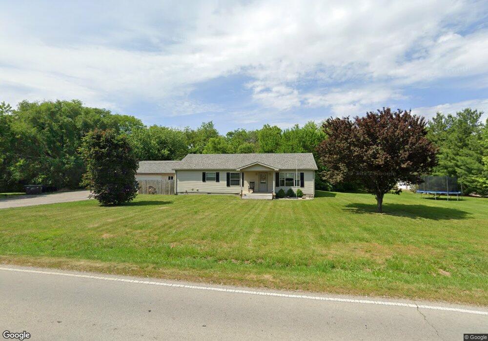
525 E Main St Westville, IL 61883
Estimated Value: $189,000 - $225,000
3
Beds
3
Baths
1,586
Sq Ft
$128/Sq Ft
Est. Value
About This Home
This home is located at 525 E Main St, Westville, IL 61883 and is currently estimated at $203,580, approximately $128 per square foot. 525 E Main St is a home located in Vermilion County with nearby schools including Judith Giacoma Elementary School, Westville Junior High School, and Westville High School.
Ownership History
Date
Name
Owned For
Owner Type
Purchase Details
Closed on
Aug 30, 2024
Sold by
Johnson Charles and Johnson Jamie
Bought by
Lyn M Ferinand Revocable Living Trust and Ferdinand
Current Estimated Value
Purchase Details
Closed on
Sep 22, 2022
Sold by
Johnson Charles
Bought by
Johnson Jamie
Home Financials for this Owner
Home Financials are based on the most recent Mortgage that was taken out on this home.
Original Mortgage
$133,895
Interest Rate
5.5%
Mortgage Type
New Conventional
Create a Home Valuation Report for This Property
The Home Valuation Report is an in-depth analysis detailing your home's value as well as a comparison with similar homes in the area
Home Values in the Area
Average Home Value in this Area
Purchase History
| Date | Buyer | Sale Price | Title Company |
|---|---|---|---|
| Lyn M Ferinand Revocable Living Trust | $176,000 | None Listed On Document | |
| Johnson Jamie | -- | None Listed On Document | |
| Johnson Jamie | $150,000 | None Listed On Document |
Source: Public Records
Mortgage History
| Date | Status | Borrower | Loan Amount |
|---|---|---|---|
| Previous Owner | Johnson Jamie | $133,895 |
Source: Public Records
Tax History Compared to Growth
Tax History
| Year | Tax Paid | Tax Assessment Tax Assessment Total Assessment is a certain percentage of the fair market value that is determined by local assessors to be the total taxable value of land and additions on the property. | Land | Improvement |
|---|---|---|---|---|
| 2024 | $3,985 | $56,858 | $10,800 | $46,058 |
| 2023 | $3,985 | $52,452 | $9,963 | $42,489 |
| 2022 | $3,570 | $43,957 | $9,448 | $34,509 |
| 2021 | $3,024 | $41,864 | $8,998 | $32,866 |
| 2020 | $2,879 | $39,495 | $8,489 | $31,006 |
| 2019 | $2,863 | $39,314 | $8,450 | $30,864 |
| 2018 | $2,770 | $37,984 | $8,164 | $29,820 |
| 2015 | $2,405 | $32,451 | $6,975 | $25,476 |
| 2014 | $2,405 | $33,674 | $7,238 | $26,436 |
| 2013 | $2,405 | $33,674 | $7,238 | $26,436 |
Source: Public Records
Map
Nearby Homes
- 130 N Jefferson St
- 141 Adams St
- 312 N State St
- 219 S West St
- 318 Pennsylvania Ave
- 216 S Scott St
- 125 Illinois Ave
- 216 Illinois Ave
- 224 Wisconsin Ave
- 202 Connecticut Ave
- 2507 S Georgetown Rd
- 11 Snyder Ave
- Lot 44 & 45 Clingan Ln
- 13835 N 1735 East Rd
- 13891 Murray Clark Rd
- 13368 Hawbuck Rd Unit B
- 1910 Adams St
- 1742 King St
- 1825 S Monroe St
- 900 Kingsdale Ave