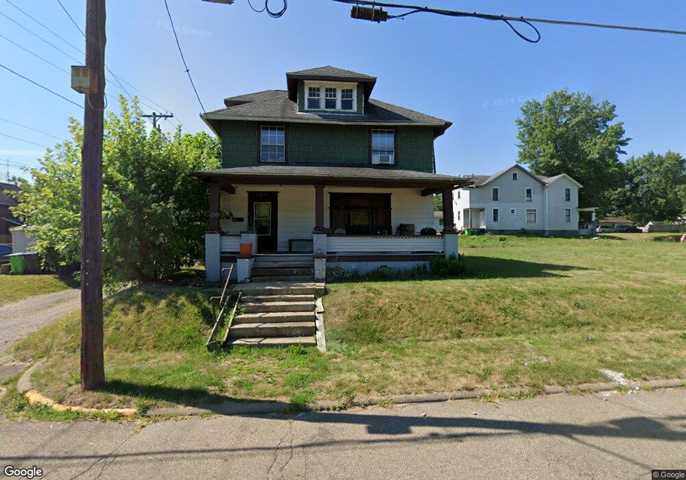
525 E Summit St Alliance, OH 44601
Estimated Value: $70,169 - $96,000
4
Beds
1
Bath
1,456
Sq Ft
$57/Sq Ft
Est. Value
About This Home
This home is located at 525 E Summit St, Alliance, OH 44601 and is currently estimated at $83,292, approximately $57 per square foot. 525 E Summit St is a home located in Stark County with nearby schools including Alliance Intermediate School at Northside, Alliance Elementary School at Rockhill, and Alliance Middle School.
Ownership History
Date
Name
Owned For
Owner Type
Purchase Details
Closed on
Jan 26, 2009
Sold by
Neos Properties Llc
Bought by
Schroeder Herbert T and Schroeder Hong T
Current Estimated Value
Purchase Details
Closed on
Feb 22, 2006
Sold by
Snow Lincoln L and Snow Alice F
Bought by
Neos Properties Llc and Thirty One Properties Ltd
Create a Home Valuation Report for This Property
The Home Valuation Report is an in-depth analysis detailing your home's value as well as a comparison with similar homes in the area
Home Values in the Area
Average Home Value in this Area
Purchase History
| Date | Buyer | Sale Price | Title Company |
|---|---|---|---|
| Schroeder Herbert T | $9,500 | Heritage Union Title Co Ltd | |
| Neos Properties Llc | $13,000 | Union Title Company |
Source: Public Records
Tax History Compared to Growth
Tax History
| Year | Tax Paid | Tax Assessment Tax Assessment Total Assessment is a certain percentage of the fair market value that is determined by local assessors to be the total taxable value of land and additions on the property. | Land | Improvement |
|---|---|---|---|---|
| 2025 | -- | $19,820 | $2,700 | $17,120 |
| 2024 | -- | $19,820 | $2,700 | $17,120 |
| 2023 | $381 | $9,250 | $1,370 | $7,880 |
| 2022 | $192 | $9,250 | $1,370 | $7,880 |
| 2021 | $384 | $9,250 | $1,370 | $7,880 |
| 2020 | $366 | $8,230 | $1,190 | $7,040 |
| 2019 | $361 | $8,230 | $1,190 | $7,040 |
| 2018 | $363 | $8,230 | $1,190 | $7,040 |
| 2017 | $317 | $7,070 | $980 | $6,090 |
| 2016 | $320 | $7,070 | $980 | $6,090 |
| 2015 | $323 | $7,070 | $980 | $6,090 |
| 2014 | $125 | $2,600 | $950 | $1,650 |
| 2013 | $62 | $2,600 | $950 | $1,650 |
Source: Public Records
Map
Nearby Homes
- 452 E Summit St
- 442 S Liberty Ave
- 1005 S Freedom Ave
- 432 S Linden Ave
- 814 Milner St
- V/L S Fredeom Ave
- 831 Wade Ave
- 1044 S Liberty Ave
- 1175 S Freedom Ave
- 356 E Broadway St
- 142 S Seneca Ave
- 551 South St
- 807 S Union Ave
- 361 E Main St
- 1395 S Webb Ave
- 427 S Union Ave
- 729 Waugh St
- 1233 Woodland Ave
- 1437 S Linden Ave
- 140 W Summit St
- 704 S Freedom Ave
- 536 E Summit St
- 716 S Freedom Ave
- 726 S Freedom Ave
- 546 E Summit St
- 686 S Freedom Ave
- 703 S Seneca Ave
- 724 S Freedom Ave
- 717 S Seneca Ave
- 550 E Summit St
- 674 S Freedom Ave
- 727 S Seneca Ave
- 736 S Freedom Ave
- 683 S Seneca Ave
- 519 Mcnally Ct
- 711 S Freedom Ave
- 737 S Seneca Ave
- 660 S Freedom Ave
- 750 S Freedom Ave
- 663 S Seneca Ave