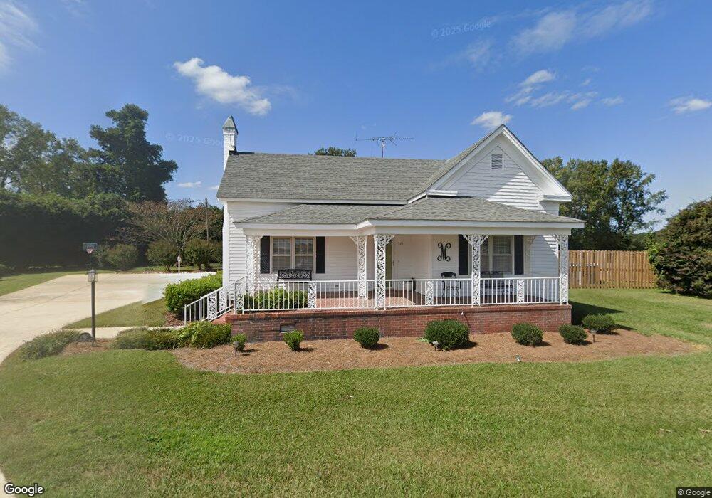
525 Matthis Rd Clinton, NC 28328
Estimated Value: $201,000 - $462,000
4
Beds
2
Baths
2,158
Sq Ft
$160/Sq Ft
Est. Value
About This Home
This home is located at 525 Matthis Rd, Clinton, NC 28328 and is currently estimated at $344,895, approximately $159 per square foot. 525 Matthis Rd is a home located in Sampson County with nearby schools including Langdon C. Kerr Elementary School, Butler Avenue Elementary School, and Sunset Avenue Elementary School.
Ownership History
Date
Name
Owned For
Owner Type
Purchase Details
Closed on
Oct 6, 2023
Sold by
Lee Joan M and Lee Marshall T
Bought by
Matthis Andy Stuart
Current Estimated Value
Home Financials for this Owner
Home Financials are based on the most recent Mortgage that was taken out on this home.
Original Mortgage
$235,000
Outstanding Balance
$229,570
Interest Rate
7.18%
Mortgage Type
Credit Line Revolving
Estimated Equity
$115,325
Purchase Details
Closed on
Jul 17, 2023
Sold by
William T Matthis Revocable Trust and Geneva K Matthis Revocable Trust
Bought by
Lee Joan M
Purchase Details
Closed on
May 15, 1959
Bought by
Matthis William Timothy
Create a Home Valuation Report for This Property
The Home Valuation Report is an in-depth analysis detailing your home's value as well as a comparison with similar homes in the area
Purchase History
| Date | Buyer | Sale Price | Title Company |
|---|---|---|---|
| Matthis Andy Stuart | $425,000 | None Listed On Document | |
| Lee Joan M | $225,000 | None Listed On Document | |
| Matthis William Timothy | -- | -- |
Source: Public Records
Mortgage History
| Date | Status | Borrower | Loan Amount |
|---|---|---|---|
| Open | Matthis Andy Stuart | $235,000 |
Source: Public Records
Tax History
| Year | Tax Paid | Tax Assessment Tax Assessment Total Assessment is a certain percentage of the fair market value that is determined by local assessors to be the total taxable value of land and additions on the property. | Land | Improvement |
|---|---|---|---|---|
| 2025 | $2,184 | $242,698 | $0 | $0 |
| 2024 | $1,990 | $242,698 | $0 | $0 |
| 2023 | $1,594 | $148,994 | $0 | $0 |
| 2022 | $1,594 | $148,994 | $0 | $0 |
| 2021 | $1,594 | $148,994 | $0 | $0 |
| 2020 | $1,594 | $148,994 | $0 | $0 |
| 2019 | $1,594 | $148,994 | $0 | $0 |
| 2018 | $1,310 | $122,461 | $0 | $0 |
| 2017 | $1,310 | $122,461 | $0 | $0 |
| 2016 | $1,316 | $122,461 | $0 | $0 |
| 2015 | $1,316 | $122,461 | $0 | $0 |
| 2014 | $1,310 | $122,461 | $0 | $0 |
Source: Public Records
Map
Nearby Homes
- 1782 Old Warsaw Rd
- 125 Cranberry Ln
- 115 Hunters Walk Ln
- 0 Moltonville Rd
- 0 Moltonville Rd Unit 100528117
- 97 Planters Walk Ln
- 1141 Faison Hwy
- 2173 Rowan Rd
- 2153 Rowan Rd
- 393 Moltonville Rd
- 0 Pugh Rd Unit 100511738
- 0 Pugh Rd
- 200 Southeast Blvd
- 406 Walking Stick Trail
- 216 Beaver Dam Dr
- 1181 Reedsford Rd
- 306 Warsaw Rd
- 107 Christopher Ct
- 417 E Powell St
- 402 Willow Rd
Your Personal Tour Guide
Ask me questions while you tour the home.