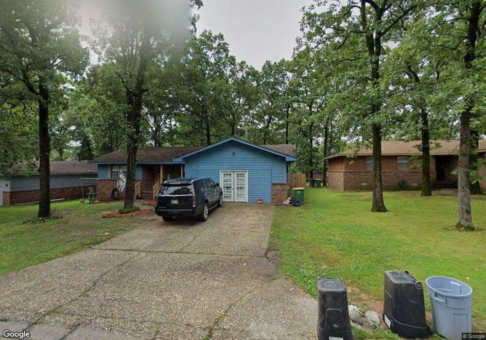
525 Melanie Ln North Little Rock, AR 72118
Amboy NeighborhoodEstimated Value: $147,543 - $197,000
--
Bed
3
Baths
1,881
Sq Ft
$92/Sq Ft
Est. Value
About This Home
This home is located at 525 Melanie Ln, North Little Rock, AR 72118 and is currently estimated at $173,886, approximately $92 per square foot. 525 Melanie Ln is a home located in Pulaski County with nearby schools including Indian Hills Elementary School, North Little Rock Middle School 6th Grade Campus, and North Little Rock High School.
Ownership History
Date
Name
Owned For
Owner Type
Purchase Details
Closed on
May 5, 2016
Sold by
Cates William A and Cates Sherry
Bought by
Famil 525 Melanie Lane North Little Rock
Current Estimated Value
Purchase Details
Closed on
Mar 24, 2015
Sold by
Cates William A
Bought by
Cates William A
Purchase Details
Closed on
Jan 29, 1980
Bought by
Gates Gearl Autry and Gates Marcy A
Create a Home Valuation Report for This Property
The Home Valuation Report is an in-depth analysis detailing your home's value as well as a comparison with similar homes in the area
Home Values in the Area
Average Home Value in this Area
Purchase History
| Date | Buyer | Sale Price | Title Company |
|---|---|---|---|
| Famil 525 Melanie Lane North Little Rock | $35,000 | American Abstract & Title Co | |
| Cates William A | -- | None Available | |
| Gates Gearl Autry | $52,000 | -- |
Source: Public Records
Tax History Compared to Growth
Tax History
| Year | Tax Paid | Tax Assessment Tax Assessment Total Assessment is a certain percentage of the fair market value that is determined by local assessors to be the total taxable value of land and additions on the property. | Land | Improvement |
|---|---|---|---|---|
| 2025 | $1,922 | $28,765 | $2,400 | $26,365 |
| 2024 | $819 | $28,765 | $2,400 | $26,365 |
| 2023 | $819 | $21,725 | $2,400 | $19,325 |
| 2022 | $751 | $21,725 | $2,400 | $19,325 |
| 2021 | $683 | $10,220 | $3,100 | $7,120 |
| 2020 | $683 | $10,220 | $3,100 | $7,120 |
| 2019 | $683 | $10,220 | $3,100 | $7,120 |
| 2018 | $683 | $10,220 | $3,100 | $7,120 |
| 2017 | $683 | $10,220 | $3,100 | $7,120 |
| 2016 | $1,025 | $15,340 | $2,600 | $12,740 |
| 2015 | $1,025 | $15,340 | $2,600 | $12,740 |
| 2014 | $1,025 | $15,340 | $2,600 | $12,740 |
Source: Public Records
Map
Nearby Homes
- 5504 Allen St
- 901 W 58th St
- 5315 Chandler St
- 104 Lindenhurst Dr
- 5630 Foxboro Dr
- 34 Jaynelle Place
- 5321 Marion St
- 900 Donovan Briley Blvd
- 60 Oakview Dr
- 5732 Camp Robinson Rd
- 1108 Nicole Dr
- 407 W 51st St
- Lot 87 Foxboro Dr
- Lot 86 Foxboro Dr
- Lot 85 Foxboro Dr
- Lot 84 Foxboro Dr
- Lot 83 Foxboro Dr
- Lot 82 Foxboro Dr
- Lot 96 Foxboro Dr
- Lot 95 Foxboro Dr
- 521 Melanie Ln
- 529 Melanie Ln
- 516 Wisteria Dr
- 517 Melanie Ln
- 520 Wisteria Dr
- 520 Melanie Ln
- 512 Wisteria Dr
- 524 Melanie Ln
- 516 Melanie Ln
- 524 Wisteria Dr
- 512 Melanie Ln
- 513 Melanie Ln
- 0 Melanie Ln
- 528 Melanie Ln
- 508 Wisteria Dr
- 508 Melanie Ln
- 5813 Granby Rd
- 504 Wisteria Dr
- 5809 Granby Rd
- 509 Melanie Ln