Estimated Value: $449,000 - $670,893
--
Bed
4
Baths
--
Sq Ft
0.33
Acres
About This Home
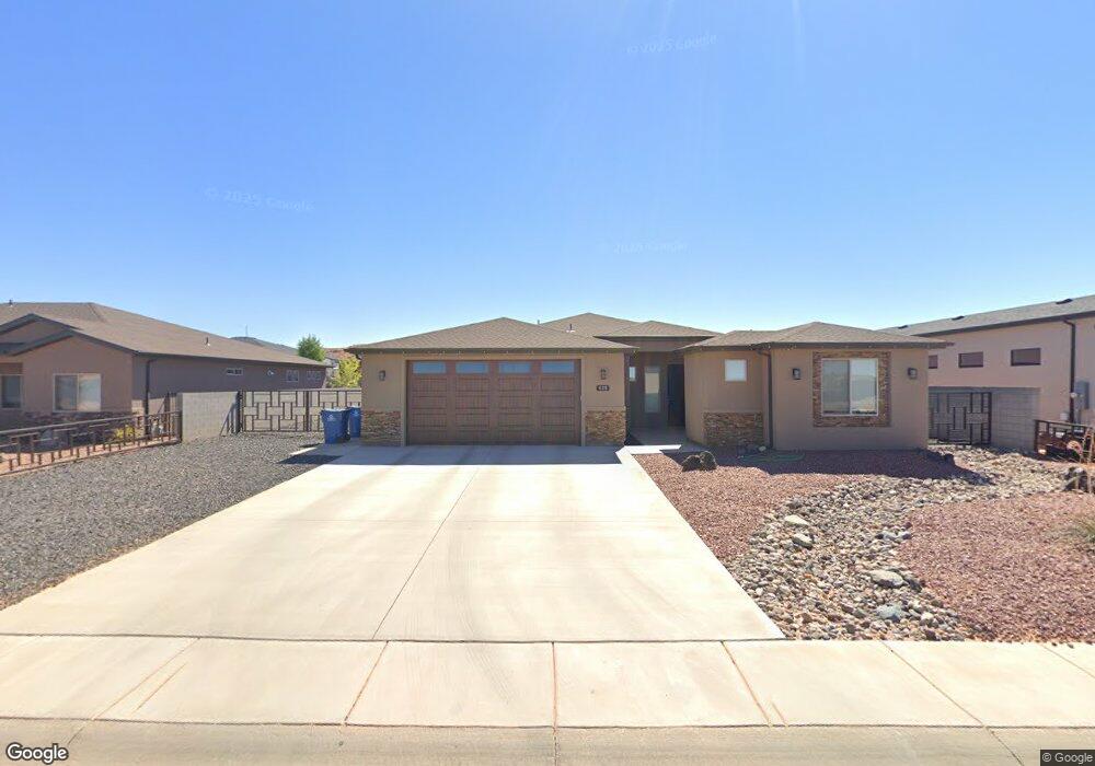
This home is located at 525 Mustang Rd, Page, AZ 86040 and is currently estimated at $559,947. 525 Mustang Rd is a home located in Coconino County with nearby schools including Desert View Elementary Intermediate School, Lake View Elementary Primary School, and Page Middle School.
Ownership History
Date
Name
Owned For
Owner Type
Purchase Details
Closed on
Oct 12, 2022
Sold by
Anderson Brad Tyler and Tysa Rae
Bought by
Hettinger Andrew Kyle and Hettinger Kenna Lynn
Current Estimated Value
Home Financials for this Owner
Home Financials are based on the most recent Mortgage that was taken out on this home.
Original Mortgage
$531,000
Outstanding Balance
$512,084
Interest Rate
6.7%
Mortgage Type
New Conventional
Estimated Equity
$47,863
Purchase Details
Closed on
Oct 9, 2018
Sold by
Monroe Michael A and Monroe Katrina
Bought by
Anderson Brad Tyler and Anderson Tysa Rae
Purchase Details
Closed on
Apr 12, 2018
Sold by
Sturdy Joseph F and Sturdy Pauline D
Bought by
Monroe Michael A and Monroe Katrina
Purchase Details
Closed on
Nov 4, 2016
Sold by
Sturdy Joseph Frederick and Sturdy Pauline Dearing
Bought by
Sturdy Joseph F and Sturdy Pauline D
Create a Home Valuation Report for This Property
The Home Valuation Report is an in-depth analysis detailing your home's value as well as a comparison with similar homes in the area
Home Values in the Area
Average Home Value in this Area
Purchase History
| Date | Buyer | Sale Price | Title Company |
|---|---|---|---|
| Hettinger Andrew Kyle | $590,000 | Pioneer Title | |
| Anderson Brad Tyler | $43,500 | Pioneer Title Agency | |
| Monroe Michael A | $46,000 | Pioneer Title Agency | |
| Sturdy Joseph F | -- | None Available |
Source: Public Records
Mortgage History
| Date | Status | Borrower | Loan Amount |
|---|---|---|---|
| Open | Hettinger Andrew Kyle | $531,000 |
Source: Public Records
Tax History Compared to Growth
Tax History
| Year | Tax Paid | Tax Assessment Tax Assessment Total Assessment is a certain percentage of the fair market value that is determined by local assessors to be the total taxable value of land and additions on the property. | Land | Improvement |
|---|---|---|---|---|
| 2025 | $361 | $9,363 | -- | -- |
| 2024 | $361 | $7,863 | -- | -- |
| 2023 | $329 | $6,837 | $0 | $0 |
| 2022 | $329 | $6,450 | $0 | $0 |
| 2021 | $366 | $5,898 | $0 | $0 |
| 2020 | $295 | $5,564 | $0 | $0 |
| 2019 | $286 | $5,249 | $0 | $0 |
| 2018 | $284 | $5,249 | $0 | $0 |
| 2017 | $269 | $5,249 | $0 | $0 |
| 2016 | $249 | $5,249 | $0 | $0 |
| 2015 | $254 | $5,599 | $0 | $0 |
Source: Public Records
Map
Nearby Homes
- 39 W Jerome St
- 22 Sunset St Unit 22
- 2 Echo Ct
- 134 Calle Hermosa
- 57 Aero Ave
- 8.35 Acres S Parcel Rainbow Dr
- 265 Myrtle Dr
- 451 Ticaboo Canyon Dr Unit 33
- 461 Ticaboo Canyon Dr Unit 34
- 12 Sumner Cove
- 142 Bryce Canyon Dr
- 152 Bryce Canyon Dr
- 30 Tek Ct
- 130 Tek Ct Unit 95
- 665 N Anasazi Dr Unit Lot 19
- 142 Dunn Dr
- 1334 E Rock Ledge Ln
- 1260 Patrick Henry Ct
- 1140 Independence
- 1140 S Independence Dr