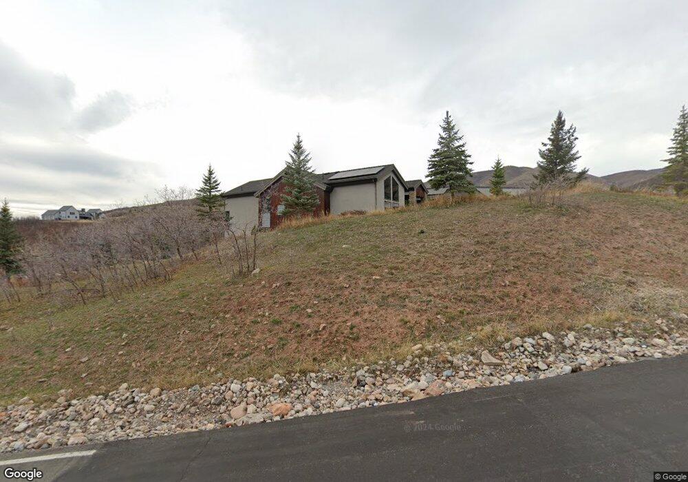
525 N Pioneer Fork Rd Unit 172 Emigration Canyon, UT 84108
Estimated Value: $1,890,000 - $2,127,816
5
Beds
6
Baths
2,879
Sq Ft
$710/Sq Ft
Est. Value
About This Home
This home is located at 525 N Pioneer Fork Rd Unit 172, Emigration Canyon, UT 84108 and is currently estimated at $2,043,605, approximately $709 per square foot. 525 N Pioneer Fork Rd Unit 172 is a home located in Salt Lake County with nearby schools including Eastwood Elementary School, Churchill Junior High School, and Skyline High School.
Ownership History
Date
Name
Owned For
Owner Type
Purchase Details
Closed on
Jun 30, 2010
Sold by
Taylor Batista Melanie
Bought by
Taylor Batista Melanie and Batista Oscar A
Current Estimated Value
Purchase Details
Closed on
Jun 7, 2007
Sold by
Jim Pack Construction
Bought by
Batista Oscar A and Batista Melanie
Home Financials for this Owner
Home Financials are based on the most recent Mortgage that was taken out on this home.
Original Mortgage
$957,400
Outstanding Balance
$584,240
Interest Rate
6.14%
Mortgage Type
New Conventional
Estimated Equity
$1,459,365
Purchase Details
Closed on
Oct 18, 2005
Sold by
Ferrin Ronald A and Ferrin Marcia P
Bought by
Jim Pack Construction
Purchase Details
Closed on
Nov 15, 2002
Sold by
The Boyer Company Lc
Bought by
Ferrin Ronald A and Ferring Marcia P
Create a Home Valuation Report for This Property
The Home Valuation Report is an in-depth analysis detailing your home's value as well as a comparison with similar homes in the area
Home Values in the Area
Average Home Value in this Area
Purchase History
| Date | Buyer | Sale Price | Title Company |
|---|---|---|---|
| Taylor Batista Melanie | -- | None Available | |
| Taylor Batista Melanie | -- | None Available | |
| Batista Oscar A | -- | Backman Title Services | |
| Jim Pack Construction | -- | Legacy Land Title | |
| Jim Pack Construction | -- | Legacy Land Title | |
| Ferrin Ronald A | -- | Legacy Land Title |
Source: Public Records
Mortgage History
| Date | Status | Borrower | Loan Amount |
|---|---|---|---|
| Open | Batista Oscar A | $957,400 |
Source: Public Records
Tax History Compared to Growth
Tax History
| Year | Tax Paid | Tax Assessment Tax Assessment Total Assessment is a certain percentage of the fair market value that is determined by local assessors to be the total taxable value of land and additions on the property. | Land | Improvement |
|---|---|---|---|---|
| 2025 | $12,608 | $1,941,490 | $604,690 | $1,336,800 |
| 2024 | $12,608 | $1,786,690 | $602,090 | $1,184,600 |
| 2023 | $11,928 | $1,656,590 | $559,290 | $1,097,300 |
| 2022 | $11,591 | $1,637,090 | $548,190 | $1,088,900 |
| 2021 | $12,318 | $1,547,600 | $481,800 | $1,065,800 |
| 2020 | $13,152 | $1,550,900 | $459,900 | $1,091,000 |
| 2019 | $12,571 | $1,470,790 | $459,890 | $1,010,900 |
| 2018 | $12,417 | $1,404,090 | $459,890 | $944,200 |
| 2017 | $11,147 | $1,330,590 | $459,890 | $870,700 |
| 2016 | $11,366 | $1,365,790 | $459,890 | $905,900 |
| 2015 | $9,838 | $1,113,190 | $401,390 | $711,800 |
| 2014 | $9,347 | $1,032,190 | $402,090 | $630,100 |
Source: Public Records
Map
Nearby Homes
- 6106 E Last Camp Cir
- 671 Freeze Creek Cir
- 5855 E Pioneer Ridge Cir Unit 195
- 938 N Pinecrest Canyon Rd E
- 5678 E Twin Creek Rd
- 5548 E Emigration Canyon Rd
- 152 Silver Oak Rd
- 1155 N Pinecrest Canyon Rd
- 5290 E Emigration Canyon Rd
- 32 S Smokey Ln
- 2148 N Pinecrest Canyon Rd
- 2205 N Pinecrest Canyon Rd
- 422 S Maryfield Dr
- 326 S Maryfield Dr Unit 404
- 4358 E Laneview Ct
- 4436 E Kenbridge Ct
- 556 Standel Dr
- 3922 E Cove Rd S Unit 4
- 370 S Got Teeth Ln
- 6907 E Mount Aire Rd
- 525 Pioneer Fork Rd
- 525 N Pioneer Fork Rd
- 525 N Pioneer Fork Rd
- 6170 Last Monument Cir
- 6170 E Last Monument Cir Unit 170
- 6170 E Last Monument Cir
- 536 N Pioneer Fork Rd
- 552 N Pioneer Fork Rd
- 552 N Pioneer Fork Rd
- 536 N Pioneer Fork Rd
- 559 N Marathon Cir
- 6175 E Last Monument Cir
- 518 N Pioneer Fork Rd
- 518 N Pioneer Fork Rd
- 493 Marathon Cir
- 493 N Marathon Cir Unit 180
- 493 N Marathon Cir
- 493 N Marathon Cir Unit 180
- 493 N Marathon Cir
- 6175 Last Monument Cir