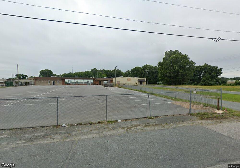
525 Purser Ave Monroe, NC 28110
Estimated Value: $680,794
Studio
--
Bath
14,000
Sq Ft
$49/Sq Ft
Est. Value
About This Home
This home is located at 525 Purser Ave, Monroe, NC 28110 and is currently priced at $680,794, approximately $48 per square foot. 525 Purser Ave is a home located in Union County with nearby schools including East Elementary School, Monroe Middle School, and Monroe High School.
Ownership History
Date
Name
Owned For
Owner Type
Purchase Details
Closed on
Nov 8, 2022
Sold by
Sam Properties
Bought by
Vstra International Corporation
Current Estimated Value
Purchase Details
Closed on
Jan 3, 2001
Sold by
King Francis B and King Madelyn D
Bought by
S A M Ltd Partnership
Home Financials for this Owner
Home Financials are based on the most recent Mortgage that was taken out on this home.
Original Mortgage
$153,000
Interest Rate
6.99%
Mortgage Type
Seller Take Back
Create a Home Valuation Report for This Property
The Home Valuation Report is an in-depth analysis detailing your home's value as well as a comparison with similar homes in the area
Purchase History
| Date | Buyer | Sale Price | Title Company |
|---|---|---|---|
| Vstra International Corporation | $1,500 | -- | |
| S A M Ltd Partnership | $243,000 | -- |
Source: Public Records
Mortgage History
| Date | Status | Borrower | Loan Amount |
|---|---|---|---|
| Previous Owner | S A M Ltd Partnership | $153,000 |
Source: Public Records
Tax History
| Year | Tax Paid | Tax Assessment Tax Assessment Total Assessment is a certain percentage of the fair market value that is determined by local assessors to be the total taxable value of land and additions on the property. | Land | Improvement |
|---|---|---|---|---|
| 2025 | $2,801 | $320,400 | $0 | $0 |
| 2024 | $2,726 | $250,000 | $152,100 | $97,900 |
| 2023 | $2,726 | $250,000 | $152,100 | $97,900 |
| 2022 | $2,726 | $250,000 | $152,100 | $97,900 |
| 2021 | $2,726 | $250,000 | $152,100 | $97,900 |
| 2020 | $5,181 | $384,600 | $304,200 | $80,400 |
| 2019 | $5,181 | $384,600 | $304,200 | $80,400 |
| 2018 | $2,370 | $384,600 | $304,200 | $80,400 |
| 2017 | $5,259 | $384,600 | $304,200 | $80,400 |
| 2016 | $5,203 | $384,600 | $304,200 | $80,400 |
| 2015 | $2,986 | $384,600 | $304,200 | $80,400 |
| 2014 | $4,971 | $407,460 | $304,200 | $103,260 |
Source: Public Records
Map
Nearby Homes
- 606 Lasalle St
- 0 N Square Dr
- 913 Winchester Ave
- 500 Boyte St
- 406 N Thompson St
- 417 Boyte St
- 706 Mcintyre St
- 802 E Franklin St
- 307 Jones St
- 217 Winburn St
- 1202 E Franklin St
- 207 Maurice St
- 715 Creekridge Dr
- 301 E Windsor St
- 406 S Church St
- 707 Summit St
- 0 Labon St
- 806 Colony Oaks Dr
- 806 Colony Oaks Dr Unit B
- 720 Mclarty St
- 512 Morgan Mill Rd
- 510 Morgan Mill Rd
- 508 Mangum St
- 504 Mangum St
- 1302 Walkup Ave
- 510 Mangum St
- 100 Normand St
- 1303 Walkup Ave
- 1230 Walkup Ave
- 120 Normand St
- 431 Morgan Mill Rd
- 507 Mangum St
- 1218 Walkup Ave
- 1400 Fairley Ave
- 1401 Fairley Ave
- 1401 Fairley Ave Unit B
- 1380 Fairley Ave
- 1380 Fairley Ave Unit A
- 1380 Fairley Ave Unit B
- 1214 Walkup Ave
Your Personal Tour Guide
Ask me questions while you tour the home.