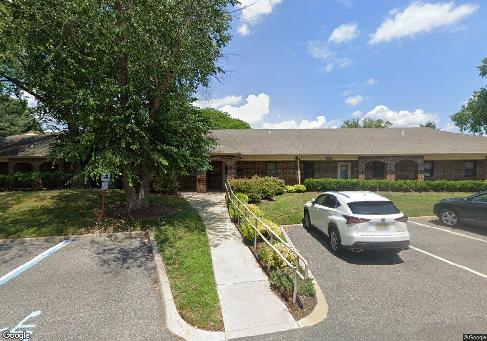
525 Route 73 S Unit 104 Marlton, NJ 08053
Estimated Value: $578,715
--
Bed
--
Bath
2,117
Sq Ft
$273/Sq Ft
Est. Value
About This Home
This home is located at 525 Route 73 S Unit 104, Marlton, NJ 08053 and is currently estimated at $578,715, approximately $273 per square foot. 525 Route 73 S Unit 104 is a home located in Burlington County with nearby schools including Marlton Middle School, Cherokee High School, and Lenape High School.
Ownership History
Date
Name
Owned For
Owner Type
Purchase Details
Closed on
Jun 1, 2010
Sold by
Jacob Joseph P and Jacob Prema
Bought by
Chase Luke Properties Llc
Current Estimated Value
Home Financials for this Owner
Home Financials are based on the most recent Mortgage that was taken out on this home.
Original Mortgage
$244,000
Outstanding Balance
$82,094
Interest Rate
5.11%
Mortgage Type
Commercial
Estimated Equity
$496,621
Purchase Details
Closed on
Jan 19, 1997
Sold by
T N W Leasing Co
Bought by
Jacob Joseph P and Jacob Prema M
Create a Home Valuation Report for This Property
The Home Valuation Report is an in-depth analysis detailing your home's value as well as a comparison with similar homes in the area
Home Values in the Area
Average Home Value in this Area
Purchase History
| Date | Buyer | Sale Price | Title Company |
|---|---|---|---|
| Chase Luke Properties Llc | $305,000 | Foundation Title | |
| Jacob Joseph P | $275,000 | Congress Title Corp |
Source: Public Records
Mortgage History
| Date | Status | Borrower | Loan Amount |
|---|---|---|---|
| Open | Chase Luke Properties Llc | $244,000 |
Source: Public Records
Tax History Compared to Growth
Tax History
| Year | Tax Paid | Tax Assessment Tax Assessment Total Assessment is a certain percentage of the fair market value that is determined by local assessors to be the total taxable value of land and additions on the property. | Land | Improvement |
|---|---|---|---|---|
| 2025 | $9,412 | $275,600 | $82,700 | $192,900 |
| 2024 | $8,855 | $275,600 | $82,700 | $192,900 |
| 2023 | $8,855 | $275,600 | $82,700 | $192,900 |
| 2022 | $8,458 | $275,600 | $82,700 | $192,900 |
| 2021 | $8,260 | $275,600 | $82,700 | $192,900 |
| 2020 | $8,152 | $275,600 | $82,700 | $192,900 |
| 2019 | $8,086 | $275,600 | $82,700 | $192,900 |
| 2018 | $7,973 | $275,600 | $82,700 | $192,900 |
| 2017 | $7,879 | $275,600 | $82,700 | $192,900 |
| 2016 | $7,686 | $275,600 | $82,700 | $192,900 |
| 2015 | $7,551 | $275,600 | $82,700 | $192,900 |
| 2014 | $7,336 | $275,600 | $82,700 | $192,900 |
Source: Public Records
Map
Nearby Homes
- 625 Route 73 S
- 35 Euston Rd W
- 20 Euston Rd
- 18 Goshawk Ct
- 75 Euston Rd S
- 1525 Squire Ln
- 2 Split Rail Ln
- 18 Sandpiper Dr
- 405 Hazelwood Ln
- 313 Hazelwood Ln
- 61 S Maple Ave
- 9 Nottingham Rd
- 17 Erindale Dr
- 8 Sequoia Ct
- 44 Acadia Dr
- 732 E Evesham Rd
- 136 Peregrine Dr
- 209 Henfield Ave
- 7 Quaker St
- 39 Willow Ridge Rd
- 525 Route 73 S Unit 305B-1
- 525 Route 73 S Unit 305B-2
- 525 Route 73 S Unit A & B
- 525 Route 73 S Unit 105A
- 525 Route 73 S Unit 300
- 525 Route 73 S Unit 306A/B
- 525 Route 73 S Unit 305
- 525 Route 73 S Unit 306 LL
- 525 Route 73 S Unit 302 & 303
- 525 Route 73 S Unit 306-C
- 525 Route 73 S Unit 106
- 134 Tara Terrace
- 132 Tara Terrace
- 136 Tara Terrace
- 144 Oak Terrace
- 142 Oak Terrace
- 128 Tara Terrace
- 138 Tara Terrace
- 122 Tara Terrace
- 146 Oak Terrace