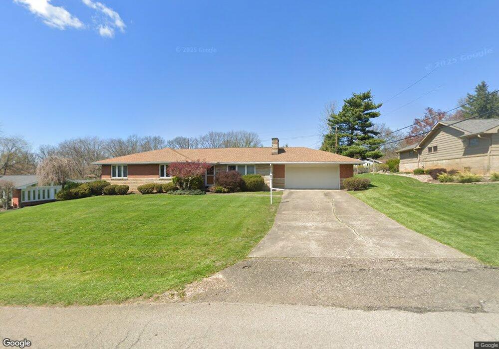
525 S Samuel Dr Zanesville, OH 43701
Estimated Value: $306,000 - $376,036
3
Beds
2
Baths
1,596
Sq Ft
$204/Sq Ft
Est. Value
About This Home
This home is located at 525 S Samuel Dr, Zanesville, OH 43701 and is currently estimated at $325,759, approximately $204 per square foot. 525 S Samuel Dr is a home located in Muskingum County with nearby schools including John McIntire Elementary School, Zanesville Middle School, and Zanesville High School.
Ownership History
Date
Name
Owned For
Owner Type
Purchase Details
Closed on
Aug 23, 2022
Sold by
Hardman Thomas B
Bought by
Hardman Karen
Current Estimated Value
Purchase Details
Closed on
Sep 28, 2010
Sold by
Estate Of Gertrude E Ebersbach
Bought by
Hardman Karen and Freeman Lois
Purchase Details
Closed on
Jun 11, 2010
Sold by
Freeman Harry J and Freeman Lois
Bought by
Hardman Thomas B and Hardman Karen
Create a Home Valuation Report for This Property
The Home Valuation Report is an in-depth analysis detailing your home's value as well as a comparison with similar homes in the area
Home Values in the Area
Average Home Value in this Area
Purchase History
| Date | Buyer | Sale Price | Title Company |
|---|---|---|---|
| Hardman Karen | -- | -- | |
| Hardman Karen | -- | None Available | |
| Hardman Thomas B | $65,500 | Attorney |
Source: Public Records
Tax History Compared to Growth
Tax History
| Year | Tax Paid | Tax Assessment Tax Assessment Total Assessment is a certain percentage of the fair market value that is determined by local assessors to be the total taxable value of land and additions on the property. | Land | Improvement |
|---|---|---|---|---|
| 2024 | $3,272 | $94,815 | $22,225 | $72,590 |
| 2023 | $2,509 | $68,810 | $14,000 | $54,810 |
| 2022 | $2,763 | $68,810 | $14,000 | $54,810 |
| 2021 | $2,740 | $68,810 | $14,000 | $54,810 |
| 2020 | $2,463 | $59,815 | $12,180 | $47,635 |
| 2019 | $2,463 | $59,815 | $12,180 | $47,635 |
| 2018 | $2,496 | $59,815 | $12,180 | $47,635 |
| 2017 | $2,422 | $55,580 | $12,180 | $43,400 |
| 2016 | $2,455 | $55,580 | $12,180 | $43,400 |
| 2015 | $2,461 | $55,580 | $12,180 | $43,400 |
| 2013 | $2,575 | $55,580 | $12,180 | $43,400 |
Source: Public Records
Map
Nearby Homes
- 530 N Ray Dr
- 0 W Ray- 36c Dr
- 0 Harding- 36b Rd
- 610 Military Rd
- 600 Military Rd
- 0 E Ray- 36a Dr
- 0 W Ray Dr
- 36C W Ray Dr
- 2700 Woodside Dr
- 36A E Ray Dr
- 36B Harding Rd
- 427 Harding Rd
- 3095 E Winding Way
- 3245 Circle Ct
- 2740 W Ridgewood Cir
- 2728 W Ridgewood Cir
- 2751 E Ridgewood Cir
- 3250 Dale Rd
- 753 Leonard Ave
- 2868 Crestway Dr
- 545 S Samuel Dr
- 515 S Samuel Dr
- 520 N Samuel Dr
- 510 N Samuel Dr
- 520 S Samuel Dr
- 540 N Samuel Dr
- 505 S Samuel Dr
- 510 S Samuel Dr
- 540 S Samuel Dr
- 555 S Samuel Dr
- 510 S Samuel Dr
- 500 N Samuel Dr
- 500 S Samuel Dr
- 500 S 485 495 Dr
- 550 S Samuel Dr
- 495 S Samuel Dr
- 525 N Samuel Dr
- 490 N Samuel Dr
- 535 N Ray Dr
- 525 N Ray Dr