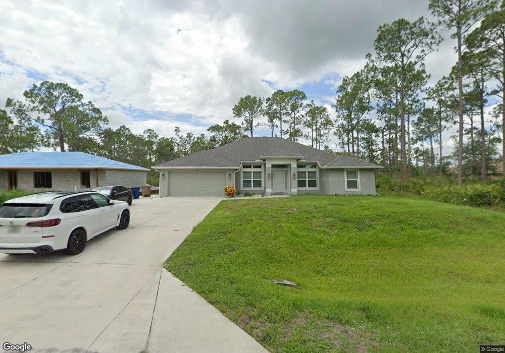
525 Sargent St Lehigh Acres, FL 33972
Richmond NeighborhoodEstimated Value: $324,289 - $484,000
4
Beds
2
Baths
2,151
Sq Ft
$179/Sq Ft
Est. Value
About This Home
This home is located at 525 Sargent St, Lehigh Acres, FL 33972 and is currently estimated at $385,322, approximately $179 per square foot. 525 Sargent St is a home with nearby schools including Lehigh Elementary School, The Alva School, and Gateway Elementary School.
Ownership History
Date
Name
Owned For
Owner Type
Purchase Details
Closed on
Dec 13, 2018
Sold by
Adams Homes Of Northwest Florida Inc
Bought by
Worth Leslie R and Worth Robert W
Current Estimated Value
Home Financials for this Owner
Home Financials are based on the most recent Mortgage that was taken out on this home.
Original Mortgage
$215,720
Outstanding Balance
$192,282
Interest Rate
5.5%
Mortgage Type
FHA
Estimated Equity
$193,040
Create a Home Valuation Report for This Property
The Home Valuation Report is an in-depth analysis detailing your home's value as well as a comparison with similar homes in the area
Home Values in the Area
Average Home Value in this Area
Purchase History
| Date | Buyer | Sale Price | Title Company |
|---|---|---|---|
| Worth Leslie R | $219,700 | Jeweel Stone Title Ins Agenc |
Source: Public Records
Mortgage History
| Date | Status | Borrower | Loan Amount |
|---|---|---|---|
| Open | Worth Leslie R | $215,720 |
Source: Public Records
Tax History Compared to Growth
Tax History
| Year | Tax Paid | Tax Assessment Tax Assessment Total Assessment is a certain percentage of the fair market value that is determined by local assessors to be the total taxable value of land and additions on the property. | Land | Improvement |
|---|---|---|---|---|
| 2025 | $2,850 | $212,753 | -- | -- |
| 2024 | $2,755 | $206,757 | -- | -- |
| 2023 | $2,755 | $200,735 | $0 | $0 |
| 2022 | $2,602 | $194,888 | $0 | $0 |
| 2021 | $2,519 | $204,342 | $3,900 | $200,442 |
| 2020 | $2,454 | $180,911 | $0 | $0 |
| 2019 | $2,422 | $176,844 | $4,500 | $172,344 |
| 2018 | $100 | $4,250 | $4,250 | $0 |
| 2017 | $96 | $4,199 | $4,199 | $0 |
| 2016 | $88 | $3,700 | $3,700 | $0 |
| 2015 | $79 | $2,640 | $2,640 | $0 |
| 2014 | -- | $2,540 | $2,540 | $0 |
| 2013 | -- | $1,900 | $1,900 | $0 |
Source: Public Records
Map
Nearby Homes
- 521 Sargent St
- 522 Sargent St
- 524 Sargent St
- 550 Sargent St
- 1951 Roderick Ln
- 1956 Quintero Ln
- 1935 Quintero Ln
- 1908 Quintero Ln
- 497 Young St
- 1922 Overland Ave
- 485 Tweed Ct
- 545 Greenbriar Blvd
- 547 Greenbriar Blvd
- 1918 Montero Ave
- 558 Sargent St
- 507 Woodman Dr
- 463 Woodman Dr Unit 3
- 451 Woodman Dr
- 514 Woodman Dr
- 457 Woodman Dr
- 523 Sargent St
- 529 Sargent St
- 1961 Quintero Ln
- 1945 Quintero Ln
- 1943 Quintero Ln
- 1952 Quintero Ln
- 1946 Quintero Ln
- 1941 Quintero Ln
- 1962 Quintero Ln
- 550 Sargent St Unit 16
- 527 Sargent St
- 531 Sargent St
- 1964 Quintero Ln
- 535 Sargent St
- 1966 Quintero Ln
- 536 Sargent St
- 1939 Quintero Ln
- 1968 Quintero Ln
- 528 Janice Ave
- 522 Janice Ave