Estimated Value: $139,010 - $190,000
Studio
--
Bath
1,463
Sq Ft
$113/Sq Ft
Est. Value
About This Home
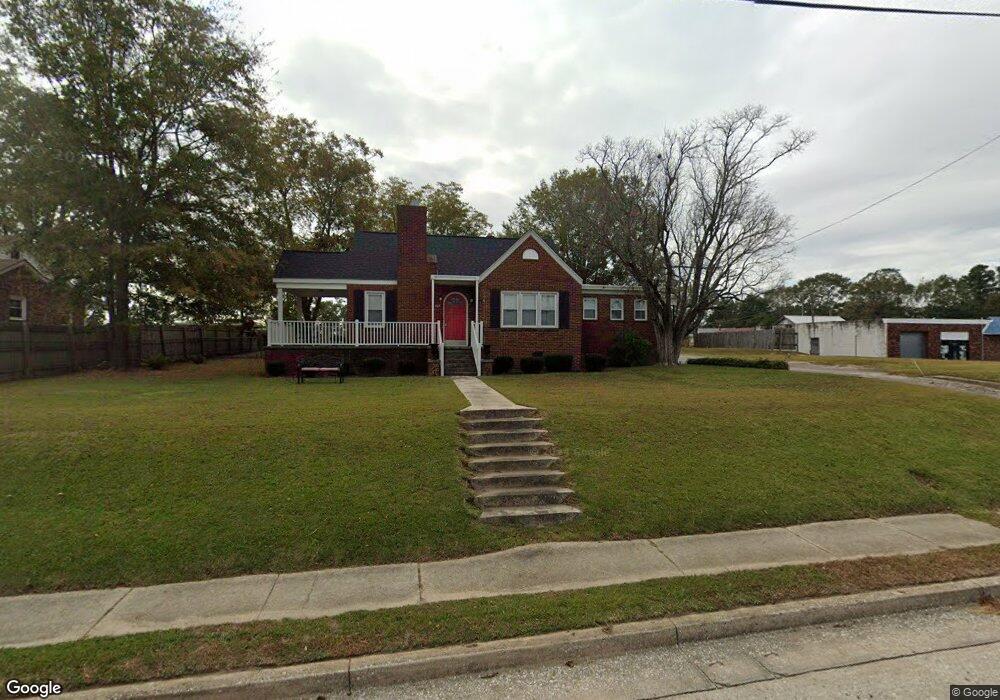
This home is located at 525 Thompson Blvd, Union, SC 29379 and is currently estimated at $165,753, approximately $113 per square foot. 525 Thompson Blvd is a home with nearby schools including Union County High School, Union Christian Day School, and Unity Christian Academy.
Ownership History
Date
Name
Owned For
Owner Type
Purchase Details
Closed on
Nov 9, 2020
Sold by
Tbk Properties Llc
Bought by
Sartor Keisha Latrell
Current Estimated Value
Home Financials for this Owner
Home Financials are based on the most recent Mortgage that was taken out on this home.
Original Mortgage
$123,666
Outstanding Balance
$108,973
Interest Rate
2.77%
Mortgage Type
Construction
Estimated Equity
$56,780
Purchase Details
Closed on
Jul 1, 2020
Sold by
South State Bank Na
Bought by
Tbk Properties Llc
Purchase Details
Closed on
Apr 2, 2002
Sold by
Crow Hazel Dyer
Bought by
Hall Stacy A
Create a Home Valuation Report for This Property
The Home Valuation Report is an in-depth analysis detailing your home's value as well as a comparison with similar homes in the area
Purchase History
| Date | Buyer | Sale Price | Title Company |
|---|---|---|---|
| Sartor Keisha Latrell | $122,430 | -- | |
| Tbk Properties Llc | $43,500 | -- | |
| Hall Stacy A | $60,000 | -- |
Source: Public Records
Mortgage History
| Date | Status | Borrower | Loan Amount |
|---|---|---|---|
| Open | Sartor Keisha Latrell | $123,666 |
Source: Public Records
Tax History
| Year | Tax Paid | Tax Assessment Tax Assessment Total Assessment is a certain percentage of the fair market value that is determined by local assessors to be the total taxable value of land and additions on the property. | Land | Improvement |
|---|---|---|---|---|
| 2025 | $532 | $96,710 | $8,000 | $88,710 |
| 2024 | $532 | $3,360 | $200 | $3,160 |
| 2023 | $532 | $3,360 | $0 | $0 |
| 2022 | $533 | $3,360 | $200 | $3,160 |
| 2021 | $533 | $3,360 | $200 | $3,160 |
| 2020 | $508 | $4,800 | $300 | $4,500 |
| 2019 | $1,458 | $4,800 | $300 | $4,500 |
| 2018 | $1,590 | $4,800 | $300 | $4,500 |
| 2017 | $625 | $4,800 | $300 | $4,500 |
| 2016 | $625 | $3,200 | $200 | $3,000 |
| 2015 | $490 | $3,200 | $200 | $3,000 |
| 2014 | $490 | $2,780 | $200 | $2,580 |
Source: Public Records
Map
Nearby Homes
- 100 William E Free Path
- 111 Spruce St
- 148 Springdale Dr
- 119 Hillcrest Dr
- 104 Santee Cir
- 218 Hillcrest Dr
- 210 Catawba St
- 211 Catawba St
- 301 Catawba St
- 203 Wilson St
- 311 Arthur Blvd
- 321 Newland Dr
- 103 Merriville Dr
- 722 N Church St
- 107 Merriville Dr
- 109 Merriville Dr
- 111 Merriville Dr
- 108 Merriville Dr
- 313 Newland Dr
- 200 Spring St
- 521 Thompson Blvd
- 519 Thompson Blvd
- 110 Harris St
- 106 Harris St
- 112 Harris St
- 104 Harris St
- 1220 N Pinckney St
- 1218 N Pinckney St
- 1216 N Pinckney St
- 1214 N Pinckney St
- 111 Harris St
- 109 Harris St
- 513 Thompson Blvd
- 113 Harris St
- 107 Harris St
- 105 Harris St
- 1224 N Pinckney St
- 100 Harris St
- 117 Harris St
- 103 Harris St
Your Personal Tour Guide
Ask me questions while you tour the home.