Estimated Value: $275,000 - $349,000
3
Beds
2
Baths
1,666
Sq Ft
$188/Sq Ft
Est. Value
About This Home
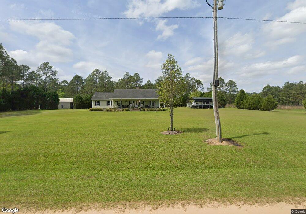
This home is located at 525 West Rd, Cairo, GA 39827 and is currently estimated at $313,890, approximately $188 per square foot. 525 West Rd is a home located in Grady County.
Ownership History
Date
Name
Owned For
Owner Type
Purchase Details
Closed on
Jul 23, 2012
Sold by
Binion Susan
Bought by
Binion Michael S
Current Estimated Value
Home Financials for this Owner
Home Financials are based on the most recent Mortgage that was taken out on this home.
Original Mortgage
$173,775
Outstanding Balance
$117,270
Interest Rate
3.58%
Mortgage Type
New Conventional
Estimated Equity
$196,620
Purchase Details
Closed on
Mar 27, 2006
Sold by
Wells Richard
Bought by
Binion Michael S and Binion Susan
Create a Home Valuation Report for This Property
The Home Valuation Report is an in-depth analysis detailing your home's value as well as a comparison with similar homes in the area
Purchase History
| Date | Buyer | Sale Price | Title Company |
|---|---|---|---|
| Binion Michael S | -- | -- | |
| Binion Michael S | $24,000 | -- |
Source: Public Records
Mortgage History
| Date | Status | Borrower | Loan Amount |
|---|---|---|---|
| Open | Binion Michael S | $173,775 | |
| Closed | Binion Michael S | $0 |
Source: Public Records
Tax History
| Year | Tax Paid | Tax Assessment Tax Assessment Total Assessment is a certain percentage of the fair market value that is determined by local assessors to be the total taxable value of land and additions on the property. | Land | Improvement |
|---|---|---|---|---|
| 2025 | $2,024 | $106,286 | $5,333 | $100,953 |
| 2024 | $2,024 | $84,834 | $5,333 | $79,501 |
| 2023 | $1,737 | $58,415 | $6,696 | $51,719 |
| 2022 | $1,237 | $58,415 | $6,696 | $51,719 |
| 2021 | $1,724 | $57,824 | $6,696 | $51,128 |
| 2020 | $730 | $57,824 | $6,696 | $51,128 |
| 2019 | $1,730 | $57,824 | $6,696 | $51,128 |
| 2018 | $1,624 | $57,824 | $6,696 | $51,128 |
| 2017 | $1,546 | $57,824 | $6,696 | $51,128 |
| 2016 | $1,339 | $50,064 | $6,696 | $43,368 |
| 2015 | $922 | $50,064 | $6,696 | $43,368 |
| 2014 | $1,324 | $50,064 | $6,696 | $43,368 |
| 2013 | -- | $47,811 | $8,100 | $39,711 |
Source: Public Records
Map
Nearby Homes
- 2427 Pierce Chapel Rd
- 3136 State Route 188
- 161 Evergreen Ln
- 3109 U S 84
- 3109 U S 84
- 414 Woodland Rd
- 0 State Route 188
- 00 State Route 188
- 171 Blair Dr
- 130 Blair Dr
- 129 Alison Dr
- 142 Dori Dr
- 2690 U S 84
- 78.6 Ac Strickland Rd
- 79 27th St NE
- 2542 Maddox Rd
- 309 Sunset Ln
- 770 Pierce Chapel Rd
- 408 Bay Tree Rd NE
- 66 22nd St NE
Your Personal Tour Guide
Ask me questions while you tour the home.