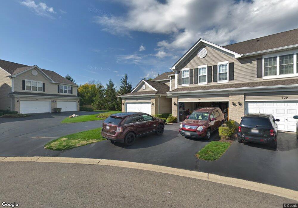
525 Windham Cove Dr Unit 501001 Crystal Lake, IL 60014
Estimated Value: $253,831 - $273,000
2
Beds
2
Baths
1,233
Sq Ft
$217/Sq Ft
Est. Value
About This Home
This home is located at 525 Windham Cove Dr Unit 501001, Crystal Lake, IL 60014 and is currently estimated at $267,208, approximately $216 per square foot. 525 Windham Cove Dr Unit 501001 is a home located in McHenry County with nearby schools including Indian Prairie Elementary School, Lundahl Middle School, and Crystal Lake South High School.
Ownership History
Date
Name
Owned For
Owner Type
Purchase Details
Closed on
Nov 13, 2013
Sold by
Miller Kenneth C and Miller Camille
Bought by
Craine Cornelius and Craine Carol
Current Estimated Value
Purchase Details
Closed on
Nov 12, 2004
Sold by
Miller Ken C and Miller Camille
Bought by
Miller Kenneth C and Miller Camille
Purchase Details
Closed on
Jul 26, 2001
Sold by
Fifth Third Bank
Bought by
Miller Ken C and Miller Camille
Purchase Details
Closed on
Oct 21, 1998
Sold by
St Paul Trust Company
Bought by
Pinnacle Bank
Create a Home Valuation Report for This Property
The Home Valuation Report is an in-depth analysis detailing your home's value as well as a comparison with similar homes in the area
Home Values in the Area
Average Home Value in this Area
Purchase History
| Date | Buyer | Sale Price | Title Company |
|---|---|---|---|
| Craine Cornelius | $114,000 | None Available | |
| Miller Kenneth C | -- | -- | |
| Miller Ken C | $128,000 | -- | |
| Pinnacle Bank | $115,000 | Chicago Title |
Source: Public Records
Tax History Compared to Growth
Tax History
| Year | Tax Paid | Tax Assessment Tax Assessment Total Assessment is a certain percentage of the fair market value that is determined by local assessors to be the total taxable value of land and additions on the property. | Land | Improvement |
|---|---|---|---|---|
| 2024 | $4,519 | $69,378 | $15,279 | $54,099 |
| 2023 | $2,345 | $62,050 | $13,665 | $48,385 |
| 2022 | $2,886 | $54,509 | $14,453 | $40,056 |
| 2021 | $2,943 | $50,782 | $13,465 | $37,317 |
| 2020 | $2,981 | $48,984 | $12,988 | $35,996 |
| 2019 | $3,042 | $46,884 | $12,431 | $34,453 |
| 2018 | $3,103 | $41,472 | $11,484 | $29,988 |
| 2017 | $3,030 | $39,070 | $10,819 | $28,251 |
| 2016 | $2,892 | $36,644 | $10,147 | $26,497 |
| 2013 | -- | $32,599 | $9,465 | $23,134 |
Source: Public Records
Map
Nearby Homes
- 1391 Acadia Cir
- 1421 Acadia Cir
- 1451 Acadia Cir
- 1441 Acadia Cir
- 1461 Acadia Cir
- 1549 Brompton Ln
- 518 Silver Aspen Cir
- 542 Silver Aspen Cir
- 1420 Trailwood Dr
- 1549 Hollytree Ln Unit 2
- 645 Kendallwood Ct
- 796 Waterford Cut
- 1668 Penn Ct Unit A
- 1542 Candlewood Dr
- 1655 Kennsington Ln
- 1694 Penny Ln Unit A
- 1201 Boxwood Dr
- 1506 Monroe St
- 1724 Becker Ct
- 1644 Stockton Ln
- 531 Windham Cove Dr Unit 501004
- 529 Windham Cove Dr Unit 501003
- 525 Windham Cove Dr Unit 1
- 527 Windham Cove Dr Unit 501002
- 527 Windham Cove Dr Unit 527
- 521 Windham Cove Dr
- 1172 Westport Ridge
- 517 Windham Cove Dr
- 1164 Crimson Dr
- 519 Windham Cove Dr
- 515 Windham Cove Dr
- 513 Windham Cove Dr
- 1304 Skyridge Dr
- 507 Windham Cove Dr
- 1302 Skyridge Dr
- 1306 Skyridge Dr
- 509 Windham Cove Dr
- 503 Windham Cove Dr
- 1168 Westport Ridge
- 1160 Crimson Dr