Estimated Value: $280,770 - $316,000
3
Beds
2
Baths
1,344
Sq Ft
$220/Sq Ft
Est. Value
About This Home
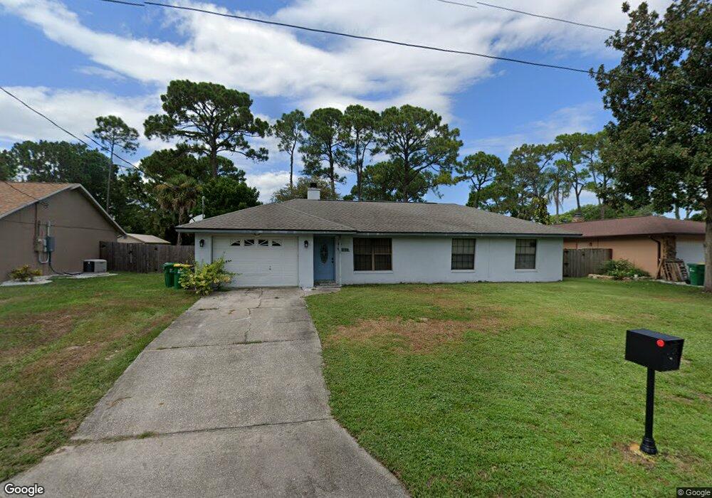
This home is located at 5250 Fruitport St, Cocoa, FL 32927 and is currently estimated at $296,193, approximately $220 per square foot. 5250 Fruitport St is a home located in Brevard County with nearby schools including Challenger 7 Elementary School, Space Coast Junior/Senior High School, and Sculptor Charter School.
Ownership History
Date
Name
Owned For
Owner Type
Purchase Details
Closed on
Apr 27, 1995
Sold by
Mangan John F and Mangan Carol J
Bought by
Anderson Terry R and Anderson Tammy L
Current Estimated Value
Home Financials for this Owner
Home Financials are based on the most recent Mortgage that was taken out on this home.
Original Mortgage
$73,517
Interest Rate
8.35%
Create a Home Valuation Report for This Property
The Home Valuation Report is an in-depth analysis detailing your home's value as well as a comparison with similar homes in the area
Home Values in the Area
Average Home Value in this Area
Purchase History
We collect this data history from publicly available records. To have your information removed, we recommend requesting removal directly through your county’s website.
| Date | Buyer | Sale Price | Title Company |
|---|---|---|---|
| Anderson Terry R | $73,900 | -- |
Source: Public Records
Mortgage History
We collect this data history from publicly available records. To have your information removed, we recommend requesting removal directly through your county’s website.
| Date | Status | Borrower | Loan Amount |
|---|---|---|---|
| Open | Anderson Terry R | $72,260 | |
| Closed | Anderson Terry R | $73,517 |
Source: Public Records
Tax History
| Year | Tax Paid | Tax Assessment Tax Assessment Total Assessment is a certain percentage of the fair market value that is determined by local assessors to be the total taxable value of land and additions on the property. | Land | Improvement |
|---|---|---|---|---|
| 2025 | $1,105 | $82,570 | -- | -- |
| 2024 | $1,071 | $80,250 | -- | -- |
| 2023 | $1,071 | $77,920 | $0 | $0 |
| 2022 | $993 | $75,660 | $0 | $0 |
| 2021 | $992 | $73,460 | $0 | $0 |
| 2020 | $946 | $72,450 | $0 | $0 |
| 2019 | $894 | $70,830 | $0 | $0 |
| 2018 | $895 | $69,510 | $0 | $0 |
| 2017 | $897 | $68,090 | $0 | $0 |
| 2016 | $905 | $66,690 | $18,000 | $48,690 |
| 2015 | $914 | $66,230 | $15,000 | $51,230 |
| 2014 | $918 | $65,710 | $11,000 | $54,710 |
Source: Public Records
Map
Nearby Homes
- 00 Unknown
- 6450 Ember Ave
- 5424 Flint Rd
- 5220 Holden Rd
- 6601 Cedar Ave
- 6375 Cable Ave
- 5209 Holden Rd
- 0000 Grissom Pkwy
- 6615 Dock Ave
- 6438 Hudson Rd
- 5525 Fairbridge St
- 6240 Grissom Pkwy
- 6460 Irving Rd
- 5221 Carrick Rd
- 6815 Bryant Rd
- 6813 Cecil Rd
- 6180 Grissom Pkwy
- 5070 Curtis Blvd
- 6581 Bancroft Ave
- 6570 Bancroft Ave
Your Personal Tour Guide
Ask me questions while you tour the home.