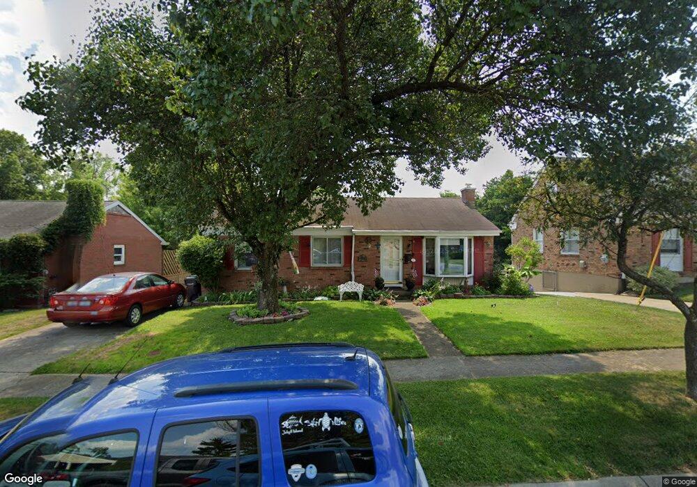
5251 Horizonvue Dr Cincinnati, OH 45239
Mount Airy NeighborhoodEstimated Value: $214,000 - $245,000
3
Beds
2
Baths
1,107
Sq Ft
$206/Sq Ft
Est. Value
About This Home
This home is located at 5251 Horizonvue Dr, Cincinnati, OH 45239 and is currently estimated at $228,330, approximately $206 per square foot. 5251 Horizonvue Dr is a home located in Hamilton County with nearby schools including Mt. Airy Elementary School, Western Hills High School, and Gilbert A. Dater High School.
Ownership History
Date
Name
Owned For
Owner Type
Purchase Details
Closed on
May 15, 2000
Sold by
Gemienhardt Gregory and Gemienhardt Diane R
Bought by
Ankenbauer Daniel T and Girmann Cynthia M
Current Estimated Value
Home Financials for this Owner
Home Financials are based on the most recent Mortgage that was taken out on this home.
Original Mortgage
$82,000
Outstanding Balance
$28,471
Interest Rate
8.21%
Estimated Equity
$199,859
Purchase Details
Closed on
Jul 8, 1999
Sold by
David Diane R and David Diane R
Bought by
Gemienhardt Gregory and Gemienhardt Diane R
Purchase Details
Closed on
Mar 18, 1994
Sold by
Frank Carl S and Frank Sandy
Bought by
David Diane R
Home Financials for this Owner
Home Financials are based on the most recent Mortgage that was taken out on this home.
Original Mortgage
$83,600
Interest Rate
7.02%
Create a Home Valuation Report for This Property
The Home Valuation Report is an in-depth analysis detailing your home's value as well as a comparison with similar homes in the area
Home Values in the Area
Average Home Value in this Area
Purchase History
| Date | Buyer | Sale Price | Title Company |
|---|---|---|---|
| Ankenbauer Daniel T | $112,500 | -- | |
| Gemienhardt Gregory | -- | -- | |
| David Diane R | -- | -- |
Source: Public Records
Mortgage History
| Date | Status | Borrower | Loan Amount |
|---|---|---|---|
| Open | Ankenbauer Daniel T | $82,000 | |
| Closed | David Diane R | $83,600 |
Source: Public Records
Tax History Compared to Growth
Tax History
| Year | Tax Paid | Tax Assessment Tax Assessment Total Assessment is a certain percentage of the fair market value that is determined by local assessors to be the total taxable value of land and additions on the property. | Land | Improvement |
|---|---|---|---|---|
| 2024 | $3,027 | $50,495 | $11,204 | $39,291 |
| 2023 | $3,095 | $50,495 | $11,204 | $39,291 |
| 2022 | $2,044 | $29,814 | $9,244 | $20,570 |
| 2021 | $1,963 | $29,814 | $9,244 | $20,570 |
| 2020 | $2,020 | $29,814 | $9,244 | $20,570 |
| 2019 | $1,904 | $25,701 | $7,970 | $17,731 |
| 2018 | $1,907 | $25,701 | $7,970 | $17,731 |
| 2017 | $1,811 | $25,701 | $7,970 | $17,731 |
| 2016 | $2,355 | $32,991 | $8,715 | $24,276 |
| 2015 | $2,124 | $32,991 | $8,715 | $24,276 |
| 2014 | $2,139 | $32,991 | $8,715 | $24,276 |
| 2013 | $2,364 | $35,858 | $9,471 | $26,387 |
Source: Public Records
Map
Nearby Homes
- 2730 Bristol Hill Ct
- 5306 Fox Rd
- 2773 W North Bend Rd
- 2969 Orchardtree Ct
- 5350 Orchardcreek Ct
- 2949 N Bend Rd
- 5277 Orchardridge Ct
- 4771 Shepherd Creek Rd
- 2601 Kathleen Ct
- 5360 Colerain Ave
- 3072 N Bend Rd
- 5587 Vogel Rd
- 3076 Hoock Ct
- 0 Samver Rd Unit 1841558
- 5618 Leumas Rd
- 5607 Leumas Dr
- 5610 Samver Rd
- 5607 Samver Rd
- 0 N Bend Rd
- 5523 Kirby Ave
- 5245 Horizonvue Dr
- 5255 Horizonvue Dr
- 5239 Horizonvue Dr
- 5259 Horizonvue Dr
- 5233 Horizonvue Dr
- 2769 Westonridge Dr
- 5246 Horizonvue Dr
- 2801 Westonridge Dr
- 5227 Horizonvue Dr
- 5242 Horizonvue Dr
- 2795 Westonridge Dr
- 2775 Westonridge Dr
- 5254 Horizonvue Dr
- 5250 Horizonvue Dr
- 5234 Horizonvue Dr
- 2805 Westonridge Dr
- 5221 Horizonvue Dr
- 2785 Westonridge Dr
- 2811 Westonridge Dr
- 2768 Westonridge Dr