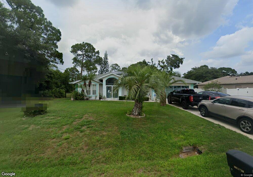
5252 Ensley Terrace North Port, FL 34288
Estimated Value: $269,899 - $307,000
3
Beds
2
Baths
1,455
Sq Ft
$198/Sq Ft
Est. Value
About This Home
This home is located at 5252 Ensley Terrace, North Port, FL 34288 and is currently estimated at $287,475, approximately $197 per square foot. 5252 Ensley Terrace is a home located in Sarasota County with nearby schools including Atwater Elementary School, North Port High School, and Woodland Middle School.
Ownership History
Date
Name
Owned For
Owner Type
Purchase Details
Closed on
Aug 27, 2025
Sold by
Simeone Mario
Bought by
Simeone Mario and Simeone Bob Joseph
Current Estimated Value
Purchase Details
Closed on
Feb 2, 1998
Sold by
Allstate Bldr Of Sw Fl Inc
Bought by
Simeone Mario and Simeone Lorraine J
Home Financials for this Owner
Home Financials are based on the most recent Mortgage that was taken out on this home.
Original Mortgage
$82,950
Interest Rate
7.01%
Mortgage Type
VA
Create a Home Valuation Report for This Property
The Home Valuation Report is an in-depth analysis detailing your home's value as well as a comparison with similar homes in the area
Home Values in the Area
Average Home Value in this Area
Purchase History
| Date | Buyer | Sale Price | Title Company |
|---|---|---|---|
| Simeone Mario | $100 | None Listed On Document | |
| Simeone Mario | $91,100 | -- |
Source: Public Records
Mortgage History
| Date | Status | Borrower | Loan Amount |
|---|---|---|---|
| Previous Owner | Simeone Mario | $82,950 |
Source: Public Records
Tax History Compared to Growth
Tax History
| Year | Tax Paid | Tax Assessment Tax Assessment Total Assessment is a certain percentage of the fair market value that is determined by local assessors to be the total taxable value of land and additions on the property. | Land | Improvement |
|---|---|---|---|---|
| 2024 | $1,726 | $105,075 | -- | -- |
| 2023 | $1,726 | $102,015 | $0 | $0 |
| 2022 | $1,619 | $99,044 | $0 | $0 |
| 2021 | $1,599 | $96,159 | $0 | $0 |
| 2020 | $1,574 | $94,831 | $0 | $0 |
| 2019 | $1,526 | $92,699 | $0 | $0 |
| 2018 | $1,406 | $90,971 | $0 | $0 |
| 2017 | $1,254 | $81,761 | $0 | $0 |
| 2016 | $1,245 | $118,100 | $5,600 | $112,500 |
| 2015 | $1,262 | $105,900 | $4,500 | $101,400 |
| 2014 | $1,235 | $77,725 | $0 | $0 |
Source: Public Records
Map
Nearby Homes
- 0 Kenvil Dr Unit MFRC7505533
- 0 Kenvil Dr Unit MFRN6141208
- 5262 Weatherton St
- 5290 Weatherton St
- 5365 Ensley Terrace
- 0 Longbow Ave Unit MFRC7508594
- 5574 Fairlane Dr
- 0 Jonquil Terrace
- 5174 Foxhall Rd
- 0 Foxhall Rd
- 0 Pinson Dr
- 1214 Rumson Ct
- 5509 Fairlane Dr
- 17362 Wellsley Ave
- 17314 Wellsley Ave
- 17427 Hillsborough Blvd
- LOT 13 Rumson Ct
- 1212 Gillespie Ave
- 17363 Wellsley Ave
- 0 Rumson Rd Unit MFRA4638802
- 5266 Ensley Terrace
- 0 Kenvil Dr Unit C7405955
- 0 Kenvil Dr Unit C7405608
- 0 Kenvil Dr Unit D6100715
- 0 Kenvil Dr Unit C7238539
- 0 Kenvil Dr Unit MFRA4598594
- 0 Kenvil Dr Unit MFRA4593348
- 0 Kenvil Dr Unit MFRA4575192
- 0 Kenvil Dr Unit A4552766
- 0 Kenvil Dr Unit N6121369
- 0 Kenvil Dr Unit C7457954
- 0 Kenvil Dr Unit N6119716
- 0 Kenvil Dr Unit A4521014
- 0 Kenvil Dr Unit C7451121
- 0 Kenvil Dr Unit C7448174
- 0 Kenvil Dr Unit A4507297
- 0 Kenvil Dr Unit A4502811
- 0 Kenvil Dr Unit C7441138
- 0 Kenvil Dr Unit A4485123
- 0 Kenvil Dr Unit A4478075