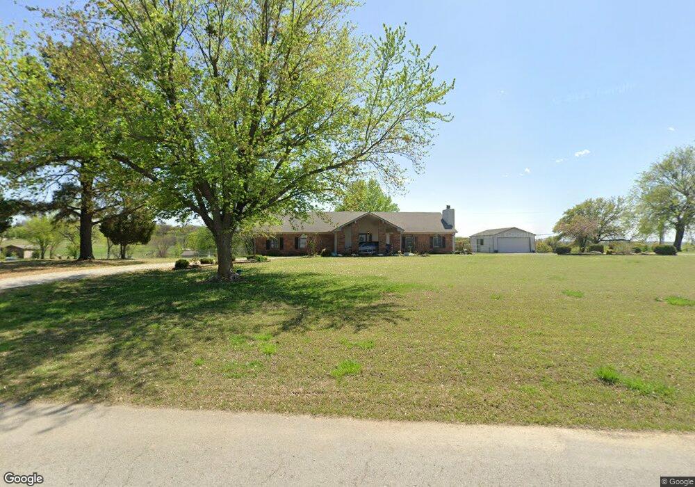
5252 W 131st St S Sapulpa, OK 74066
Estimated Value: $296,000 - $552,000
4
Beds
3
Baths
2,263
Sq Ft
$172/Sq Ft
Est. Value
About This Home
This home is located at 5252 W 131st St S, Sapulpa, OK 74066 and is currently estimated at $390,201, approximately $172 per square foot. 5252 W 131st St S is a home located in Creek County with nearby schools including Kiefer Elementary School, Rongey Middle School, and Kiefer High School.
Ownership History
Date
Name
Owned For
Owner Type
Purchase Details
Closed on
Jul 24, 2023
Sold by
Kent And Jackie Clark Family Revocable T
Bought by
Belk Troy and Belk Erin
Current Estimated Value
Purchase Details
Closed on
Nov 24, 2009
Sold by
Stobaugh Donald and Stobaugh Patti
Bought by
Stobaugh Donald and Stobaugh Patti
Purchase Details
Closed on
Nov 14, 2005
Sold by
Stobauch Charles Elbert and Stobauch Charles E
Bought by
Peirce Robert A and Peirce Sandra K
Purchase Details
Closed on
Jun 30, 2005
Sold by
Ware Charles W and Ware Ginger
Bought by
Stobaugh Charles Elbert
Create a Home Valuation Report for This Property
The Home Valuation Report is an in-depth analysis detailing your home's value as well as a comparison with similar homes in the area
Home Values in the Area
Average Home Value in this Area
Purchase History
| Date | Buyer | Sale Price | Title Company |
|---|---|---|---|
| Belk Troy | $450,000 | First American Title | |
| Stobaugh Donald | -- | -- | |
| Stobaugh Donald | $159,000 | -- | |
| Peirce Robert A | $165,000 | None Available | |
| Stobaugh Charles Elbert | -- | None Available |
Source: Public Records
Tax History Compared to Growth
Tax History
| Year | Tax Paid | Tax Assessment Tax Assessment Total Assessment is a certain percentage of the fair market value that is determined by local assessors to be the total taxable value of land and additions on the property. | Land | Improvement |
|---|---|---|---|---|
| 2025 | $2,182 | $21,329 | $774 | $20,555 |
| 2024 | $2,112 | $20,313 | $774 | $19,539 |
| 2023 | $2,112 | $19,346 | $774 | $18,572 |
| 2022 | $1,848 | $18,425 | $774 | $17,651 |
| 2021 | $1,841 | $17,547 | $774 | $16,773 |
| 2020 | $2,111 | $20,660 | $774 | $19,886 |
| 2019 | $1,975 | $19,677 | $1,374 | $18,303 |
| 2018 | $1,949 | $19,450 | $1,374 | $18,076 |
| 2017 | $1,895 | $19,450 | $1,374 | $18,076 |
| 2016 | $1,902 | $19,450 | $1,374 | $18,076 |
| 2015 | -- | $19,450 | $1,374 | $18,076 |
| 2014 | -- | $19,080 | $1,374 | $17,706 |
Source: Public Records
Map
Nearby Homes
- 13435 S Garrett St
- 6355 Rockwood Cir N
- 6490 Lindsay Dr
- 0 33rd West Ave
- 4367 Lakeside Dr
- 0 Lakeside Dr
- 609 Cross Timbers Blvd
- 605 Cross Timbers Blvd
- 590 Creekside Dr
- 12933 S 33rd West Ave
- 2810 E Hwy 117
- 626 Countrywood Way
- 8 Ryan Place
- 461 Cross Timbers Blvd
- 527 Pioneer Rd
- 540 Creekside Dr
- 421 Summercrest Ct
- 33 Mary
- 00 W 126th St S
- 341 N Main St
- 5350 W 131st St S
- 13112 S 49th West Ave
- 13248 S 49th West Ave
- null S 49th West Ave
- 11240 S 49th Ave W
- 11260 S 49th Ave W
- 5500 W 131st St S
- 5568 W 131st St S
- 13265 S 49th West Ave
- 5587 W 131st St S
- 5145 W 134th St S
- 13349 S 49th West Ave
- 13410 S 49th West Ave
- 5652 W 131st St S
- 13383 S 49th West Ave
- 13419 S 49th West Ave
- 13419 S 49th Ave W
- 5741 W 131st St S
- 5736 W 131st St S
- 2 E 131st St S