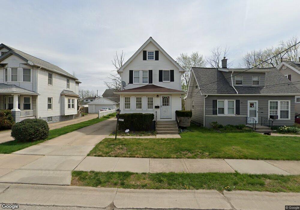
5253 Milo Ave Maple Heights, OH 44137
Estimated Value: $120,539 - $139,000
3
Beds
2
Baths
1,152
Sq Ft
$112/Sq Ft
Est. Value
About This Home
This home is located at 5253 Milo Ave, Maple Heights, OH 44137 and is currently estimated at $129,385, approximately $112 per square foot. 5253 Milo Ave is a home located in Cuyahoga County with nearby schools including Abraham Lincoln Elementary School, Rockside/ J.F. Kennedy School, and Barack Obama School.
Ownership History
Date
Name
Owned For
Owner Type
Purchase Details
Closed on
Aug 29, 2009
Sold by
Shott Michael
Bought by
Owens Kenterrian L
Current Estimated Value
Home Financials for this Owner
Home Financials are based on the most recent Mortgage that was taken out on this home.
Original Mortgage
$73,641
Outstanding Balance
$48,381
Interest Rate
5.28%
Mortgage Type
FHA
Estimated Equity
$81,004
Purchase Details
Closed on
Jan 16, 1987
Sold by
Stettin Marie
Bought by
Shott Michael
Purchase Details
Closed on
Jan 1, 1975
Bought by
Stettin Marie
Create a Home Valuation Report for This Property
The Home Valuation Report is an in-depth analysis detailing your home's value as well as a comparison with similar homes in the area
Home Values in the Area
Average Home Value in this Area
Purchase History
| Date | Buyer | Sale Price | Title Company |
|---|---|---|---|
| Owens Kenterrian L | $75,000 | Attorney | |
| Shott Michael | $39,000 | -- | |
| Stettin Marie | -- | -- |
Source: Public Records
Mortgage History
| Date | Status | Borrower | Loan Amount |
|---|---|---|---|
| Open | Owens Kenterrian L | $73,641 |
Source: Public Records
Tax History
| Year | Tax Paid | Tax Assessment Tax Assessment Total Assessment is a certain percentage of the fair market value that is determined by local assessors to be the total taxable value of land and additions on the property. | Land | Improvement |
|---|---|---|---|---|
| 2024 | $3,718 | $41,965 | $7,140 | $34,825 |
| 2023 | $2,920 | $28,280 | $3,780 | $24,500 |
| 2022 | $2,909 | $28,280 | $3,780 | $24,500 |
| 2021 | $3,107 | $28,280 | $3,780 | $24,500 |
| 2020 | $2,640 | $21,420 | $2,870 | $18,550 |
| 2019 | $2,628 | $61,200 | $8,200 | $53,000 |
| 2018 | $2,583 | $21,420 | $2,870 | $18,550 |
| 2017 | $2,743 | $22,120 | $3,640 | $18,480 |
| 2016 | $2,654 | $22,120 | $3,640 | $18,480 |
| 2015 | $2,531 | $22,120 | $3,640 | $18,480 |
| 2014 | $2,531 | $22,830 | $3,750 | $19,080 |
Source: Public Records
Map
Nearby Homes
- 5179 Milo Ave
- 5220 Forest Ave
- 14305 Granger Rd
- 14510 Granger Rd
- 14512 Granger Rd
- 13704 Linn Ave
- 5270 E 135th St
- 13417 Granger Rd
- 5408 Roland Dr
- 13719 Wolf Ave
- 15095 Granger Rd
- 5380 E 131st St
- 5353 E 129th St
- 4955 E 141st St
- 13009 Willard Ave
- 13008 Willard Ave
- 13116 Oak Park Blvd
- 13206 Shady Oak Blvd
- 12328 Granger Rd
- 13917 Maple Leaf Dr
Your Personal Tour Guide
Ask me questions while you tour the home.