5253 Somers Point Rd Mays Landing, NJ 08330
Estimated payment $1,082/month
About This Home
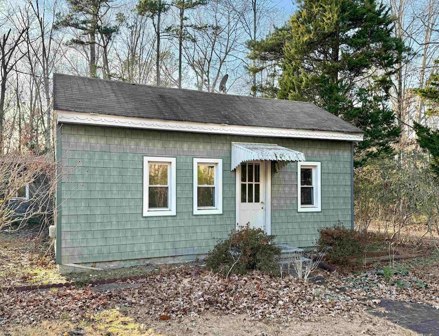
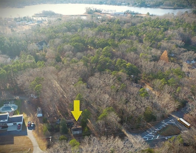
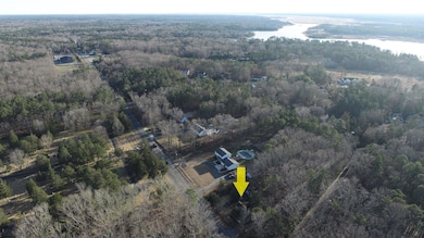
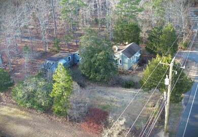
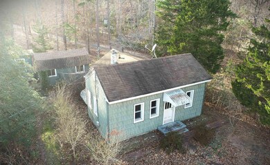
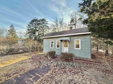
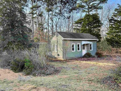
Charming Cottage Opportunity in Mays Landing! Welcome to 5253 Mays Landing Somers Point Road, a cozy 1-bedroom, 1-bath home offering endless potential for those looking to bring their vision to life. With 492 sq ft of living space, this bungalow features a functional layout including a kitchen, comfortable living room, and a laundry area. Two detached outbuildings provide ample room for storage, hobbies, or future workshop space. Situated on a peaceful stretch of Mays Landing Somers Point Road, this property offers a balance of quiet living with convenient access to everything the area has to offer. Enjoy close proximity to downtown Mays Landing’s local shops and dining, the Hamilton Mall, Storybook Land, and the Atlantic City Expressway—making travel to the beaches, boardwalks, or Philadelphia a breeze. Outdoor recreation enthusiasts will appreciate nearby access to Lake Lenape, boating, fishing, parks, and nature trails. This home needs repairs and updates and is being sold strictly as-is, making it a great opportunity for investors, downsizers seeking a project, or anyone looking to create a personalized retreat in a desirable location. Bring your ideas and imagination—this cottage is ready to shine again! Property is being sold As-Is condition. Buyer is responsible for all certifications. Seller never occupied. Neither the seller or listing agent make any representation as to the accuracy of any information contained herein. Buyer must conduct their own due diligence, verification, research and inspections and are relying solely on the results thereof.
Home Details
Home Type
- Single Family
Est. Annual Taxes
- $2,918
Year Built
- Built in 1920
Home Design
- 492 Sq Ft Home
- Cottage
Bedrooms and Bathrooms
- 1 Bedroom
- 1 Full Bathroom
Utilities
- Heating System Uses Oil
- Private Sewer
Listing and Financial Details
- Tax Lot 2
Map
Home Values in the Area
Average Home Value in this Area
Tax History
| Year | Tax Paid | Tax Assessment Tax Assessment Total Assessment is a certain percentage of the fair market value that is determined by local assessors to be the total taxable value of land and additions on the property. | Land | Improvement |
|---|---|---|---|---|
| 2025 | $2,844 | $82,900 | $49,900 | $33,000 |
| 2024 | $2,844 | $82,900 | $49,900 | $33,000 |
| 2023 | $2,674 | $82,900 | $49,900 | $33,000 |
| 2022 | $2,674 | $82,900 | $49,900 | $33,000 |
| 2021 | $2,169 | $82,900 | $49,900 | $33,000 |
| 2020 | $2,169 | $82,900 | $49,900 | $33,000 |
| 2019 | $2,175 | $82,900 | $49,900 | $33,000 |
| 2018 | $2,082 | $82,900 | $49,900 | $33,000 |
| 2017 | $2,041 | $82,900 | $49,900 | $33,000 |
| 2016 | $1,970 | $82,900 | $49,900 | $33,000 |
| 2015 | $2,136 | $82,900 | $49,900 | $33,000 |
| 2014 | $2,259 | $95,500 | $59,600 | $35,900 |
Property History
| Date | Event | Price | List to Sale | Price per Sq Ft |
|---|---|---|---|---|
| 12/04/2025 12/04/25 | For Sale | $159,900 | -- | $325 / Sq Ft |
Purchase History
| Date | Type | Sale Price | Title Company |
|---|---|---|---|
| Interfamily Deed Transfer | -- | -- | |
| Deed | $45,000 | The Title Company Of Jersey | |
| Quit Claim Deed | -- | -- |
Source: South Jersey Shore Regional MLS
MLS Number: 602870
APN: 12-00982-0000-00002
Disclaimer: Certain information contained herein is derived from information provided by parties other than Homes.com. All information provided is deemed reliable, but is not guaranteed to be accurate and should be independently verified.
![]() IDX information is provided exclusively for personal, non-commercial use, and may not be used for any purpose other than to identify prospective properties consumers may be interested in purchasing.
IDX information is provided exclusively for personal, non-commercial use, and may not be used for any purpose other than to identify prospective properties consumers may be interested in purchasing.
Information is deemed reliable but not guaranteed.
© 2025 South Jersey Shore Regional Multiple Listing Service. All rights reserved.
- 5253 Mays Landing Sp Rd
- 570 North St
- 116 Post Rd
- 1410 Cantillon Blvd
- 1303 W Riverside Dr
- 225 Old River Rd
- 101 Vail Ct
- 504 Meadowbrook Dr
- 15 Lowell St
- 148 Marucci Place
- 109 Deal Ln
- 98 Gasko Rd
- 112 Giunta Walk
- 1403 Loretta Ave
- 1305 Matthews Ave
- 76 Gasko Rd
- 1 Lafayette Ave
- 1404 Loretta Ave
- Rt 50 and Old Mays Landing Rd
- 0 3rd St
- 908 Morris Ln
- 254 Vail Ct Unit 1504
- 254 Vail Ct
- 1309 Matthews Ave
- 30 Mill St
- 4850 Corwen Ct
- 1932 Cologne Ave
- 2444 Bayberry Ct
- 3401 Montgomery Dr
- 2465 Arbor Ct Unit 311
- 2602 Dogwood Ct Unit 162
- 2839 Forsythia Ct Unit 277
- 2744 Mimosa Ct
- 3214 Juniper Ct Unit 652
- 3137 Woodlands Dr Unit C0025
- 2613 Boulder Ct
- 2708 Falcon Ct
- 3307 Falcon Ct
- 2000 Timber Glen Dr
- 6216 Cypress St
