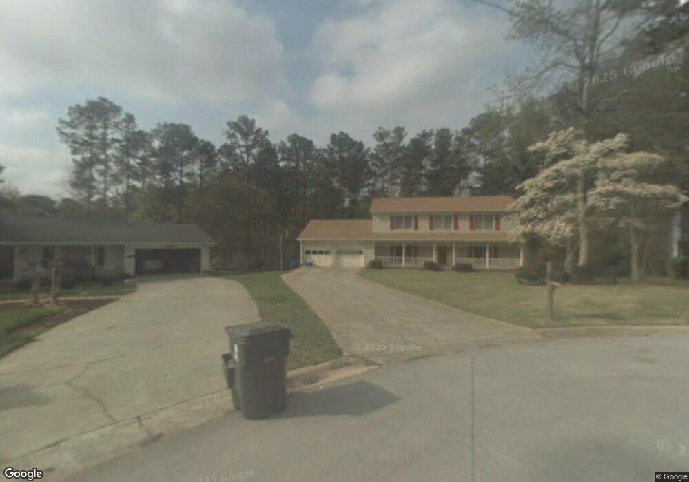
5256 Ashford Ct SW Unit 10 Lilburn, GA 30047
Estimated Value: $417,017 - $444,000
4
Beds
3
Baths
2,509
Sq Ft
$172/Sq Ft
Est. Value
About This Home
This home is located at 5256 Ashford Ct SW Unit 10, Lilburn, GA 30047 and is currently estimated at $431,504, approximately $171 per square foot. 5256 Ashford Ct SW Unit 10 is a home located in Gwinnett County with nearby schools including Camp Creek Elementary School, Trickum Middle School, and Parkview High School.
Ownership History
Date
Name
Owned For
Owner Type
Purchase Details
Closed on
Feb 15, 2023
Sold by
Goff Cynthia J
Bought by
Baez Ricardo
Current Estimated Value
Home Financials for this Owner
Home Financials are based on the most recent Mortgage that was taken out on this home.
Original Mortgage
$361,810
Outstanding Balance
$349,262
Interest Rate
6.15%
Mortgage Type
New Conventional
Estimated Equity
$82,242
Purchase Details
Closed on
Apr 26, 2004
Sold by
Roesler Dennis N and Roesler Margaret
Bought by
Atkins Wesley and Atkins Patricia
Home Financials for this Owner
Home Financials are based on the most recent Mortgage that was taken out on this home.
Original Mortgage
$142,000
Interest Rate
5.36%
Mortgage Type
New Conventional
Create a Home Valuation Report for This Property
The Home Valuation Report is an in-depth analysis detailing your home's value as well as a comparison with similar homes in the area
Home Values in the Area
Average Home Value in this Area
Purchase History
| Date | Buyer | Sale Price | Title Company |
|---|---|---|---|
| Baez Ricardo | $373,000 | -- | |
| Atkins Wesley | $177,500 | -- |
Source: Public Records
Mortgage History
| Date | Status | Borrower | Loan Amount |
|---|---|---|---|
| Open | Baez Ricardo | $361,810 | |
| Previous Owner | Atkins Wesley | $142,000 |
Source: Public Records
Tax History Compared to Growth
Tax History
| Year | Tax Paid | Tax Assessment Tax Assessment Total Assessment is a certain percentage of the fair market value that is determined by local assessors to be the total taxable value of land and additions on the property. | Land | Improvement |
|---|---|---|---|---|
| 2025 | $5,310 | $177,760 | $22,200 | $155,560 |
| 2024 | $5,659 | $149,200 | $22,200 | $127,000 |
| 2023 | $5,659 | $172,200 | $26,000 | $146,200 |
| 2022 | $4,323 | $146,560 | $26,000 | $120,560 |
| 2021 | $3,634 | $110,480 | $16,800 | $93,680 |
| 2020 | $3,659 | $110,480 | $16,800 | $93,680 |
| 2019 | $3,461 | $106,000 | $16,800 | $89,200 |
| 2018 | $3,048 | $86,800 | $12,800 | $74,000 |
| 2016 | $3,119 | $79,640 | $12,800 | $66,840 |
| 2015 | $2,920 | $79,400 | $11,200 | $68,200 |
| 2014 | -- | $79,400 | $11,200 | $68,200 |
Source: Public Records
Map
Nearby Homes
- 5104 Onawa Ct SW
- 881 Rockbridge Rd SW
- 746 Oxford Ct SW
- 717 Oxford Ct SW
- 5033 Charlemagne Way SW
- 5041 Bainbridge Ct SW Unit 3
- 574 Horseshoe Cir SW
- 851 Rockbridge Rd SW
- 5000 Bainbridge Ct SW
- 1054 Morgan Garner Dr SW
- 888 Castle Walk Cove SW
- 771 Mountainbrooke Cir SW
- 5002 Abbey Ln SW
- 551 Briggs Cir SW
- 954 Camp Creek Dr SW
- 1075 Westchester Dr SW
- 5221 La Paloma Dr SW Unit 1
- 5256 Ashford Ct SW
- 5246 Ashford Ct SW
- 5255 Ashford Ct SW
- 5236 Ashford Ct SW
- 5237 Manitu Ct SW
- 5247 Manitu Ct SW
- 5245 Ashford Ct SW
- 5235 Ashford Ct SW
- 5226 Ashford Ct SW
- 5225 Ashford Ct SW Unit 1
- 5248 SW 5248 Manitu Ct SW
- 5217 Manitu Ct SW
- 5248 Manitu Ct SW
- 5216 Ashford Ct SW
- 5215 Ashford Ct SW
- 5207 Manitu Ct SW
- 0 Garner Rd SW Unit 8889959
- 0 Garner Rd SW Unit 8024073
- 0 Garner Rd SW Unit 3125974
- 0 Garner Rd SW Unit 8354604