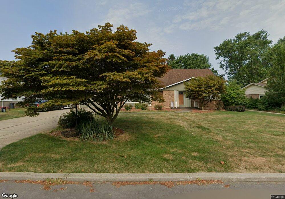
5256 Hewitt Pkwy Lewiston, NY 14092
Estimated Value: $495,000 - $627,000
5
Beds
3
Baths
2,685
Sq Ft
$203/Sq Ft
Est. Value
About This Home
This home is located at 5256 Hewitt Pkwy, Lewiston, NY 14092 and is currently estimated at $544,767, approximately $202 per square foot. 5256 Hewitt Pkwy is a home located in Niagara County with nearby schools including Primary Education Center, Intermediate Education Center, and Lewiston Porter Middle School.
Ownership History
Date
Name
Owned For
Owner Type
Purchase Details
Closed on
Nov 15, 2007
Sold by
Altieri Frank
Bought by
Arnold Francine
Current Estimated Value
Home Financials for this Owner
Home Financials are based on the most recent Mortgage that was taken out on this home.
Original Mortgage
$220,000
Outstanding Balance
$139,913
Interest Rate
6.48%
Mortgage Type
New Conventional
Estimated Equity
$404,854
Create a Home Valuation Report for This Property
The Home Valuation Report is an in-depth analysis detailing your home's value as well as a comparison with similar homes in the area
Home Values in the Area
Average Home Value in this Area
Purchase History
| Date | Buyer | Sale Price | Title Company |
|---|---|---|---|
| Arnold Francine | $275,000 | Brandon Piasecki |
Source: Public Records
Mortgage History
| Date | Status | Borrower | Loan Amount |
|---|---|---|---|
| Open | Arnold Francine | $220,000 | |
| Closed | Arnold Francine | $41,250 |
Source: Public Records
Tax History Compared to Growth
Tax History
| Year | Tax Paid | Tax Assessment Tax Assessment Total Assessment is a certain percentage of the fair market value that is determined by local assessors to be the total taxable value of land and additions on the property. | Land | Improvement |
|---|---|---|---|---|
| 2024 | $8,805 | $199,100 | $33,600 | $165,500 |
| 2023 | $9,977 | $199,100 | $33,600 | $165,500 |
| 2022 | $8,769 | $199,100 | $33,600 | $165,500 |
| 2021 | $8,675 | $199,100 | $33,600 | $165,500 |
| 2020 | $8,151 | $199,100 | $33,600 | $165,500 |
| 2019 | $7,570 | $199,100 | $33,600 | $165,500 |
| 2018 | $7,813 | $199,100 | $33,600 | $165,500 |
| 2017 | $7,570 | $199,100 | $33,600 | $165,500 |
| 2016 | $7,562 | $199,100 | $33,600 | $165,500 |
| 2015 | -- | $199,100 | $33,600 | $165,500 |
| 2014 | -- | $199,100 | $33,600 | $165,500 |
Source: Public Records
Map
Nearby Homes
- 450 Barton Dr
- 5129 Woodland Dr
- 5117 Woodland Dr
- 5079 Forest Rd
- 5158 Country Club Trail
- 722 Tuscarora St
- 0 S 5th St
- 270 S 4th St
- 305 S 1st St
- 933 Creek Road Extension
- 700 Mountain View Dr
- 737 Mountain View Dr
- 5092 Dana Dr
- 5236 Bridle Path Ln
- 490 Ridge St
- 481 Onondaga St
- 901 Onondaga St
- Berkley Essex Ridge Plan at Essex Ridge
- Weston Plan at Essex Ridge
- Concorde Essex Ridge Plan at Essex Ridge
- 5250 Hewitt Pkwy
- 5264 Hewitt Pkwy
- 5255 Fort Gray Dr
- 5263 Fort Gray Dr
- 5244 Hewitt Pkwy
- 5270 Hewitt Pkwy
- 5249 Fort Gray Dr
- 5269 Fort Gray Dr
- 5236 Hewitt Pkwy
- 5259 Hewitt Pkwy
- 5241 Fort Gray Dr
- 5251 Hewitt Pkwy
- 5278 Hewitt Pkwy
- 5275 Fort Gray Dr
- 5267 Hewitt Pkwy
- 5243 Hewitt Pkwy
- 5235 Fort Gray Dr
- 5273 Hewitt Pkwy
- 5230 Hewitt Pkwy
- 5281 Fort Gray Dr