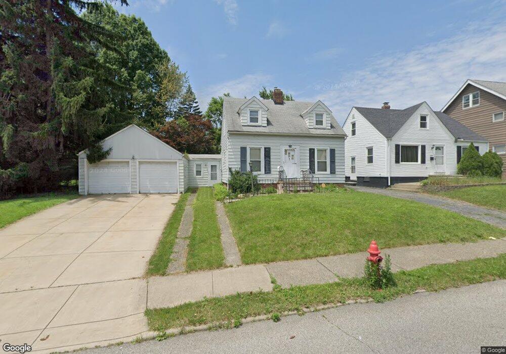
5258 Joseph St Maple Heights, OH 44137
Estimated Value: $128,126 - $157,000
3
Beds
2
Baths
1,215
Sq Ft
$117/Sq Ft
Est. Value
About This Home
This home is located at 5258 Joseph St, Maple Heights, OH 44137 and is currently estimated at $142,532, approximately $117 per square foot. 5258 Joseph St is a home located in Cuyahoga County with nearby schools including Abraham Lincoln Elementary School, Rockside/ J.F. Kennedy School, and Italy High School.
Ownership History
Date
Name
Owned For
Owner Type
Purchase Details
Closed on
Mar 7, 2022
Sold by
Harrison Mollie M
Bought by
Harrison Aaron D
Current Estimated Value
Home Financials for this Owner
Home Financials are based on the most recent Mortgage that was taken out on this home.
Original Mortgage
$5,500
Outstanding Balance
$5,139
Interest Rate
3.92%
Estimated Equity
$137,393
Purchase Details
Closed on
Dec 5, 2002
Sold by
Katona Kenneth R
Bought by
Harrison Mollie M
Home Financials for this Owner
Home Financials are based on the most recent Mortgage that was taken out on this home.
Original Mortgage
$83,230
Interest Rate
6.38%
Mortgage Type
FHA
Purchase Details
Closed on
Mar 25, 1999
Sold by
Frank Katona
Bought by
Katona Frank
Purchase Details
Closed on
Oct 5, 1983
Sold by
Katona Frank and Katona Florence C
Bought by
Katona Frank
Purchase Details
Closed on
Jan 1, 1975
Bought by
Katona Frank and Katona Florence C
Create a Home Valuation Report for This Property
The Home Valuation Report is an in-depth analysis detailing your home's value as well as a comparison with similar homes in the area
Home Values in the Area
Average Home Value in this Area
Purchase History
| Date | Buyer | Sale Price | Title Company |
|---|---|---|---|
| Harrison Aaron D | -- | Mutual Title Agency | |
| Harrison Mollie M | $102,500 | Chicago Title | |
| Katona Frank | -- | -- | |
| Katona Frank | -- | -- | |
| Katona Frank | -- | -- |
Source: Public Records
Mortgage History
| Date | Status | Borrower | Loan Amount |
|---|---|---|---|
| Open | Harrison Aaron D | $5,500 | |
| Open | Harrison Aaron D | $108,007 | |
| Previous Owner | Harrison Mollie M | $83,230 |
Source: Public Records
Tax History Compared to Growth
Tax History
| Year | Tax Paid | Tax Assessment Tax Assessment Total Assessment is a certain percentage of the fair market value that is determined by local assessors to be the total taxable value of land and additions on the property. | Land | Improvement |
|---|---|---|---|---|
| 2024 | $4,495 | $39,830 | $11,620 | $28,210 |
| 2023 | $2,768 | $24,400 | $7,040 | $17,360 |
| 2022 | $2,758 | $24,395 | $7,035 | $17,360 |
| 2021 | $2,929 | $24,400 | $7,040 | $17,360 |
| 2020 | $2,526 | $18,480 | $5,320 | $13,160 |
| 2019 | $2,499 | $52,800 | $15,200 | $37,600 |
| 2018 | $2,487 | $18,480 | $5,320 | $13,160 |
| 2017 | $2,347 | $16,770 | $4,940 | $11,830 |
| 2016 | $2,258 | $16,770 | $4,940 | $11,830 |
| 2015 | $2,247 | $16,770 | $4,940 | $11,830 |
| 2014 | $2,247 | $18,420 | $5,430 | $12,990 |
Source: Public Records
Map
Nearby Homes
- 5234 Erwin St
- 5239 Arch St
- 5199 Arch St
- 17916 North Blvd
- 17912 North Blvd
- 5257 Philip Ave
- 5231 Philip Ave
- 5265 Bellview St
- 18909 Maple Heights Blvd
- 5212 Catherine St
- 5409 Hollywood Ave
- 5110 Philip Ave
- 5185 Clement Ave
- 5031 Cato St
- 5082 Philip Ave
- 5061 Philip Ave
- 5208 Clement Ave
- 19221 Stafford Ave
- 5320 Clement Ave
- 5425 Grasmere Ave