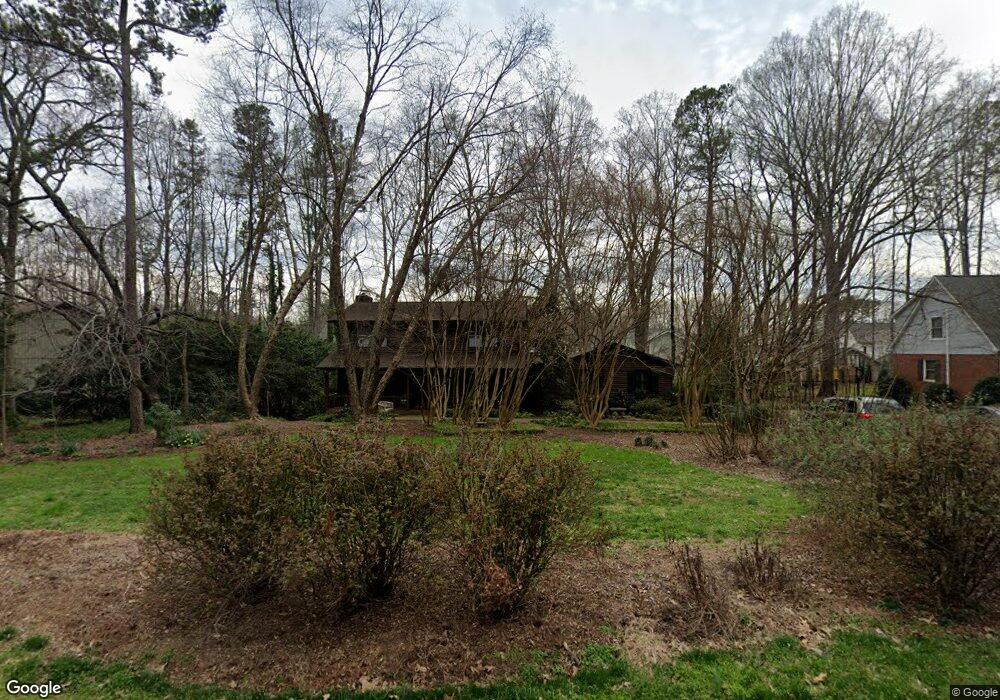
526 Pine Rd Davidson, NC 28036
Estimated Value: $864,176 - $1,264,000
4
Beds
4
Baths
2,639
Sq Ft
$384/Sq Ft
Est. Value
About This Home
This home is located at 526 Pine Rd, Davidson, NC 28036 and is currently estimated at $1,013,794, approximately $384 per square foot. 526 Pine Rd is a home located in Mecklenburg County with nearby schools including Davidson Elementary School, William Amos Hough High School, and Davidson Green School.
Ownership History
Date
Name
Owned For
Owner Type
Purchase Details
Closed on
Mar 26, 1998
Sold by
Mietz Gordon J and Mietz Alice J
Bought by
Bringewatt Kevin M and Bringewatt Tamara W
Current Estimated Value
Home Financials for this Owner
Home Financials are based on the most recent Mortgage that was taken out on this home.
Original Mortgage
$210,000
Outstanding Balance
$39,064
Interest Rate
6.87%
Estimated Equity
$974,730
Create a Home Valuation Report for This Property
The Home Valuation Report is an in-depth analysis detailing your home's value as well as a comparison with similar homes in the area
Home Values in the Area
Average Home Value in this Area
Purchase History
| Date | Buyer | Sale Price | Title Company |
|---|---|---|---|
| Bringewatt Kevin M | $210,000 | -- |
Source: Public Records
Mortgage History
| Date | Status | Borrower | Loan Amount |
|---|---|---|---|
| Open | Bringewatt Kevin M | $210,000 |
Source: Public Records
Tax History
| Year | Tax Paid | Tax Assessment Tax Assessment Total Assessment is a certain percentage of the fair market value that is determined by local assessors to be the total taxable value of land and additions on the property. | Land | Improvement |
|---|---|---|---|---|
| 2025 | -- | $600,900 | $335,000 | $265,900 |
| 2024 | -- | $600,900 | $335,000 | $265,900 |
| 2023 | $5,108 | $600,900 | $335,000 | $265,900 |
| 2022 | $5,108 | $538,100 | $360,000 | $178,100 |
| 2021 | $4,880 | $538,100 | $360,000 | $178,100 |
| 2020 | $4,880 | $538,100 | $360,000 | $178,100 |
| 2019 | $5,115 | $538,100 | $360,000 | $178,100 |
| 2018 | $4,833 | $392,500 | $240,000 | $152,500 |
| 2017 | $4,800 | $392,500 | $240,000 | $152,500 |
| 2016 | $4,797 | $392,500 | $240,000 | $152,500 |
| 2015 | $4,793 | $392,500 | $240,000 | $152,500 |
| 2014 | $4,791 | $0 | $0 | $0 |
Source: Public Records
Map
Nearby Homes
- 606 Ardrey Cir
- 1016 Concord Rd
- 866 Concord Rd
- 239 Kimberly Rd
- 130 Copper Pine Ln Unit 1
- 129 Hunt Camp Trail Unit 15
- 12309 Westbranch Pkwy
- 1425 Samuel Spencer Pkwy Unit 5
- 131 Morrison Hill Rd
- 136 Spencer St
- 757 Concord Rd
- 233 Twain Ave
- 1400 Samuel Spencer Pkwy
- 1413 Samuel Spencer Pkwy Unit 3
- 306 Ashby Dr
- 100 Martin St
- 720 Dogwood Ln
- 11916 Westbranch Pkwy
- 1418 Samuel Spencer Pkwy
- 11826 Westbranch Pkwy
- 516 Pine Rd
- 536 Pine Rd
- 719 Patrick Johnston Ln Unit 6
- 723 Patrick Johnston Ln Unit 5
- 723 Patrick Johnston Ln
- 715 Patrick Johnston Ln Unit 7
- 727 Patrick Johnston Ln
- 727 Patrick Johnston Ln Unit 4
- 711 Patrick Johnston Ln Unit 8
- 548 Pine Rd
- 506 Pine Rd
- 515 Pine Rd
- 535 Pine Rd
- 707 Patrick Johnston Ln Unit 9
- 707 Patrick Johnston Ln
- 801 Patrick Johnston Ln Unit 3
- 703 Patrick Johnston Ln
- 703 Patrick Johnston Ln Unit 10
- 505 Pine Rd
- 543 Pine Rd
Your Personal Tour Guide
Ask me questions while you tour the home.