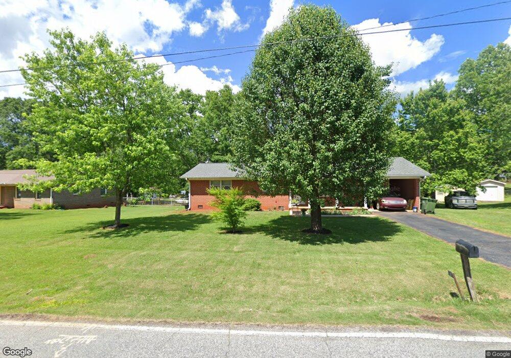
526 Playground Rd Walhalla, SC 29691
Estimated Value: $208,000 - $245,000
3
Beds
2
Baths
1,067
Sq Ft
$211/Sq Ft
Est. Value
About This Home
This home is located at 526 Playground Rd, Walhalla, SC 29691 and is currently estimated at $225,087, approximately $210 per square foot. 526 Playground Rd is a home located in Oconee County with nearby schools including Walhalla Elementary School, Walhalla Middle School, and Walhalla High School.
Ownership History
Date
Name
Owned For
Owner Type
Purchase Details
Closed on
Oct 3, 2022
Sold by
Young Delores A
Bought by
Mcdowell Marc T and Mcdowell Christina
Current Estimated Value
Home Financials for this Owner
Home Financials are based on the most recent Mortgage that was taken out on this home.
Original Mortgage
$186,188
Outstanding Balance
$177,454
Interest Rate
5.13%
Mortgage Type
VA
Estimated Equity
$47,633
Purchase Details
Closed on
Feb 5, 2015
Sold by
Young Delores Ann
Bought by
Young Delores A
Create a Home Valuation Report for This Property
The Home Valuation Report is an in-depth analysis detailing your home's value as well as a comparison with similar homes in the area
Home Values in the Area
Average Home Value in this Area
Purchase History
| Date | Buyer | Sale Price | Title Company |
|---|---|---|---|
| Mcdowell Marc T | $182,000 | -- | |
| Young Delores A | -- | -- |
Source: Public Records
Mortgage History
| Date | Status | Borrower | Loan Amount |
|---|---|---|---|
| Open | Mcdowell Marc T | $186,188 |
Source: Public Records
Tax History
| Year | Tax Paid | Tax Assessment Tax Assessment Total Assessment is a certain percentage of the fair market value that is determined by local assessors to be the total taxable value of land and additions on the property. | Land | Improvement |
|---|---|---|---|---|
| 2025 | $533 | $6,974 | $394 | $6,580 |
| 2024 | $527 | $6,974 | $394 | $6,580 |
| 2023 | $517 | $6,974 | $394 | $6,580 |
| 2022 | $1,073 | $3,334 | $442 | $2,892 |
| 2021 | $1,495 | $3,178 | $442 | $2,736 |
| 2020 | $1,073 | $3,178 | $442 | $2,736 |
| 2019 | $1,073 | $0 | $0 | $0 |
| 2018 | $1,045 | $0 | $0 | $0 |
| 2017 | $1,495 | $0 | $0 | $0 |
| 2016 | $1,495 | $0 | $0 | $0 |
| 2015 | -- | $0 | $0 | $0 |
| 2014 | -- | $3,370 | $634 | $2,736 |
| 2013 | -- | $0 | $0 | $0 |
Source: Public Records
Map
Nearby Homes
- Tract B Bobolink Dr
- 101 Hazelwood Way
- 308 Wildwood Rd
- 606 N Poplar St
- 223 N Dogwood Dr
- 324 Fox Run Rd
- 221 Cub Cove Dr
- 323 Fox Run Rd
- 229 Cub Cove Dr
- 00 N Church St
- 00 Abbott Ln
- 147 White Oak St
- 384 E Woodland Dr
- 804 W North Broad St
- 00 W North Broad St
- 606 W South Broad St
- 107 S Laurel St
- 109 S Laurel St
- 98 Mountain View Dr
- 00 Heaven View Dr
- 525 Playground Rd
- 528 Playground Rd Unit Bobolink
- 528 Playground Rd
- 524 Playground Rd
- 00 Playground Rd Unit Rocky Knoll Road
- 00 Playground Rd
- L2 Playground Rd
- 706 N Poplar St
- 104 Bobolink Dr
- 521 Playground Rd
- 600 Playground Rd
- 101 Christy Ln
- 518 Playground Rd Unit PLAYGROUND ESTATES
- 518 Playground Rd
- 105 Bobolink Dr
- 105 Meadowlark Dr
- 110 Bobolink Dr
- 112 Bobolink Dr
- 000 Bobolink Dr
- 01-03 Bobolink Dr
Your Personal Tour Guide
Ask me questions while you tour the home.