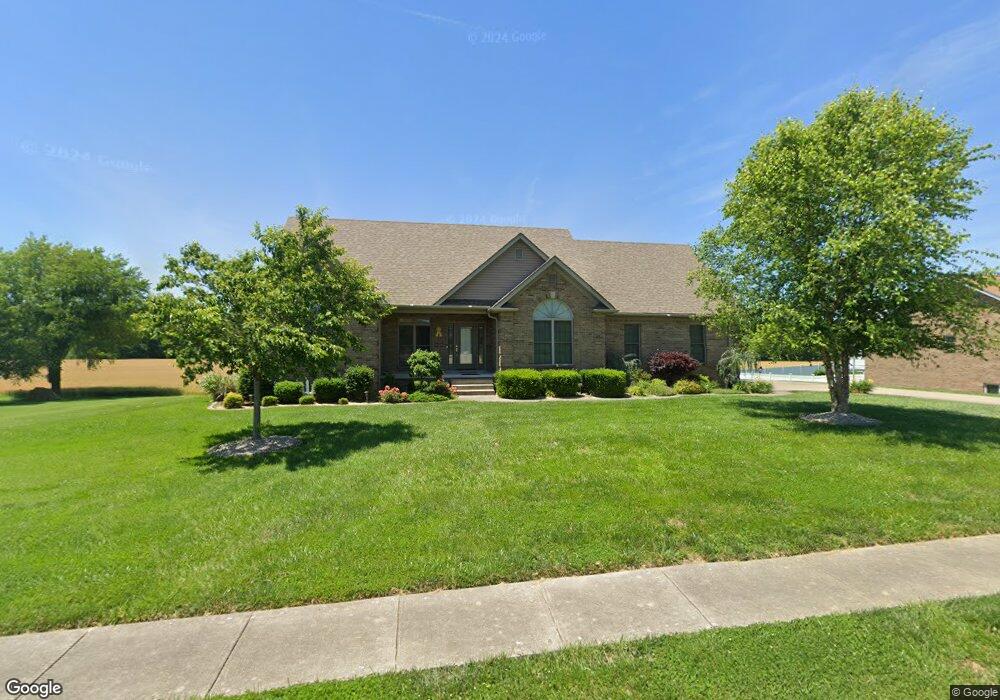
526 Saint Andrews Dr Vine Grove, KY 40175
Estimated Value: $367,000 - $516,000
3
Beds
3
Baths
2,170
Sq Ft
$195/Sq Ft
Est. Value
About This Home
This home is located at 526 Saint Andrews Dr, Vine Grove, KY 40175 and is currently estimated at $423,204, approximately $195 per square foot. 526 Saint Andrews Dr is a home located in Hardin County with nearby schools including Vine Grove Elementary School, James T. Alton Middle School, and North Hardin High School.
Ownership History
Date
Name
Owned For
Owner Type
Purchase Details
Closed on
Jul 28, 2010
Sold by
Stewart Brenda and Stewart Brenda Kay
Bought by
Rhoads David R and Rhoads Angela D
Current Estimated Value
Home Financials for this Owner
Home Financials are based on the most recent Mortgage that was taken out on this home.
Original Mortgage
$299,155
Outstanding Balance
$199,761
Interest Rate
4.74%
Mortgage Type
New Conventional
Estimated Equity
$223,443
Create a Home Valuation Report for This Property
The Home Valuation Report is an in-depth analysis detailing your home's value as well as a comparison with similar homes in the area
Home Values in the Area
Average Home Value in this Area
Purchase History
| Date | Buyer | Sale Price | Title Company |
|---|---|---|---|
| Rhoads David R | $314,900 | Metro Title Llc |
Source: Public Records
Mortgage History
| Date | Status | Borrower | Loan Amount |
|---|---|---|---|
| Open | Rhoads David R | $299,155 |
Source: Public Records
Tax History Compared to Growth
Tax History
| Year | Tax Paid | Tax Assessment Tax Assessment Total Assessment is a certain percentage of the fair market value that is determined by local assessors to be the total taxable value of land and additions on the property. | Land | Improvement |
|---|---|---|---|---|
| 2024 | $2,504 | $314,900 | $38,000 | $276,900 |
| 2023 | $2,911 | $314,900 | $38,000 | $276,900 |
| 2022 | $2,584 | $314,900 | $38,000 | $276,900 |
| 2021 | $3,031 | $314,900 | $34,600 | $280,300 |
| 2020 | $3,070 | $314,900 | $34,600 | $280,300 |
| 2019 | $0 | $275,600 | $0 | $0 |
| 2018 | $3,015 | $277,300 | $0 | $0 |
| 2017 | $3,001 | $277,300 | $0 | $0 |
| 2016 | $0 | $314,900 | $0 | $0 |
| 2015 | $2,751 | $314,900 | $0 | $0 |
| 2012 | -- | $314,900 | $0 | $0 |
Source: Public Records
Map
Nearby Homes
- 155 Sawgrass Ave
- 26 Sawgrass Ave
- 24 Sawgrass Ave
- 14 Sawgrass Ave
- 86 Sawgrass Ave
- 27 Sawgrass Ave
- 23 Sawgrass Ave
- 13 Sawgrass Ave
- 15 Sawgrass Ave
- 405 Turnberry Ct
- Lot 94 Royal Birkdale Ct
- Lot 17 Sawgrass Ave
- Lot 11 Sawgrass Ave
- Lot 10 Sawgrass Ave
- 230 Royal Birkdale Ct
- 203 Creekvale Ct
- 900 Edgebrook Dr
- 586 Pinehurst Dr
- 584 Pinehurst Dr
- 578 Pinehurst Dr
- 524 Saint Andrews Dr
- 510 Saint Andrews Dr
- 525 Saint Andrews Dr
- 522 Saint Andrews Dr
- 527 Saint Andrews Dr
- 528 Saint Andrews Dr
- 521 Saint Andrews Dr
- 529 Saint Andrews Dr
- 520 Saint Andrews Dr
- 519 Saint Andrews Dr
- 531 Saint Andrews Dr
- 518 Saint Andrews Dr
- 532 Saint Andrews Dr
- 517 Saint Andrews Dr
- 533 Saint Andrews Dr
- 515 Saint Andrews Dr
- 534 Saint Andrews Dr
- 535 Saint Andrews Dr
- 514 Saint Andrews Dr
- 536 Saint Andrews Dr