Estimated Value: $206,181 - $269,000
4
Beds
1
Bath
1,368
Sq Ft
$180/Sq Ft
Est. Value
About This Home
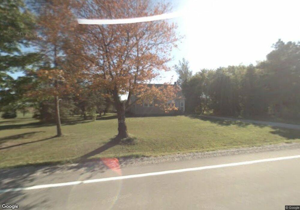
This home is located at 5261 Beard Rd, Clyde, MI 48049 and is currently estimated at $246,045, approximately $179 per square foot. 5261 Beard Rd is a home located in St. Clair County with nearby schools including Edison Elementary School, Fort Gratiot Middle School, and Port Huron Northern High School.
Ownership History
Date
Name
Owned For
Owner Type
Purchase Details
Closed on
Apr 15, 2024
Sold by
Rankin Danny M
Bought by
Rankin Danny M and Rankin Tammy
Current Estimated Value
Home Financials for this Owner
Home Financials are based on the most recent Mortgage that was taken out on this home.
Original Mortgage
$130,000
Outstanding Balance
$128,058
Interest Rate
6.88%
Mortgage Type
New Conventional
Estimated Equity
$117,987
Purchase Details
Closed on
Dec 17, 2010
Sold by
Ropposch Thomas J and Ropposch Debra L
Bought by
Rankin Danny M
Home Financials for this Owner
Home Financials are based on the most recent Mortgage that was taken out on this home.
Original Mortgage
$96,255
Interest Rate
4.44%
Mortgage Type
New Conventional
Purchase Details
Closed on
Jun 18, 2009
Sold by
Sears Brian M and Sears Annette
Bought by
American General Financial Services De I
Create a Home Valuation Report for This Property
The Home Valuation Report is an in-depth analysis detailing your home's value as well as a comparison with similar homes in the area
Home Values in the Area
Average Home Value in this Area
Purchase History
| Date | Buyer | Sale Price | Title Company |
|---|---|---|---|
| Rankin Danny M | -- | Timios | |
| Rankin Danny M | -- | Timios | |
| Rankin Danny M | $86,000 | Liberty Title | |
| American General Financial Services De I | $90,000 | None Available |
Source: Public Records
Mortgage History
| Date | Status | Borrower | Loan Amount |
|---|---|---|---|
| Open | Rankin Danny M | $130,000 | |
| Closed | Rankin Danny M | $130,000 | |
| Previous Owner | Rankin Danny M | $96,255 |
Source: Public Records
Tax History
| Year | Tax Paid | Tax Assessment Tax Assessment Total Assessment is a certain percentage of the fair market value that is determined by local assessors to be the total taxable value of land and additions on the property. | Land | Improvement |
|---|---|---|---|---|
| 2025 | $917 | $84,900 | $0 | $0 |
| 2024 | $889 | $83,700 | $0 | $0 |
| 2023 | $821 | $72,200 | $0 | $0 |
| 2022 | $1,113 | $65,000 | $0 | $0 |
| 2020 | $1,038 | $54,000 | $9,500 | $44,500 |
| 2019 | $1,017 | $54,400 | $0 | $0 |
| 2018 | $994 | $49,200 | $0 | $0 |
| 2017 | $974 | $47,800 | $0 | $0 |
| 2016 | $674 | $47,800 | $0 | $0 |
| 2015 | -- | $40,400 | $9,500 | $30,900 |
| 2014 | -- | $40,500 | $9,500 | $31,000 |
| 2013 | -- | $44,300 | $0 | $0 |
Source: Public Records
Map
Nearby Homes
- VL North Rd
- 3975 Wadhams Rd
- 0 Metcalf Rd Unit 20250029560
- 0 Mcintyre Unit 50191499
- Lot #9 Thornton Dr
- 4452 Cole Rd
- 3559 Lightle Rd
- 4008 Keewahdin Rd
- 3766 Abbottsford Rd
- 000 Metcalf Rd
- 00 Metcalf Rd
- 3679 Old Farm Ln
- 3625 Angus Rd
- 3935 Capital Ave
- 0 Mcintyre Rd Unit 50193698
- 3948 Stoney Ridge Dr
- 4570 Atkins Rd
- 4167 N River Rd
- 3865 Krafft Rd
- 6318 Rynn Rd
Your Personal Tour Guide
Ask me questions while you tour the home.