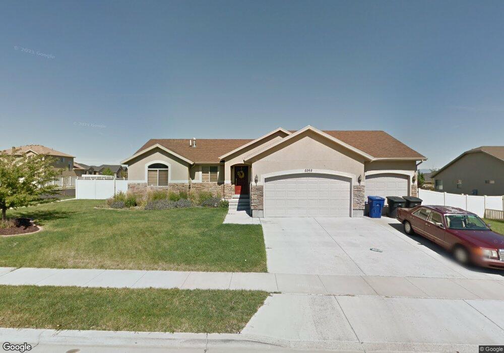
5262 W Freeman Peak Cir Herriman, UT 84096
Estimated Value: $577,000 - $676,000
5
Beds
3
Baths
2,626
Sq Ft
$235/Sq Ft
Est. Value
About This Home
This home is located at 5262 W Freeman Peak Cir, Herriman, UT 84096 and is currently estimated at $616,404, approximately $234 per square foot. 5262 W Freeman Peak Cir is a home located in Salt Lake County with nearby schools including Blackridge School, South Hills Middle School, and Mountain Ridge High School.
Ownership History
Date
Name
Owned For
Owner Type
Purchase Details
Closed on
May 21, 2012
Sold by
Nielsen Megan
Bought by
Harvey Jason I and Harvey Tami Ann
Current Estimated Value
Home Financials for this Owner
Home Financials are based on the most recent Mortgage that was taken out on this home.
Original Mortgage
$199,500
Outstanding Balance
$138,741
Interest Rate
3.98%
Mortgage Type
New Conventional
Estimated Equity
$477,663
Purchase Details
Closed on
Dec 18, 2006
Sold by
Moro Andrew J
Bought by
Nielsen Megan
Purchase Details
Closed on
Dec 5, 2002
Sold by
Desert Point Builders Inc
Bought by
Moro Andrew J
Home Financials for this Owner
Home Financials are based on the most recent Mortgage that was taken out on this home.
Original Mortgage
$187,530
Interest Rate
8.62%
Create a Home Valuation Report for This Property
The Home Valuation Report is an in-depth analysis detailing your home's value as well as a comparison with similar homes in the area
Home Values in the Area
Average Home Value in this Area
Purchase History
| Date | Buyer | Sale Price | Title Company |
|---|---|---|---|
| Harvey Jason I | -- | First American Title | |
| Nielsen Megan | -- | Meridian Title | |
| Moro Andrew J | -- | Meridian Title |
Source: Public Records
Mortgage History
| Date | Status | Borrower | Loan Amount |
|---|---|---|---|
| Open | Harvey Jason I | $199,500 | |
| Previous Owner | Moro Andrew J | $187,530 |
Source: Public Records
Tax History Compared to Growth
Tax History
| Year | Tax Paid | Tax Assessment Tax Assessment Total Assessment is a certain percentage of the fair market value that is determined by local assessors to be the total taxable value of land and additions on the property. | Land | Improvement |
|---|---|---|---|---|
| 2025 | $3,272 | $553,300 | $198,200 | $355,100 |
| 2024 | $3,272 | $536,600 | $188,800 | $347,800 |
| 2023 | $3,272 | $514,500 | $171,400 | $343,100 |
| 2022 | $3,386 | $524,000 | $168,000 | $356,000 |
| 2021 | $2,935 | $398,800 | $147,000 | $251,800 |
| 2020 | $2,803 | $358,900 | $108,100 | $250,800 |
| 2019 | $2,776 | $349,500 | $108,100 | $241,400 |
| 2018 | $2,623 | $325,200 | $103,800 | $221,400 |
| 2017 | $2,487 | $304,900 | $103,800 | $201,100 |
| 2016 | $2,367 | $278,400 | $103,800 | $174,600 |
| 2015 | $2,466 | $281,000 | $105,800 | $175,200 |
| 2014 | $2,238 | $249,800 | $94,900 | $154,900 |
Source: Public Records
Map
Nearby Homes
- 5248 Little Water Peak Dr
- 13908 S 5180 W
- 5288 Shaggy Peak Dr
- 14032 Lewiston Peak Dr
- 5030 Little Water Peak Dr
- 5036 W Cedar Point Peak Dr
- 14054 Elk Horn Peak Dr
- 14048 van Cott Peak Cir
- 14049 S van Cott Peak Cir
- 14121 Elk Horn Peak Dr
- 13597 S Firetip Ct
- 13842 Pioneer Peak Cir
- 5557 W 13680 S
- 13863 S Kessler Peak Dr
- 5217 Autumn Creek Dr
- 5617 W High Spirit Ct
- 5613 Prospero Ln
- 14254 S Amber Rose Ln
- 4952 W Atala Way
- 14322 Pepper Grass Ln
- 5262 Freeman Peak Cir
- 5248 Freeman Peak Cir
- 5248 W Freeman Peak Cir
- 5269 Gossamer Way
- 5269 W Gossamer Way
- 5253 Gossamer Way
- 13831 Freeman Peak Dr
- 13831 S Freeman Peak Dr
- 13806 S Freeman Peak Dr
- 13806 Freeman Peak Dr
- 5241 W Gossamer Way
- 5241 Gossamer Way
- 5234 Freeman Peak Cir
- 5234 W Freeman Peak Cir
- 13822 Freeman Peak Dr
- 13822 S Freeman Peak Dr
- 5291 Gossamer Way
- 5253 W Freeman Peak Cir
- 5253 Freeman Peak Cir
- 13832 Freeman Peak Dr