Estimated Value: $531,021
Studio
--
Bath
7,000
Sq Ft
$76/Sq Ft
Est. Value
About This Home
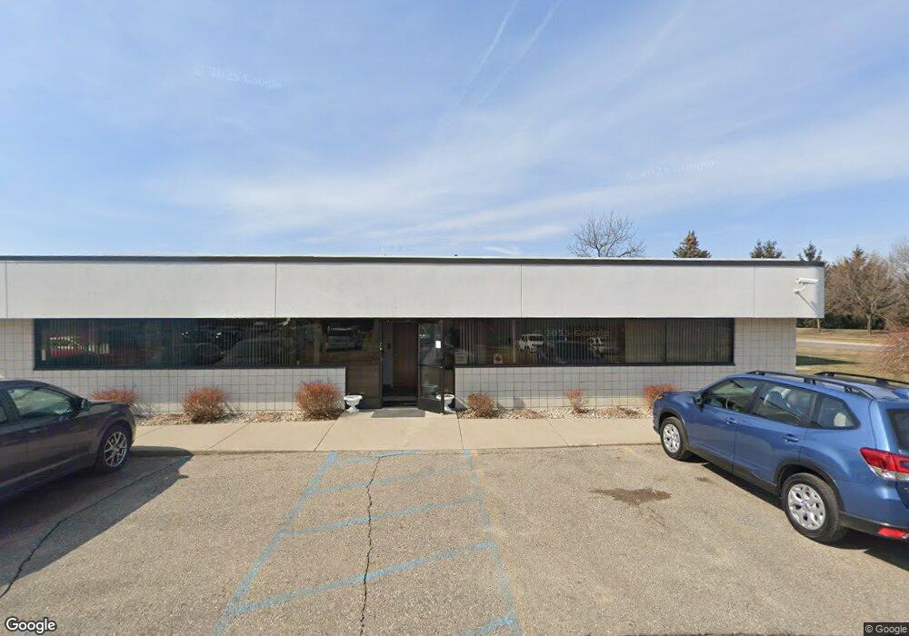
This home is located at 5267 Commerce Rd, Flint, MI 48507 and is currently estimated at $531,021, approximately $75 per square foot. 5267 Commerce Rd is a home located in Genesee County with nearby schools including Elms Road Elementary School, Syring Elementary School, and Morrish Elementary School.
Ownership History
Date
Name
Owned For
Owner Type
Purchase Details
Closed on
Aug 23, 2012
Sold by
The Estate Of Michael J Ryan
Bought by
Miller Family Holdings Llc
Current Estimated Value
Purchase Details
Closed on
Sep 23, 2009
Sold by
Quality Tech Inc
Bought by
Merit Leasing Enterprises Llc
Purchase Details
Closed on
Aug 2, 2000
Sold by
R L White Development
Bought by
Quality Tech Inc
Purchase Details
Closed on
Jan 19, 2000
Sold by
Kinslow Elizabeth
Bought by
R L White Development
Purchase Details
Closed on
Jan 18, 2000
Sold by
Paavola Gary C
Bought by
Kinslow Elizabeth
Create a Home Valuation Report for This Property
The Home Valuation Report is an in-depth analysis detailing your home's value as well as a comparison with similar homes in the area
Home Values in the Area
Average Home Value in this Area
Purchase History
| Date | Buyer | Sale Price | Title Company |
|---|---|---|---|
| Miller Family Holdings Llc | $237,500 | Cislo Title Co | |
| The Estate Of Michael J Ryan | -- | Cislo Title Co | |
| Merit Leasing Enterprises Llc | $420,000 | First American Title Ins Co | |
| Quality Tech Inc | $532,758 | Cislo Title Company | |
| R L White Development | -- | Cislo Title Company | |
| Kinslow Elizabeth | $48,000 | Cislo Title Company |
Source: Public Records
Tax History
| Year | Tax Paid | Tax Assessment Tax Assessment Total Assessment is a certain percentage of the fair market value that is determined by local assessors to be the total taxable value of land and additions on the property. | Land | Improvement |
|---|---|---|---|---|
| 2025 | $14,380 | $391,900 | $0 | $0 |
| 2024 | $9,458 | $376,100 | $0 | $0 |
| 2023 | $9,016 | $362,000 | $0 | $0 |
| 2022 | $7,078 | $350,400 | $0 | $0 |
| 2021 | $3,468 | $337,800 | $0 | $0 |
| 2020 | $8,266 | $341,100 | $0 | $0 |
| 2019 | $8,130 | $333,400 | $0 | $0 |
| 2018 | $10,275 | $242,900 | $0 | $0 |
| 2017 | $9,892 | $242,900 | $0 | $0 |
| 2016 | $9,896 | $216,000 | $0 | $0 |
| 2015 | $9,733 | $200,400 | $0 | $0 |
| 2014 | $6,761 | $179,300 | $0 | $0 |
| 2012 | -- | $178,600 | $30,700 | $147,900 |
Source: Public Records
Map
Nearby Homes
- 5168 Champagne Dr Unit 144
- 5201 Chantelle Dr Unit 134
- 5162 Miller Rd
- 5142 Rhine Dr Unit 16
- 5446 Miller Rd
- 5454 Miller Rd
- 5082 Miller Rd
- 4341 Staunton Dr
- 4378 Staunton Dr
- 5252 Maple Ave
- 5141 Maple Ave
- 3365 Swartz St
- 3435 Swartz St
- 3343 Heritage Blvd
- 3333 Heritage Blvd
- 6251 Saint Charles Pass Unit 52
- 3330 Heritage Blvd
- 3139 Red Barn Rd
- 4490 W Lennon Rd
- 4175 Miller Rd
Your Personal Tour Guide
Ask me questions while you tour the home.