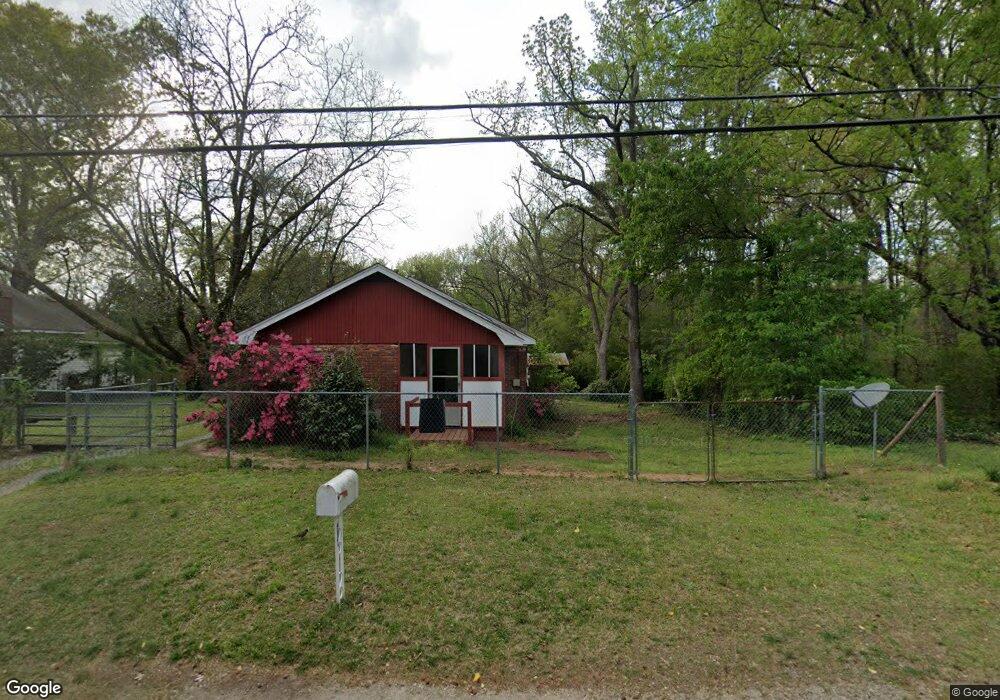
5267 Old Bill Cook Rd Atlanta, GA 30349
Estimated Value: $156,753 - $184,000
2
Beds
1
Bath
1,032
Sq Ft
$162/Sq Ft
Est. Value
About This Home
This home is located at 5267 Old Bill Cook Rd, Atlanta, GA 30349 and is currently estimated at $167,438, approximately $162 per square foot. 5267 Old Bill Cook Rd is a home located in Fulton County with nearby schools including Heritage Elementary School, Woodland Middle School, and Banneker High School.
Ownership History
Date
Name
Owned For
Owner Type
Purchase Details
Closed on
May 1, 2002
Sold by
Austin John F
Bought by
Sfd Llc
Current Estimated Value
Home Financials for this Owner
Home Financials are based on the most recent Mortgage that was taken out on this home.
Original Mortgage
$75,563
Outstanding Balance
$32,333
Interest Rate
7.12%
Mortgage Type
Construction
Estimated Equity
$135,105
Purchase Details
Closed on
Feb 11, 2000
Sold by
Anderson Lemair
Bought by
Anderson Alvina J
Purchase Details
Closed on
Oct 17, 1996
Sold by
Harkins Jane C
Bought by
Anderson Lemair Alvina
Create a Home Valuation Report for This Property
The Home Valuation Report is an in-depth analysis detailing your home's value as well as a comparison with similar homes in the area
Home Values in the Area
Average Home Value in this Area
Purchase History
| Date | Buyer | Sale Price | Title Company |
|---|---|---|---|
| Sfd Llc | -- | -- | |
| Anderson Alvina J | -- | -- | |
| Anderson Lemair Alvina | $47,000 | -- |
Source: Public Records
Mortgage History
| Date | Status | Borrower | Loan Amount |
|---|---|---|---|
| Open | Sfd Llc | $75,563 |
Source: Public Records
Tax History Compared to Growth
Tax History
| Year | Tax Paid | Tax Assessment Tax Assessment Total Assessment is a certain percentage of the fair market value that is determined by local assessors to be the total taxable value of land and additions on the property. | Land | Improvement |
|---|---|---|---|---|
| 2025 | $71 | $51,680 | $19,360 | $32,320 |
| 2023 | $1,505 | $53,320 | $22,960 | $30,360 |
| 2022 | $63 | $24,880 | $9,000 | $15,880 |
| 2021 | $60 | $19,400 | $4,600 | $14,800 |
| 2020 | $60 | $17,920 | $3,560 | $14,360 |
| 2019 | $58 | $16,640 | $2,440 | $14,200 |
| 2018 | $187 | $12,360 | $2,000 | $10,360 |
| 2017 | $54 | $4,840 | $1,000 | $3,840 |
| 2016 | $54 | $4,840 | $1,000 | $3,840 |
| 2015 | $54 | $4,840 | $1,000 | $3,840 |
| 2014 | $54 | $4,840 | $1,000 | $3,840 |
Source: Public Records
Map
Nearby Homes
- 5312 Westford Cir
- 5425 Westford Cir
- 5342 Sand Bar Ln
- 5157 Seashell Ln
- 2765 Live Oak Trail
- 2760 Swansea Ct
- 5149 Seashell Ln
- 5430 Old Bill Cook Rd
- 2595 Northfield Ct
- 5337 Jerome Rd
- 5439 Baybrook Cir
- 5441 Baybrook Cir
- 5443 Baybrook Cir
- 5445 Baybrook Cir
- 5449 Baybrook Cir
- 3120 Godby Rd Unit 1132
- 3120 Godby Rd
- 5074 Windsor Forrest Ln
- 5072 Windsor Forrest Ln
- 5261 Old Bill Cook Rd
- 5275 Old Bill Cook Rd
- 2715 High Tide Dr
- 2715 High Tide Dr
- 2715 High Tide Dr
- 2765 Westfield Trail
- 0 Westfield Trail SW
- 2731 High Tide Dr
- 5285 Westford Cir
- 5295 Westford Cir
- 2735 High Tide Dr Unit 2
- 2719 High Tide Dr
- 2719 High Tide Dr Unit 2
- 2723 High Tide Dr
- 2770 Westfield Trail
- 5240 Old Bill Cook Rd
- 2711 High Tide Dr
- 5275 Westford Cir
- 2739 High Tide Dr
- 5305 Westford Cir