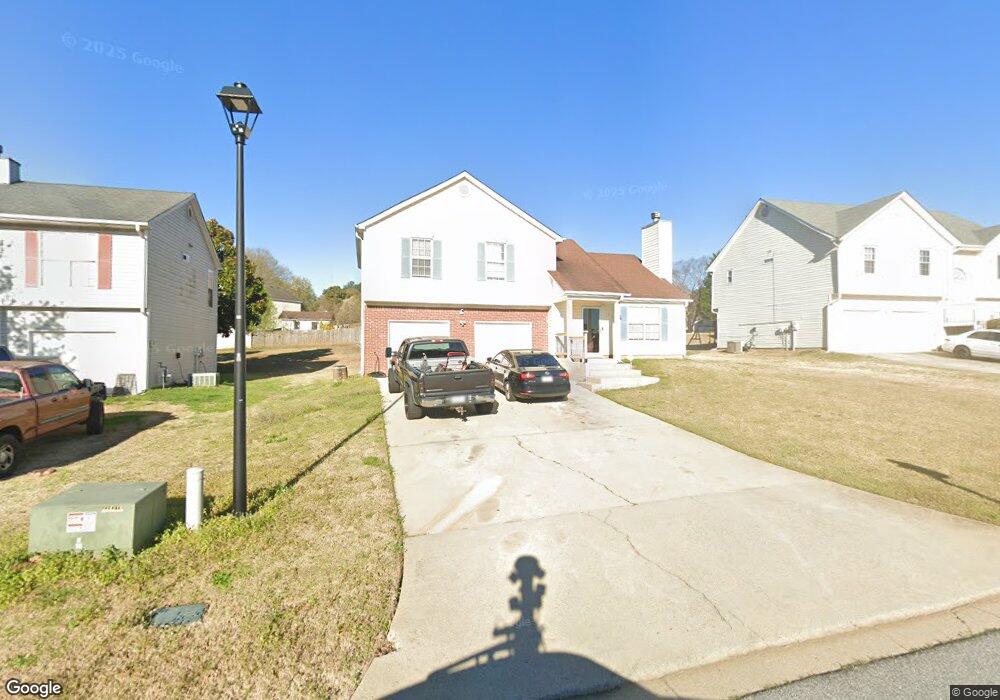
527 Brenston Blvd Ellenwood, GA 30294
Estimated Value: $256,000 - $280,000
3
Beds
3
Baths
1,364
Sq Ft
$197/Sq Ft
Est. Value
About This Home
This home is located at 527 Brenston Blvd, Ellenwood, GA 30294 and is currently estimated at $268,146, approximately $196 per square foot. 527 Brenston Blvd is a home located in Clayton County with nearby schools including Thurgood Marshall Elementary School, Morrow Middle School, and Morrow High School.
Ownership History
Date
Name
Owned For
Owner Type
Purchase Details
Closed on
Dec 30, 2010
Sold by
Federal Natl Mtg Assn Fnma
Bought by
Tran Phong T and Cao Truc
Current Estimated Value
Purchase Details
Closed on
Sep 7, 2010
Sold by
Hsbc Mtg Corp Usa
Bought by
Federal Natl Mtg Assn Fnma
Purchase Details
Closed on
Dec 3, 1999
Sold by
Gt Architecture Contractors Corp
Bought by
Chheng Saren
Home Financials for this Owner
Home Financials are based on the most recent Mortgage that was taken out on this home.
Original Mortgage
$111,282
Interest Rate
7.85%
Mortgage Type
New Conventional
Create a Home Valuation Report for This Property
The Home Valuation Report is an in-depth analysis detailing your home's value as well as a comparison with similar homes in the area
Home Values in the Area
Average Home Value in this Area
Purchase History
| Date | Buyer | Sale Price | Title Company |
|---|---|---|---|
| Tran Phong T | -- | -- | |
| Federal Natl Mtg Assn Fnma | -- | -- | |
| Hsbc Mtg Corp Usa | $110,578 | -- | |
| Chheng Saren | $112,200 | -- |
Source: Public Records
Mortgage History
| Date | Status | Borrower | Loan Amount |
|---|---|---|---|
| Previous Owner | Chheng Saren | $111,282 |
Source: Public Records
Tax History Compared to Growth
Tax History
| Year | Tax Paid | Tax Assessment Tax Assessment Total Assessment is a certain percentage of the fair market value that is determined by local assessors to be the total taxable value of land and additions on the property. | Land | Improvement |
|---|---|---|---|---|
| 2024 | $4,381 | $111,320 | $8,800 | $102,520 |
| 2023 | $3,865 | $107,040 | $8,800 | $98,240 |
| 2022 | $3,443 | $86,760 | $8,800 | $77,960 |
| 2021 | $2,918 | $72,920 | $8,800 | $64,120 |
| 2020 | $2,875 | $70,943 | $8,800 | $62,143 |
| 2019 | $2,707 | $65,744 | $6,400 | $59,344 |
| 2018 | $2,207 | $53,425 | $6,400 | $47,025 |
| 2017 | $1,825 | $43,910 | $6,400 | $37,510 |
| 2016 | $1,298 | $30,964 | $6,400 | $24,564 |
| 2015 | $1,277 | $0 | $0 | $0 |
| 2014 | $1,216 | $29,619 | $6,400 | $23,219 |
Source: Public Records
Map
Nearby Homes
- 5712 Wesson Dr Unit 2
- 2635 Luke Dr
- 5753 Gum Ct
- 5790 Twain Dr
- 0 Old Rex Morrow Rd Unit 7659496
- 0 Old Rex Morrow Rd Unit 10616003
- 5871 Dan Dr
- 2382 Old Rex Morrow Rd
- 2436 Rex Rd
- 0 Poplar Ave Unit 10580022
- 0 Poplar Ave Unit 10481115
- 0 Poplar Ave Unit 7543163
- 2850 Amerson Trail
- 2811 Appaloosa Run
- 2276 Santa fe St Unit 19
- 2272 Santa fe St Unit 21
- 2274 Santa fe St Unit 20
- 5838 Highway 42
- 6010 Fieldcrest Dr
- 2247 Cypress Ave
- 519 Brenston Blvd
- 535 Brenston Blvd
- 2511 Brenston Dr
- 543 Brenston Blvd Unit 1
- 0 Brenston Blvd Unit 8261893
- 0 Brenston Blvd Unit 8768485
- 0 Brenston Blvd Unit 3125634
- 0 Brenston Blvd Unit 3259497
- 0 Brenston Blvd Unit 7159001
- 0 Brenston Blvd Unit 7277173
- 0 Brenston Blvd Unit 7403193
- 0 Brenston Blvd
- 2517 Brenston Dr
- 2507 Brenston Dr
- 530 Brenston Blvd Unit 26
- 530 Brenston Blvd Unit 1
- 522 Brenston Blvd Unit 1
- 538 Brenston Blvd Unit 1
- 538 Brenston Blvd
- 538 Brenston Blvd Unit 25