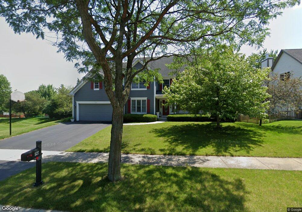
527 Carolian Dr Lake Zurich, IL 60047
Estimated Value: $634,000 - $789,000
--
Bed
4
Baths
2,966
Sq Ft
$234/Sq Ft
Est. Value
About This Home
This home is located at 527 Carolian Dr, Lake Zurich, IL 60047 and is currently estimated at $695,139, approximately $234 per square foot. 527 Carolian Dr is a home located in Lake County with nearby schools including Sarah Adams Elementary School, Lake Zurich Middle School - South Campus, and Lake Zurich High School.
Ownership History
Date
Name
Owned For
Owner Type
Purchase Details
Closed on
Aug 9, 1996
Sold by
American National Bk & Tr Co Of Chicago
Bought by
Howser Douglas A and Howser Lucinda M
Current Estimated Value
Home Financials for this Owner
Home Financials are based on the most recent Mortgage that was taken out on this home.
Original Mortgage
$247,650
Outstanding Balance
$18,987
Interest Rate
7.87%
Estimated Equity
$676,152
Create a Home Valuation Report for This Property
The Home Valuation Report is an in-depth analysis detailing your home's value as well as a comparison with similar homes in the area
Home Values in the Area
Average Home Value in this Area
Purchase History
| Date | Buyer | Sale Price | Title Company |
|---|---|---|---|
| Howser Douglas A | $155,000 | -- |
Source: Public Records
Mortgage History
| Date | Status | Borrower | Loan Amount |
|---|---|---|---|
| Open | Howser Douglas A | $247,650 |
Source: Public Records
Tax History Compared to Growth
Tax History
| Year | Tax Paid | Tax Assessment Tax Assessment Total Assessment is a certain percentage of the fair market value that is determined by local assessors to be the total taxable value of land and additions on the property. | Land | Improvement |
|---|---|---|---|---|
| 2024 | $11,786 | $184,026 | $37,759 | $146,267 |
| 2023 | $12,494 | $165,817 | $34,023 | $131,794 |
| 2022 | $12,494 | $164,591 | $27,923 | $136,668 |
| 2021 | $12,064 | $160,373 | $27,207 | $133,166 |
| 2020 | $11,847 | $160,373 | $27,207 | $133,166 |
| 2019 | $11,665 | $158,974 | $26,970 | $132,004 |
| 2018 | $11,342 | $155,211 | $29,016 | $126,195 |
| 2017 | $11,265 | $153,340 | $28,666 | $124,674 |
| 2016 | $11,047 | $148,484 | $27,758 | $120,726 |
| 2015 | $10,894 | $141,427 | $26,439 | $114,988 |
| 2014 | $11,196 | $143,632 | $29,375 | $114,257 |
| 2012 | $10,649 | $143,934 | $29,437 | $114,497 |
Source: Public Records
Map
Nearby Homes
- 533 Surryse Rd
- 600 Ivy Ct
- 429 Grand Ave
- 155 Canterbury Way
- 795 Harvest Dr
- 890 June Terrace Unit 140
- 898 S Rand Rd
- 54 Mionske Dr
- 77 Mionske Dr
- 21839 Cambridge Dr
- 21742 N Ashley St
- 21763 Deerpath Rd
- 27 Maple Ave
- 20992 W Preserve Dr
- 21186 W Preserve Dr
- 461 N Newberry Ct
- 21031 N Quentin Rd
- 21041-51 N Quentin Rd
- 99 Quentin Rd
- O Midlothian Rd