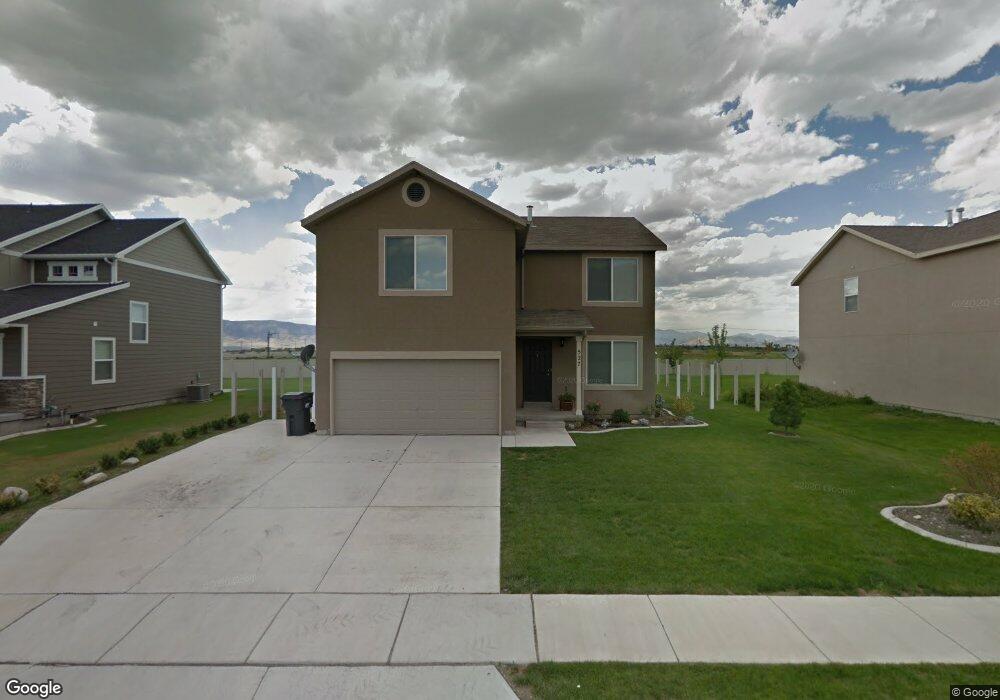
527 N 1790 W Lindon, UT 84042
Estimated Value: $542,000 - $592,000
3
Beds
2
Baths
1,850
Sq Ft
$302/Sq Ft
Est. Value
About This Home
This home is located at 527 N 1790 W, Lindon, UT 84042 and is currently estimated at $558,876, approximately $302 per square foot. 527 N 1790 W is a home located in Utah County with nearby schools including Lindon Elementary School, Oak Canyon Junior High School, and Pleasant Grove High School.
Ownership History
Date
Name
Owned For
Owner Type
Purchase Details
Closed on
Sep 24, 2018
Sold by
Carter Caley
Bought by
Laycock Robert G and Laycock Katherine L
Current Estimated Value
Home Financials for this Owner
Home Financials are based on the most recent Mortgage that was taken out on this home.
Original Mortgage
$260,950
Outstanding Balance
$227,095
Interest Rate
4.5%
Mortgage Type
New Conventional
Estimated Equity
$331,781
Purchase Details
Closed on
Jul 20, 2012
Sold by
Sweat W Rustin W and Sweat Karli R
Bought by
Carter Caley
Home Financials for this Owner
Home Financials are based on the most recent Mortgage that was taken out on this home.
Original Mortgage
$192,057
Interest Rate
3.62%
Mortgage Type
FHA
Purchase Details
Closed on
Nov 2, 2007
Sold by
Fieldstone Homes Utah Llc
Bought by
Sweat W Rustin W and Sweat Karli R
Home Financials for this Owner
Home Financials are based on the most recent Mortgage that was taken out on this home.
Original Mortgage
$190,050
Interest Rate
6.29%
Mortgage Type
Purchase Money Mortgage
Create a Home Valuation Report for This Property
The Home Valuation Report is an in-depth analysis detailing your home's value as well as a comparison with similar homes in the area
Home Values in the Area
Average Home Value in this Area
Purchase History
| Date | Buyer | Sale Price | Title Company |
|---|---|---|---|
| Laycock Robert G | -- | Inwest Title | |
| Carter Caley | -- | Invest Title Services Inc | |
| Sweat W Rustin W | -- | Bartlett Title Insurance Ag |
Source: Public Records
Mortgage History
| Date | Status | Borrower | Loan Amount |
|---|---|---|---|
| Open | Laycock Robert G | $260,950 | |
| Previous Owner | Carter Caley | $192,057 | |
| Previous Owner | Sweat W Rustin W | $190,050 |
Source: Public Records
Tax History Compared to Growth
Tax History
| Year | Tax Paid | Tax Assessment Tax Assessment Total Assessment is a certain percentage of the fair market value that is determined by local assessors to be the total taxable value of land and additions on the property. | Land | Improvement |
|---|---|---|---|---|
| 2025 | $2,077 | $274,615 | $239,200 | $260,100 |
| 2024 | $2,077 | $255,695 | $0 | $0 |
| 2023 | $1,952 | $258,005 | $0 | $0 |
| 2022 | $2,162 | $276,100 | $0 | $0 |
| 2021 | $1,850 | $356,300 | $150,200 | $206,100 |
| 2020 | $1,733 | $328,500 | $134,100 | $194,400 |
| 2019 | $1,537 | $303,900 | $120,000 | $183,900 |
| 2018 | $1,455 | $271,100 | $98,800 | $172,300 |
| 2017 | $1,395 | $139,425 | $0 | $0 |
| 2016 | $1,335 | $123,420 | $0 | $0 |
| 2015 | $1,388 | $121,275 | $0 | $0 |
| 2014 | $1,246 | $107,855 | $0 | $0 |
Source: Public Records
Map
Nearby Homes
- 337 N Brookview Dr
- 556 N Buffalo Grass Ln
- 566 N Buffalo Grass Ln
- 554 N Buffalo Grass Ln
- 570 N Buffalo Grass Ln
- 564 N Buffalo Grass Ln
- 564 N Buffalo Grass Ln Unit 1250
- 558 N Buffalo Grass Ln
- 575 N Buffalo Grass Ln
- 574 N Cornstalk Ln
- 582 N Cornstalk Ln
- 568 N Buffalo Grass Ln
- 560 N Buffalo Grass Ln
- 605 N Buffalo Grass Ln
- 600 N Cornstalk Ln
- 572 N Buffalo Grass Ln
- 1362 W Valley Dr
- 611 N Briarwood Ln
- 1309 W Sweet Corn Ln
- Kirkwood Farmhouse Plan at Anderson Farms