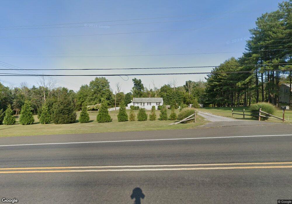
527 Route 31 N Ringoes, NJ 08551
Estimated Value: $403,250 - $578,000
--
Bed
--
Bath
1,248
Sq Ft
$377/Sq Ft
Est. Value
About This Home
This home is located at 527 Route 31 N, Ringoes, NJ 08551 and is currently estimated at $470,063, approximately $376 per square foot. 527 Route 31 N is a home located in Hunterdon County with nearby schools including East Amwell Township, Hunterdon Central Regional High School District, and Our Hope Christian Academy.
Ownership History
Date
Name
Owned For
Owner Type
Purchase Details
Closed on
Sep 23, 2019
Sold by
Keller Tabitha K and Keller Leonard Brian
Bought by
Hope Howard
Current Estimated Value
Home Financials for this Owner
Home Financials are based on the most recent Mortgage that was taken out on this home.
Original Mortgage
$259,462
Outstanding Balance
$227,269
Interest Rate
3.6%
Mortgage Type
FHA
Estimated Equity
$242,794
Purchase Details
Closed on
Apr 6, 2017
Sold by
Franke Gilbert
Bought by
Franke Gilbert
Purchase Details
Closed on
Mar 23, 2015
Sold by
Omick Gladys M
Bought by
Keller Tabitha K
Create a Home Valuation Report for This Property
The Home Valuation Report is an in-depth analysis detailing your home's value as well as a comparison with similar homes in the area
Home Values in the Area
Average Home Value in this Area
Purchase History
| Date | Buyer | Sale Price | Title Company |
|---|---|---|---|
| Hope Howard | $265,000 | Cortes & Hay Title Agcy Inc | |
| Franke Gilbert | -- | None Available | |
| Keller Tabitha K | $260,000 | Nassau Abstract Llc |
Source: Public Records
Mortgage History
| Date | Status | Borrower | Loan Amount |
|---|---|---|---|
| Open | Hope Howard | $259,462 |
Source: Public Records
Tax History Compared to Growth
Tax History
| Year | Tax Paid | Tax Assessment Tax Assessment Total Assessment is a certain percentage of the fair market value that is determined by local assessors to be the total taxable value of land and additions on the property. | Land | Improvement |
|---|---|---|---|---|
| 2025 | $5,672 | $214,600 | $119,500 | $95,100 |
| 2024 | $5,603 | $214,600 | $119,500 | $95,100 |
| 2023 | $5,603 | $214,600 | $119,500 | $95,100 |
| 2022 | $5,565 | $214,600 | $119,500 | $95,100 |
| 2021 | $5,286 | $214,600 | $119,500 | $95,100 |
| 2020 | $5,444 | $214,600 | $119,500 | $95,100 |
| 2019 | $5,286 | $214,600 | $119,500 | $95,100 |
| 2018 | $5,140 | $214,600 | $119,500 | $95,100 |
| 2017 | $5,099 | $214,600 | $119,500 | $95,100 |
| 2016 | $4,741 | $200,900 | $119,500 | $81,400 |
| 2015 | $4,371 | $200,900 | $119,500 | $81,400 |
| 2014 | -- | $200,900 | $119,500 | $81,400 |
Source: Public Records
Map
Nearby Homes
- 106 Rocktown Rd
- 22 Rocktown Hill Rd
- 38 John Ringo Rd
- 0 Old York Rd
- 80 Linvale Rd
- 0 Back Brook Rd
- 13 Iron Horse Dr
- 34 Back Brook Rd
- 14 Hwy202 31
- 16 U S 202
- 7 Toad Ln
- 14 Rosemont Ringoes Rd
- 9 Woodsville Rd
- 10 Pheasant Dr
- 526 County Rd Unit 579
- 0 Mount Airy-Harbourton Rd
- 58 Dunkard Church Rd
- 300 Rock Rd E
- 2 Dairy Farm Ln
- 50 Dunkard Church Rd
- 521 Route 31
- 521 New Jersey 31
- 523 Route 31 N
- 522 Route 31 N
- 515 Route 31 N
- 518 Route 31 N
- 534 Route 31 N
- 514 Route 31 N
- 520 Route 31 N
- 520 Route 31 N Unit 1
- 512 Route 31 N
- 512 New Jersey 31
- 2 Hilltop Rd
- 533 Route 31 N
- 4 Hilltop Rd
- 505 Route 31 N
- 536 Route 31 N
- 505 New Jersey 31
- 510 Route 31 N
- 6 Hilltop Rd