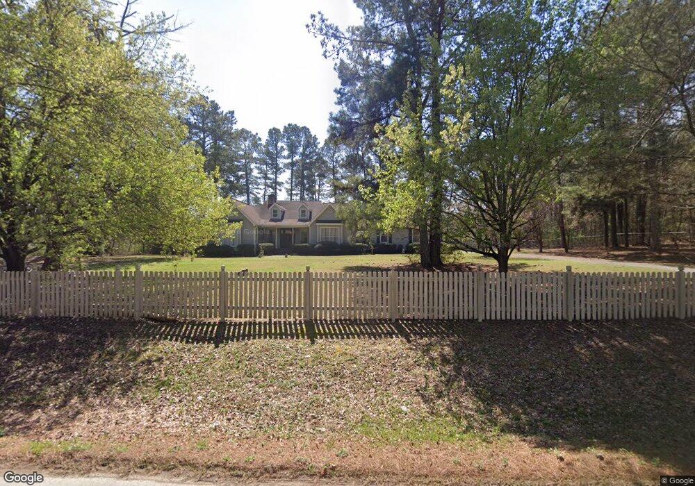
527 Stringer Rd Rockmart, GA 30153
Estimated Value: $416,000 - $484,992
3
Beds
2
Baths
2,424
Sq Ft
$190/Sq Ft
Est. Value
About This Home
This home is located at 527 Stringer Rd, Rockmart, GA 30153 and is currently estimated at $460,498, approximately $189 per square foot. 527 Stringer Rd is a home located in Polk County with nearby schools including Rockmart Middle School.
Ownership History
Date
Name
Owned For
Owner Type
Purchase Details
Closed on
Dec 11, 2025
Sold by
Harper Ashley D
Bought by
Harper Ashley D and Harper Nancy
Current Estimated Value
Home Financials for this Owner
Home Financials are based on the most recent Mortgage that was taken out on this home.
Original Mortgage
$351,037
Outstanding Balance
$350,370
Interest Rate
6.26%
Mortgage Type
Purchase Money Mortgage
Estimated Equity
$110,128
Purchase Details
Closed on
Sep 4, 2009
Sold by
Murphy Anne W
Bought by
Harper Ashley D
Home Financials for this Owner
Home Financials are based on the most recent Mortgage that was taken out on this home.
Original Mortgage
$206,196
Interest Rate
5.15%
Mortgage Type
FHA
Purchase Details
Closed on
Jul 3, 1984
Sold by
Campbell Billy
Bought by
Murphy Anne W
Purchase Details
Closed on
Jan 1, 1984
Bought by
Campbell Billy
Create a Home Valuation Report for This Property
The Home Valuation Report is an in-depth analysis detailing your home's value as well as a comparison with similar homes in the area
Home Values in the Area
Average Home Value in this Area
Purchase History
| Date | Buyer | Sale Price | Title Company |
|---|---|---|---|
| Harper Ashley D | -- | -- | |
| Harper Ashley D | $226,000 | -- | |
| Murphy Anne W | -- | -- | |
| Campbell Billy | -- | -- |
Source: Public Records
Mortgage History
| Date | Status | Borrower | Loan Amount |
|---|---|---|---|
| Open | Harper Ashley D | $351,037 | |
| Previous Owner | Harper Ashley D | $206,196 |
Source: Public Records
Tax History
| Year | Tax Paid | Tax Assessment Tax Assessment Total Assessment is a certain percentage of the fair market value that is determined by local assessors to be the total taxable value of land and additions on the property. | Land | Improvement |
|---|---|---|---|---|
| 2025 | $4,197 | $186,512 | $48,735 | $137,777 |
| 2024 | $3,613 | $172,824 | $36,552 | $136,272 |
| 2023 | $2,949 | $124,248 | $36,552 | $87,696 |
| 2022 | $2,372 | $99,936 | $24,368 | $75,568 |
| 2021 | $2,402 | $99,936 | $24,368 | $75,568 |
| 2020 | $2,407 | $99,936 | $24,368 | $75,568 |
| 2019 | $2,218 | $82,611 | $24,368 | $58,243 |
| 2018 | $2,178 | $79,038 | $24,368 | $54,670 |
| 2017 | $2,151 | $79,038 | $24,368 | $54,670 |
| 2016 | $2,036 | $74,827 | $20,157 | $54,670 |
| 2015 | $2,049 | $75,073 | $20,157 | $54,916 |
| 2014 | $2,064 | $75,073 | $20,157 | $54,916 |
Source: Public Records
Map
Nearby Homes
- 397 Stringer Rd
- 461 Lakeview Rd
- 93 Clay Rd
- 907 Stringer Rd
- 184 Morgan Ln
- 18 Hillside Dr
- 65 Wheeler Rd
- 865 Morgan Valley Rd
- 957 Bethlehem Rd
- 1714 Cedartown Hwy
- 60 Lee St
- 2512 Tolbert Town Rd
- 0 Tolbert Town Rd Unit 10640593
- 0 Tolbert Town Rd Unit 7678739
- 11 Lee St
- 479 Morgan Valley Rd
- 92 Autumn Path
- 0 Bethlehem Rd Unit 7730467
- 0 Bethlehem Rd Unit 10705308
- 831 Government Farm Rd
- 493 Stringer Rd
- 559 Stringer Rd
- 460 Stringer Rd
- 596 Stringer Rd
- 606 Stringer Rd
- 504 Stringer Rd
- 433 Stringer Rd
- 432 Stringer Rd
- 618 Stringer Rd
- 417 Stringer Rd
- 604 Lakeview Rd
- 414 Stringer Rd
- 548 Stringer Rd
- 665 Stringer Rd
- 592 Lakeview Rd
- 576 Lakeview Rd
- 605 Lakeview Rd
- 398 Stringer Rd
- 379 Stringer Rd
- 585 Lakeview Rd
Your Personal Tour Guide
Ask me questions while you tour the home.