Estimated Value: $571,991 - $647,000
3
Beds
2
Baths
2,015
Sq Ft
$306/Sq Ft
Est. Value
About This Home
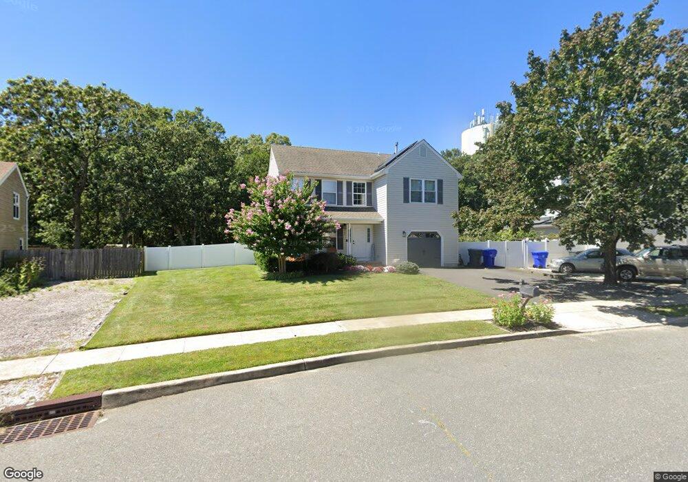
This home is located at 527 Whitehorn Ct, Brick, NJ 08723 and is currently estimated at $616,498, approximately $305 per square foot. 527 Whitehorn Ct is a home located in Ocean County with nearby schools including Osbornville Elementary School, Lake Riviera Middle School, and Brick Township High School.
Ownership History
Date
Name
Owned For
Owner Type
Purchase Details
Closed on
Oct 11, 1994
Sold by
Mountain Ridge Devel Corp
Bought by
Huizing Barry and Huizing Theresa
Current Estimated Value
Home Financials for this Owner
Home Financials are based on the most recent Mortgage that was taken out on this home.
Original Mortgage
$100,000
Interest Rate
8.49%
Create a Home Valuation Report for This Property
The Home Valuation Report is an in-depth analysis detailing your home's value as well as a comparison with similar homes in the area
Home Values in the Area
Average Home Value in this Area
Purchase History
| Date | Buyer | Sale Price | Title Company |
|---|---|---|---|
| Huizing Barry | $143,990 | -- |
Source: Public Records
Mortgage History
| Date | Status | Borrower | Loan Amount |
|---|---|---|---|
| Closed | Huizing Barry | $100,000 |
Source: Public Records
Tax History Compared to Growth
Tax History
| Year | Tax Paid | Tax Assessment Tax Assessment Total Assessment is a certain percentage of the fair market value that is determined by local assessors to be the total taxable value of land and additions on the property. | Land | Improvement |
|---|---|---|---|---|
| 2025 | $8,051 | $311,700 | $136,000 | $175,700 |
| 2024 | $7,652 | $311,700 | $136,000 | $175,700 |
| 2023 | $7,552 | $311,700 | $136,000 | $175,700 |
| 2022 | $7,552 | $311,700 | $136,000 | $175,700 |
| 2021 | $7,135 | $311,700 | $136,000 | $175,700 |
| 2020 | $7,300 | $311,700 | $136,000 | $175,700 |
| 2019 | $7,178 | $311,700 | $136,000 | $175,700 |
| 2018 | $7,013 | $311,700 | $136,000 | $175,700 |
| 2017 | $6,823 | $311,700 | $136,000 | $175,700 |
| 2016 | $6,789 | $311,700 | $136,000 | $175,700 |
| 2015 | $6,611 | $311,700 | $136,000 | $175,700 |
| 2014 | $6,558 | $311,700 | $136,000 | $175,700 |
Source: Public Records
Map
Nearby Homes
- 417 Mamie Dr
- 463 Mamie Dr
- 455 Mamie Dr
- 484 Bara St
- 570 Mantoloking Rd
- 507 Riverside Dr S
- 0 Mantoloking Rd Unit 11584872
- 618 Leanora St
- 10 Riverside Dr W
- 470 Mantoloking Rd
- 553 Kingfisher Cr
- 553 Kingfisher Cir
- 621 Preston St
- 474 Burnt Bark Rd
- 118 Law-Win Ct
- 42 Arbutus Ave
- 458 Drum Point Rd
- 455 Drum Point Rd
- 595 Kingfisher Cir
- 307 Drum Point Rd
- 525 Whitehorn Ct
- 529 Whitehorn Ct
- 523 Whitehorn Ct
- 528 Whitehorn Ct
- 526 Whitehorn Ct
- 531 Whitehorn Ct
- 524 Whitehorn Ct
- 530 Whitehorn Ct
- 521 Whitehorn Ct
- 524 Adamston Rd
- 519 Whitehorn Ct
- 520 Old Adamston Rd
- 520 Whitehorn Ct
- 549 Mark Dr
- 546 Adamston Rd
- 522 Old Adamston Rd
- 518 Adamston Rd
- 551 Mark Dr
- 515 Dorothy Place
- 513 Dorothy Place