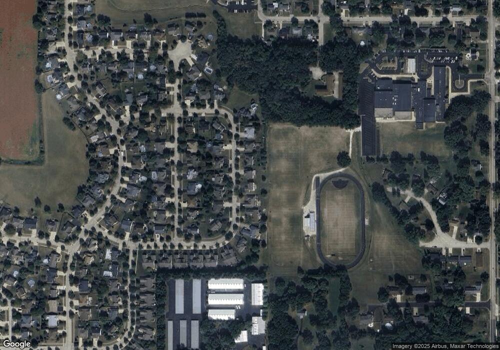
527 Whitetail Cir Hampshire, IL 60140
Estimated Value: $423,000 - $464,000
4
Beds
3
Baths
2,646
Sq Ft
$169/Sq Ft
Est. Value
About This Home
This home is located at 527 Whitetail Cir, Hampshire, IL 60140 and is currently estimated at $447,034, approximately $168 per square foot. 527 Whitetail Cir is a home located in Kane County with nearby schools including Hampshire Elementary School, Hampshire Middle School, and Hampshire High School.
Ownership History
Date
Name
Owned For
Owner Type
Purchase Details
Closed on
Dec 3, 2002
Sold by
Spartz Paul G
Bought by
Spartz Suzanne M
Current Estimated Value
Home Financials for this Owner
Home Financials are based on the most recent Mortgage that was taken out on this home.
Original Mortgage
$80,000
Outstanding Balance
$33,795
Interest Rate
6.01%
Estimated Equity
$413,239
Purchase Details
Closed on
Jan 26, 1998
Sold by
The Old Second National Bank Of Aurora
Bought by
Spartz Paul G and Spartz Suzanne M
Create a Home Valuation Report for This Property
The Home Valuation Report is an in-depth analysis detailing your home's value as well as a comparison with similar homes in the area
Home Values in the Area
Average Home Value in this Area
Purchase History
| Date | Buyer | Sale Price | Title Company |
|---|---|---|---|
| Spartz Suzanne M | -- | Chicago Title Insurance Co | |
| Spartz Paul G | $47,000 | First American Title Ins Co |
Source: Public Records
Mortgage History
| Date | Status | Borrower | Loan Amount |
|---|---|---|---|
| Open | Spartz Suzanne M | $80,000 |
Source: Public Records
Tax History Compared to Growth
Tax History
| Year | Tax Paid | Tax Assessment Tax Assessment Total Assessment is a certain percentage of the fair market value that is determined by local assessors to be the total taxable value of land and additions on the property. | Land | Improvement |
|---|---|---|---|---|
| 2024 | $8,431 | $122,841 | $34,541 | $88,300 |
| 2023 | $8,041 | $110,498 | $31,070 | $79,428 |
| 2022 | $7,541 | $99,713 | $28,554 | $71,159 |
| 2021 | $6,931 | $91,230 | $26,935 | $64,295 |
| 2020 | $6,816 | $88,737 | $26,199 | $62,538 |
| 2019 | $6,744 | $85,835 | $25,342 | $60,493 |
| 2018 | $6,589 | $81,099 | $23,944 | $57,155 |
| 2017 | $6,388 | $77,890 | $22,997 | $54,893 |
| 2016 | $6,224 | $72,749 | $21,148 | $51,601 |
| 2015 | -- | $67,617 | $19,656 | $47,961 |
| 2014 | -- | $65,387 | $19,008 | $46,379 |
| 2013 | -- | $69,568 | $20,223 | $49,345 |
Source: Public Records
Map
Nearby Homes
- 602 Woodside Terrace
- 704 S State St
- LOT 37 W Oak Knoll Dr
- 895 S State St
- 120 Jack Dylan Dr
- 190 Grove Ave
- 244 Panama Ave
- 125 Mill Ave
- 263 E Jackson Ave
- 804 Briar Glen Ct
- 820 Briar Glen Ct
- 862 Briar Glen Ct
- 318 Old Mill Ln
- 699 Centennial Dr
- 286 Wild Prairie Pointe
- 284 Wild Prairie Pointe
- 283 Wild Prairie Pointe
- 282 Wild Prairie Pointe
- Lot 0 N State St
- 222 White Oak St
- 529 Whitetail Cir
- 525 Whitetail Cir
- 531 Whitetail Cir
- 523 Whitetail Cir
- 526 Whitetail Cir
- 524 Whitetail Cir
- 528 Whitetail Cir
- 521 Whitetail Cir
- 533 Whitetail Cir
- 522 Whitetail Cir
- 530 Whitetail Cir
- 513 Whitetail Cir
- 507 Fox Run Ln
- 535 Whitetail Cir
- 505 Fox Run Ln
- 509 Fox Run Ln
- 519 Whitetail Cir
- 534 Whitetail Cir
- 503 Fox Run Ln
- 511 Fox Run Ln
