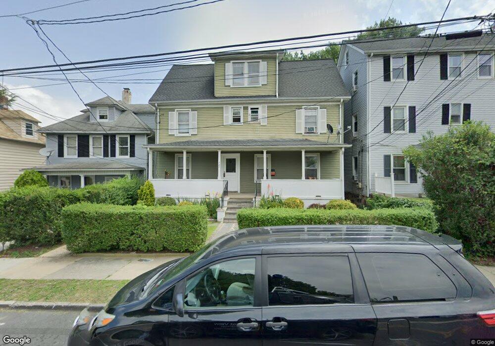
527 Willett Ave Port Chester, NY 10573
Estimated Value: $679,375 - $817,000
6
Beds
3
Baths
2,820
Sq Ft
$270/Sq Ft
Est. Value
About This Home
This home is located at 527 Willett Ave, Port Chester, NY 10573 and is currently estimated at $760,094, approximately $269 per square foot. 527 Willett Ave is a home located in Westchester County with nearby schools including Port Chester Middle School, Port Chester Senior High School, and Westchester Fairfield Hebrew A.
Ownership History
Date
Name
Owned For
Owner Type
Purchase Details
Closed on
Feb 25, 2008
Sold by
Medina Luis Mario
Bought by
Barajas Jose
Current Estimated Value
Home Financials for this Owner
Home Financials are based on the most recent Mortgage that was taken out on this home.
Original Mortgage
$432,000
Interest Rate
5.57%
Mortgage Type
Purchase Money Mortgage
Create a Home Valuation Report for This Property
The Home Valuation Report is an in-depth analysis detailing your home's value as well as a comparison with similar homes in the area
Home Values in the Area
Average Home Value in this Area
Purchase History
| Date | Buyer | Sale Price | Title Company |
|---|---|---|---|
| Barajas Jose | $480,000 | Stewart Title Insurance Co |
Source: Public Records
Mortgage History
| Date | Status | Borrower | Loan Amount |
|---|---|---|---|
| Previous Owner | Barajas Jose | $432,000 |
Source: Public Records
Tax History Compared to Growth
Tax History
| Year | Tax Paid | Tax Assessment Tax Assessment Total Assessment is a certain percentage of the fair market value that is determined by local assessors to be the total taxable value of land and additions on the property. | Land | Improvement |
|---|---|---|---|---|
| 2024 | $15,056 | $672,200 | $120,100 | $552,100 |
| 2023 | $15,244 | $628,200 | $114,400 | $513,800 |
| 2022 | $12,077 | $592,600 | $114,400 | $478,200 |
| 2021 | $12,537 | $481,000 | $114,400 | $366,600 |
| 2020 | $10,967 | $471,600 | $114,400 | $357,200 |
| 2019 | $14,515 | $376,300 | $114,400 | $261,900 |
| 2018 | $9,122 | $349,500 | $115,600 | $233,900 |
| 2017 | $1,538 | $367,700 | $107,000 | $260,700 |
| 2016 | $13,563 | $349,400 | $101,900 | $247,500 |
| 2015 | -- | $344,300 | $112,100 | $232,200 |
| 2014 | -- | $298,100 | $85,800 | $212,300 |
| 2013 | -- | $298,100 | $85,800 | $212,300 |
Source: Public Records
Map
Nearby Homes
- 531 1/2 Willett Ave
- 558 Locust Ave
- 180 Madison Ave
- 238 Madison Ave
- 340 Locust Ave
- 38 Riverdale Ave
- 53 Linden St
- 412 Orchard St
- 26 Homestead Ln Unit A
- 95 Byram Rd
- 14 Sherman Ave
- 16 Rollhaus Place
- 220 Chestnut St Unit 2K
- 23 Pemberwick Rd
- 18 Sherman Ave
- 374 King St
- 325 King St Unit 2G
- 325 King St Unit 4D
- 325 King St Unit 6J
- 315 King St Unit 1L
- 529 Willett Ave
- 531 Willett Ave
- 517 Willett Ave
- 528 Locust Ave
- 501 Willett Ave
- 524 Locust Ave
- 530 Locust Ave
- 532 Locust Ave
- 0 Locust Ave
- 522 Locust Ave
- 533 Willett Ave
- 534 Locust Ave
- 538 Locust Ave
- 518 Locust Ave
- 535 Willett Ave
- 217 Mortimer St
- 537 Willett Ave
- 540 Locust Ave Unit 2
- 540 Locust Ave Unit 1
- 540 Locust Ave