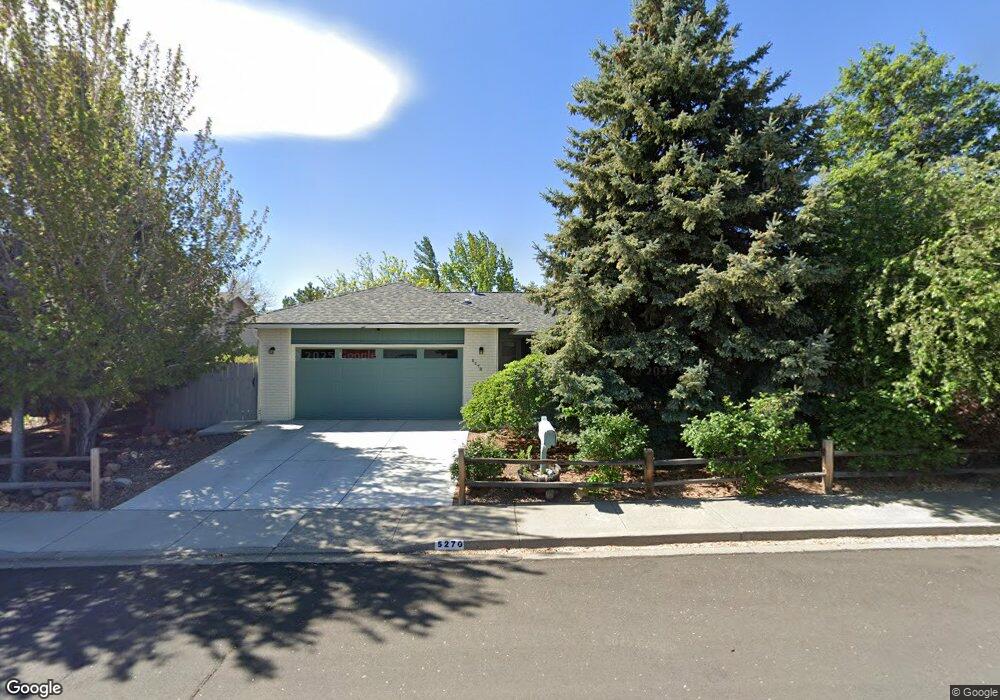
5270 Coit Dr Reno, NV 89523
Mae Anne Avenue NeighborhoodEstimated Value: $536,000 - $556,000
3
Beds
2
Baths
1,439
Sq Ft
$379/Sq Ft
Est. Value
About This Home
This home is located at 5270 Coit Dr, Reno, NV 89523 and is currently estimated at $545,104, approximately $378 per square foot. 5270 Coit Dr is a home located in Washoe County with nearby schools including Sarah Winnemucca Elementary School, B D Billinghurst Middle School, and Robert McQueen High School.
Ownership History
Date
Name
Owned For
Owner Type
Purchase Details
Closed on
Dec 11, 2020
Sold by
Jay Jones Jerry and Jay Anne Joe
Bought by
Jones Family Trust
Current Estimated Value
Home Financials for this Owner
Home Financials are based on the most recent Mortgage that was taken out on this home.
Original Mortgage
$216,200
Interest Rate
2.8%
Mortgage Type
New Conventional
Purchase Details
Closed on
Jan 26, 2019
Sold by
Jones Jerry J and Jones Joe Anne
Bought by
Jones Jerry J and Jones Joe Anne
Home Financials for this Owner
Home Financials are based on the most recent Mortgage that was taken out on this home.
Original Mortgage
$210,180
Interest Rate
4.5%
Mortgage Type
New Conventional
Purchase Details
Closed on
Apr 26, 2007
Sold by
Jones Jerry J and Jones Joe Anne
Bought by
Jones Jerry J and Jones Joe Anne
Home Financials for this Owner
Home Financials are based on the most recent Mortgage that was taken out on this home.
Original Mortgage
$225,000
Interest Rate
6.11%
Mortgage Type
Unknown
Purchase Details
Closed on
Apr 24, 2007
Sold by
Brown Scott L and Turnbull Bonnie L
Bought by
Jones Jerry J and Jones Joeanne
Home Financials for this Owner
Home Financials are based on the most recent Mortgage that was taken out on this home.
Original Mortgage
$225,000
Interest Rate
6.11%
Mortgage Type
Unknown
Purchase Details
Closed on
Dec 30, 2003
Sold by
Liv Hunt Marleen Ann
Bought by
Brown Scott L and Turnbull Bonnie L
Home Financials for this Owner
Home Financials are based on the most recent Mortgage that was taken out on this home.
Original Mortgage
$196,000
Interest Rate
5.81%
Mortgage Type
Unknown
Purchase Details
Closed on
Sep 21, 1998
Sold by
Shimkovsky Cris K and Shimkovsky Laura M
Bought by
Hunt Marleen Ann and The Marleen Ann Hunt Revocabel Living Tr
Purchase Details
Closed on
Oct 21, 1997
Sold by
Hutchings Laura M
Bought by
Shimkovsky Cris K and Shimkovsky Laura M
Home Financials for this Owner
Home Financials are based on the most recent Mortgage that was taken out on this home.
Original Mortgage
$21,840
Interest Rate
7.49%
Create a Home Valuation Report for This Property
The Home Valuation Report is an in-depth analysis detailing your home's value as well as a comparison with similar homes in the area
Home Values in the Area
Average Home Value in this Area
Purchase History
| Date | Buyer | Sale Price | Title Company |
|---|---|---|---|
| Jones Family Trust | -- | Amrock | |
| Jones Jerry Jay | -- | None Listed On Document | |
| Jones Jerry J | -- | Amrock | |
| Jones Jerry J | -- | First Centennial Title Co | |
| Jones Jerry J | $300,000 | First Centennial Title Co | |
| Brown Scott L | $245,500 | Stewart Title Of Northern Nv | |
| Hunt Marleen Ann | $157,500 | Stewart Title | |
| Shimkovsky Cris K | -- | Western Title Company Inc |
Source: Public Records
Mortgage History
| Date | Status | Borrower | Loan Amount |
|---|---|---|---|
| Previous Owner | Jones Jerry Jay | $216,200 | |
| Previous Owner | Jones Jerry J | $210,180 | |
| Previous Owner | Jones Jerry J | $225,000 | |
| Previous Owner | Brown Scott L | $196,000 | |
| Previous Owner | Shimkovsky Cris K | $21,840 |
Source: Public Records
Tax History Compared to Growth
Tax History
| Year | Tax Paid | Tax Assessment Tax Assessment Total Assessment is a certain percentage of the fair market value that is determined by local assessors to be the total taxable value of land and additions on the property. | Land | Improvement |
|---|---|---|---|---|
| 2025 | $1,971 | $85,416 | $42,028 | $43,388 |
| 2024 | $1,914 | $83,375 | $39,235 | $44,140 |
| 2023 | $1,914 | $83,847 | $41,662 | $42,185 |
| 2022 | $1,977 | $69,781 | $34,314 | $35,467 |
| 2021 | $1,813 | $59,047 | $23,441 | $35,606 |
| 2020 | $1,761 | $60,483 | $24,505 | $35,978 |
| 2019 | $1,704 | $57,295 | $22,411 | $34,884 |
| 2018 | $1,656 | $50,790 | $16,359 | $34,431 |
| 2017 | $2,211 | $49,699 | $15,262 | $34,437 |
| 2016 | $1,660 | $49,500 | $14,896 | $34,604 |
| 2015 | $2,111 | $47,790 | $13,001 | $34,789 |
| 2014 | $1,609 | $44,659 | $10,507 | $34,152 |
| 2013 | -- | $42,437 | $8,612 | $33,825 |
Source: Public Records
Map
Nearby Homes
- 2195 Santona Cir
- 2210 Altamira Dr
- 5455 Montego Ct
- 5420 Montego Ct
- 5554 Tappan Dr
- 2130 Canyon Mesa Ct
- 3996 Buckingham Square
- 2101 Soldier Pass Ct
- 3967 Kings Row
- 4059 Kings Row
- 1200 Wild Oak Ct
- 1915 Celestial Ct
- 3887 Allen Glen Dr
- 1421 Surf Way
- 5715 W Brookdale Dr
- 1245 Conway Ln
- 2273 Sapphire Ridge Way
- 5921 Sapphire Ridge Ct
- 5765 Tappan Dr
- 5721 Royal Vista Way
- 5280 Coit Dr Unit 3
- 5260 Coit Dr
- 5291 Challis Cir
- 5281 Challis Cir
- 5290 Coit Dr
- 5250 Coit Dr
- 5281 Coit Dr
- 5261 Coit Dr
- 5311 Challis Cir
- 5291 Coit Dr
- 5251 Coit Dr
- 5331 Challis Cir
- 5271 Challis Cir
- 5211 Challis Cir
- 5201 Challis Cir Unit 3
- 5221 Challis Cir
- 5301 Coit Dr
- 5191 Challis Cir
- 5241 Coit Dr
- 5251 Challis Cir