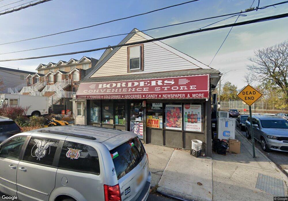
5271 Arthur Kill Rd Unit 5275 Staten Island, NY 10307
Tottenville NeighborhoodEstimated Value: $289,966
--
Bed
--
Bath
8,263
Sq Ft
$35/Sq Ft
Est. Value
About This Home
This home is located at 5271 Arthur Kill Rd Unit 5275, Staten Island, NY 10307 and is currently priced at $289,966, approximately $35 per square foot. 5271 Arthur Kill Rd Unit 5275 is a home located in Richmond County with nearby schools including P.S. 1 Tottenville, Is 34 Tottenville, and Tottenville High School.
Ownership History
Date
Name
Owned For
Owner Type
Purchase Details
Closed on
Jul 26, 2016
Sold by
Nuzzolo Anthony and Nuzzolo Christopher
Bought by
Delaglio Nicholas and Delaglio Debra Rosa
Current Estimated Value
Purchase Details
Closed on
Dec 21, 2006
Sold by
Sign Brothers Llc
Bought by
Nuzzolo Anthony and Nuzzolo Christopher
Home Financials for this Owner
Home Financials are based on the most recent Mortgage that was taken out on this home.
Original Mortgage
$465,500
Interest Rate
6.16%
Mortgage Type
Commercial
Purchase Details
Closed on
Jan 23, 2006
Sold by
Nuzzolo Ronald and Nuzzolo Grace
Bought by
Sign Brothers Llc
Purchase Details
Closed on
Jun 15, 2000
Sold by
Burke Kevin T
Bought by
Nuzzolo Ronald V and Nuzzolo Grace
Home Financials for this Owner
Home Financials are based on the most recent Mortgage that was taken out on this home.
Original Mortgage
$230,000
Interest Rate
9.5%
Mortgage Type
Seller Take Back
Create a Home Valuation Report for This Property
The Home Valuation Report is an in-depth analysis detailing your home's value as well as a comparison with similar homes in the area
Home Values in the Area
Average Home Value in this Area
Purchase History
| Date | Buyer | Sale Price | Title Company |
|---|---|---|---|
| Delaglio Nicholas | -- | The Judicial Title Ins Agenc | |
| Nuzzolo Anthony | -- | Old Republic National Title | |
| Sign Brothers Llc | $180,000 | None Available | |
| Nuzzolo Ronald V | $235,000 | Commonwealth Land Title Ins |
Source: Public Records
Mortgage History
| Date | Status | Borrower | Loan Amount |
|---|---|---|---|
| Previous Owner | Nuzzolo Anthony | $465,500 | |
| Previous Owner | Nuzzolo Ronald V | $230,000 |
Source: Public Records
Tax History Compared to Growth
Tax History
| Year | Tax Paid | Tax Assessment Tax Assessment Total Assessment is a certain percentage of the fair market value that is determined by local assessors to be the total taxable value of land and additions on the property. | Land | Improvement |
|---|---|---|---|---|
| 2025 | $10,305 | $96,750 | $40,410 | $56,340 |
| 2024 | $10,305 | $104,400 | $38,790 | $65,610 |
| 2023 | $10,655 | $100,080 | $37,170 | $62,910 |
| 2022 | $10,115 | $94,050 | $35,550 | $58,500 |
| 2021 | $8,470 | $79,200 | $35,550 | $43,650 |
| 2020 | $10,631 | $103,500 | $35,550 | $67,950 |
| 2019 | $10,040 | $118,350 | $35,550 | $82,800 |
| 2016 | $7,984 | $83,250 | $35,550 | $47,700 |
| 2015 | $7,340 | $76,500 | $35,550 | $40,950 |
| 2014 | $7,340 | $71,100 | $35,550 | $35,550 |
Source: Public Records
Map
Nearby Homes
- 5265 Arthur Kill Rd
- 397 Ellis St
- 133 Fisher Ave
- 147 Wood Ave
- 5362 Arthur Kill Rd
- 197 Craig Ave
- 42 Girard St
- 217-219 Fisher Ave
- 140 Craig Ave
- 112 Johnson Ave
- 233 Fisher Ave
- 69 Nashville St
- 46 Parker St
- 7372 Amboy Rd
- 133 Butler Ave
- 7036 Amboy Rd
- 137 Butler Ave
- 141 Butler Ave
- 21 Sprague Ave
- 5463 Arthur Kill Rd Unit 5465
- 5271 Arthur Kill Rd
- 5279A Arthur Kill Rd
- 5267 Arthur Kill Rd Unit A
- 5267 Arthur Kill Rd Unit B
- 5267 Arthur Kill Rd Unit C
- 5267 Arthur Kill Rd
- 5279B Arthur Kill Rd
- 5262 Arthur Kill Rd
- 5266 Arthur Kill Rd
- 5279C Arthur Kill Rd
- 5279 Arthur Kill Rd
- 5268-5270 Arthur Kill Rd
- 5279D Arthur Kill Rd
- 5272 Arthur Kill Rd
- 5279E Arthur Kill Rd
- 5278 Arthur Kill Rd
- 5285 Arthur Kill Rd
- 5258 Arthur Kill Rd
- 5256 Arthur Kill Rd Unit 5258
- 5256 Arthur Kill Rd Unit 5256-58