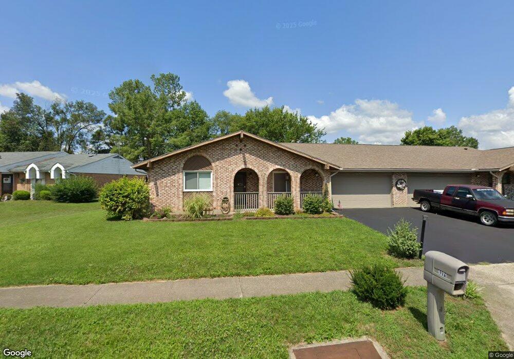
5271 Coco Dr Unit 12A Dayton, OH 45424
Estimated Value: $162,000 - $192,000
3
Beds
2
Baths
1,381
Sq Ft
$129/Sq Ft
Est. Value
About This Home
This home is located at 5271 Coco Dr Unit 12A, Dayton, OH 45424 and is currently estimated at $178,242, approximately $129 per square foot. 5271 Coco Dr Unit 12A is a home located in Montgomery County with nearby schools including Wayne High School and Pathway School of Discovery.
Ownership History
Date
Name
Owned For
Owner Type
Purchase Details
Closed on
Mar 29, 2002
Sold by
Cimprich Paul V and Cimprich John A
Bought by
Plemons Floyd D and Plemons Barbara J
Current Estimated Value
Home Financials for this Owner
Home Financials are based on the most recent Mortgage that was taken out on this home.
Original Mortgage
$84,000
Outstanding Balance
$33,554
Interest Rate
6.87%
Estimated Equity
$144,688
Purchase Details
Closed on
Mar 26, 2002
Sold by
Welker Mary C
Bought by
Plemons Floyd D and Plemons Barbara J
Home Financials for this Owner
Home Financials are based on the most recent Mortgage that was taken out on this home.
Original Mortgage
$84,000
Outstanding Balance
$33,554
Interest Rate
6.87%
Estimated Equity
$144,688
Purchase Details
Closed on
Oct 19, 1999
Sold by
Estate Of Joseph M Cimprich
Bought by
Cimprich Paul V and Cimprich John A
Purchase Details
Closed on
Sep 24, 1998
Sold by
Wiggins Sarah H
Bought by
Cimprich Joseph M
Create a Home Valuation Report for This Property
The Home Valuation Report is an in-depth analysis detailing your home's value as well as a comparison with similar homes in the area
Home Values in the Area
Average Home Value in this Area
Purchase History
| Date | Buyer | Sale Price | Title Company |
|---|---|---|---|
| Plemons Floyd D | $42,000 | -- | |
| Plemons Floyd D | $21,000 | -- | |
| Plemons Floyd D | $21,000 | -- | |
| Cimprich Paul V | -- | -- | |
| Cimprich Joseph M | $85,000 | -- | |
| Cimprich Joseph M | $85,000 | -- |
Source: Public Records
Mortgage History
| Date | Status | Borrower | Loan Amount |
|---|---|---|---|
| Open | Plemons Floyd D | $84,000 |
Source: Public Records
Tax History
| Year | Tax Paid | Tax Assessment Tax Assessment Total Assessment is a certain percentage of the fair market value that is determined by local assessors to be the total taxable value of land and additions on the property. | Land | Improvement |
|---|---|---|---|---|
| 2025 | $2,046 | $38,580 | $8,010 | $30,570 |
| 2024 | $1,976 | $38,580 | $8,010 | $30,570 |
| 2023 | $1,976 | $38,580 | $8,010 | $30,570 |
| 2022 | $1,771 | $26,980 | $5,600 | $21,380 |
| 2021 | $1,777 | $26,980 | $5,600 | $21,380 |
| 2020 | $1,778 | $26,980 | $5,600 | $21,380 |
| 2019 | $1,792 | $24,060 | $5,600 | $18,460 |
| 2018 | $1,798 | $24,060 | $5,600 | $18,460 |
| 2017 | $1,786 | $24,060 | $5,600 | $18,460 |
| 2016 | $1,984 | $26,090 | $5,600 | $20,490 |
| 2015 | $1,958 | $26,090 | $5,600 | $20,490 |
| 2014 | $1,958 | $26,090 | $5,600 | $20,490 |
| 2012 | -- | $28,860 | $5,600 | $23,260 |
Source: Public Records
Map
Nearby Homes
- 4214 Pheasant Ct Unit 4214
- 5202 Old Troy Pike
- 4105 Vitek Dr Unit 4105
- 4095 Vitek Dr Unit 4297
- 5216 Lemoyne Dr
- 4536 Powell Rd
- 4581 Pennyston Ave
- 4401 Nowak Ave
- 5422 Pitcairn Rd
- 4612 Passaic Ct
- 4457 Longfellow Ave
- 4602 Elysian Way
- 4633 Elysian Way
- 4507 Longfellow Ave
- 5669 Traymore Dr
- 4642 Kautz Dr
- 4479 Cardinal Flower Dr
- 4813 Nebraska Ave
- 5080 Tilbury Rd
- 4972 Fishburg Rd
- 5263 Coco Dr Unit 11B
- 5273 Coco Dr Unit 12B
- 5261 Coco Dr Unit 11A
- 5279 Coco Dr Unit 13A
- 5274 Coco Dr Unit 7A
- 4232 Bird Dog Ct Unit 4232
- 4224 Bird Dog Ct Unit 4224
- 5281 Coco Dr Unit 13B
- 4234 Bird Dog Ct Unit 4234
- 5257 Coco Dr
- 5266 Coco Dr Unit 8A
- 5280 Coco Dr Unit 6B
- 5272 Coco Dr Unit 7B
- 4222 Bird Dog Ct Unit 4222
- 5264 Coco Dr Unit 8B
- 5282 Coco Dr Unit 6A
- 4219 Pheasant Ct Unit 4219
- 4221 Pheasant Ct Unit 4221
- 5255 Coco Dr
- 4229 Bird Dog Ct Unit 4229
Your Personal Tour Guide
Ask me questions while you tour the home.