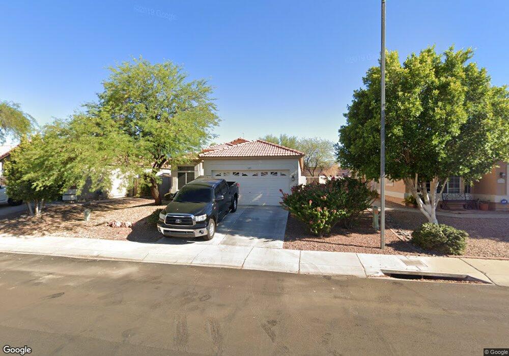
5271 W Pontiac Dr Glendale, AZ 85308
Arrowhead NeighborhoodEstimated Value: $394,545 - $457,000
--
Bed
2
Baths
1,409
Sq Ft
$310/Sq Ft
Est. Value
About This Home
This home is located at 5271 W Pontiac Dr, Glendale, AZ 85308 and is currently estimated at $436,886, approximately $310 per square foot. 5271 W Pontiac Dr is a home located in Maricopa County with nearby schools including Legend Springs Elementary School, Hillcrest Middle School, and Mountain Ridge High School.
Ownership History
Date
Name
Owned For
Owner Type
Purchase Details
Closed on
Jun 12, 1998
Sold by
Lennar Homes Of Arizona Inc
Bought by
Chrobak Douglas J
Current Estimated Value
Home Financials for this Owner
Home Financials are based on the most recent Mortgage that was taken out on this home.
Original Mortgage
$102,250
Outstanding Balance
$20,562
Interest Rate
7.11%
Mortgage Type
New Conventional
Estimated Equity
$416,324
Create a Home Valuation Report for This Property
The Home Valuation Report is an in-depth analysis detailing your home's value as well as a comparison with similar homes in the area
Home Values in the Area
Average Home Value in this Area
Purchase History
| Date | Buyer | Sale Price | Title Company |
|---|---|---|---|
| Chrobak Douglas J | $113,657 | North American Title Agency | |
| Lennar Homes Of Arizona Inc | -- | North American Title Agency |
Source: Public Records
Mortgage History
| Date | Status | Borrower | Loan Amount |
|---|---|---|---|
| Open | Chrobak Douglas J | $102,250 |
Source: Public Records
Tax History Compared to Growth
Tax History
| Year | Tax Paid | Tax Assessment Tax Assessment Total Assessment is a certain percentage of the fair market value that is determined by local assessors to be the total taxable value of land and additions on the property. | Land | Improvement |
|---|---|---|---|---|
| 2025 | $1,748 | $21,655 | -- | -- |
| 2024 | $1,727 | $20,624 | -- | -- |
| 2023 | $1,727 | $31,030 | $6,200 | $24,830 |
| 2022 | $1,682 | $23,930 | $4,780 | $19,150 |
| 2021 | $1,773 | $22,200 | $4,440 | $17,760 |
| 2020 | $1,753 | $20,950 | $4,190 | $16,760 |
| 2019 | $1,710 | $21,350 | $4,270 | $17,080 |
| 2018 | $1,667 | $20,030 | $4,000 | $16,030 |
| 2017 | $1,622 | $18,810 | $3,760 | $15,050 |
| 2016 | $1,539 | $15,850 | $3,170 | $12,680 |
| 2015 | $1,427 | $15,630 | $3,120 | $12,510 |
Source: Public Records
Map
Nearby Homes
- 5415 W Pontiac Dr
- 20390 N 54th Ave
- 5153 W Pontiac Dr
- 20283 N 51st Dr Unit 8B
- 20615 N 55th Ave
- 20391 N 55th Dr
- 20637 N 56th Ave
- 5344 W Oraibi Dr
- 19731 N 55th Ave
- 19814 N 49th Dr
- 4918 W Wahalla Ln Unit 1
- 19519 N 53rd Dr
- 20712 N 56th Ave
- 4932 W Oraibi Dr
- 5561 W Rose Garden Ln
- 4760 W Wahalla Ln
- 5422 W Topeka Dr
- 5812 W Del Lago Cir
- 5153 W Topeka Dr
- 21480 N 56th Ave
- 5275 W Pontiac Dr
- 5267 W Pontiac Dr Unit 8A
- 5279 W Pontiac Dr Unit 8A
- 5263 W Pontiac Dr
- 5272 W Pontiac Dr
- 5283 W Pontiac Dr
- 5276 W Pontiac Dr
- 5268 W Pontiac Dr Unit 8A
- 5259 W Pontiac Dr Unit 8A
- 5280 W Pontiac Dr
- 5264 W Pontiac Dr
- 5287 W Pontiac Dr Unit 8A
- 5255 W Pontiac Dr Unit 8A
- 5284 W Pontiac Dr
- 5260 W Pontiac Dr
- 5288 W Pontiac Dr
- 5291 W Pontiac Dr Unit 8A
- 5256 W Pontiac Dr Unit 8A
- 5251 W Pontiac Dr
- 5292 W Pontiac Dr Unit 8A