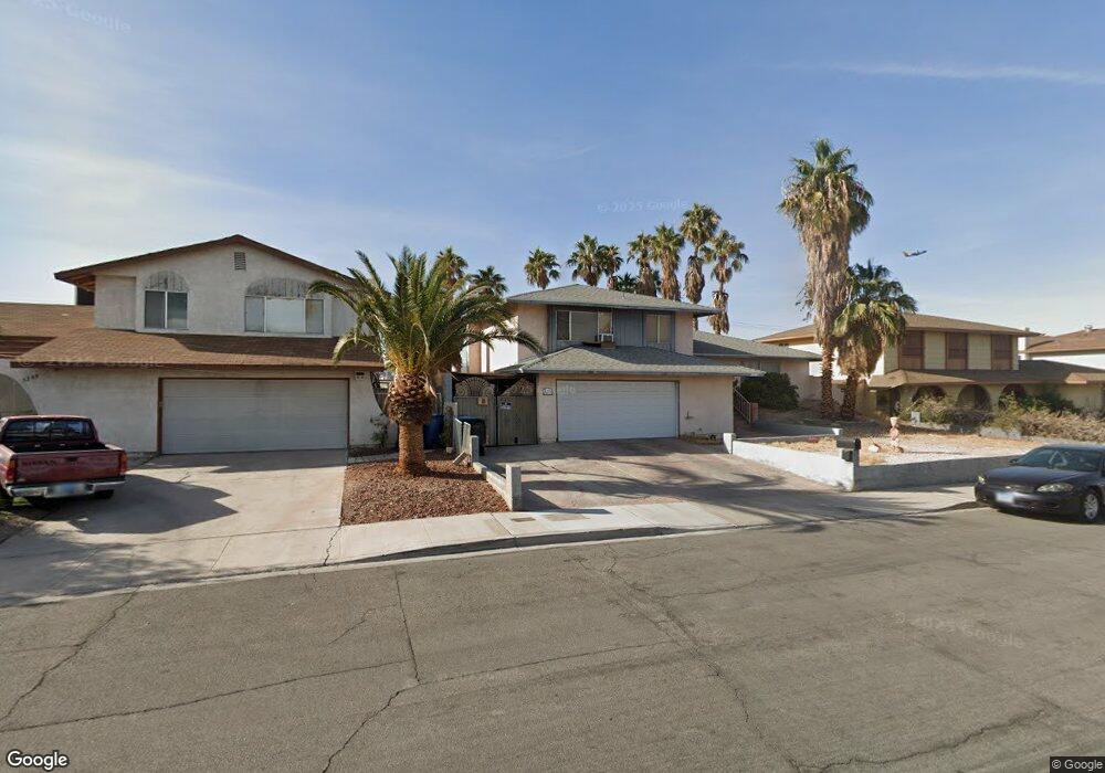
5279 Barbara Way Las Vegas, NV 89119
University District NeighborhoodEstimated Value: $442,000 - $520,000
3
Beds
3
Baths
2,254
Sq Ft
$207/Sq Ft
Est. Value
About This Home
This home is located at 5279 Barbara Way, Las Vegas, NV 89119 and is currently estimated at $467,372, approximately $207 per square foot. 5279 Barbara Way is a home located in Clark County with nearby schools including Gene Ward Elementary School, Jack Dailey Elementary School, and Helen C. Cannon Junior High School.
Ownership History
Date
Name
Owned For
Owner Type
Purchase Details
Closed on
Sep 20, 1994
Sold by
Hud
Bought by
Hayes Wanda
Current Estimated Value
Home Financials for this Owner
Home Financials are based on the most recent Mortgage that was taken out on this home.
Original Mortgage
$110,092
Interest Rate
8.58%
Mortgage Type
FHA
Purchase Details
Closed on
Dec 10, 1993
Sold by
Bancplus Mtg Corp
Bought by
Hud
Create a Home Valuation Report for This Property
The Home Valuation Report is an in-depth analysis detailing your home's value as well as a comparison with similar homes in the area
Home Values in the Area
Average Home Value in this Area
Purchase History
| Date | Buyer | Sale Price | Title Company |
|---|---|---|---|
| Hayes Wanda | -- | Stewart Title | |
| Hud | -- | First American Title Company |
Source: Public Records
Mortgage History
| Date | Status | Borrower | Loan Amount |
|---|---|---|---|
| Closed | Hayes Wanda | $110,092 |
Source: Public Records
Tax History Compared to Growth
Tax History
| Year | Tax Paid | Tax Assessment Tax Assessment Total Assessment is a certain percentage of the fair market value that is determined by local assessors to be the total taxable value of land and additions on the property. | Land | Improvement |
|---|---|---|---|---|
| 2025 | $1,464 | $72,180 | $36,050 | $36,130 |
| 2024 | $1,422 | $72,180 | $36,050 | $36,130 |
| 2023 | $1,422 | $73,190 | $37,100 | $36,090 |
| 2022 | $1,381 | $59,880 | $25,900 | $33,980 |
| 2021 | $1,341 | $59,045 | $25,900 | $33,145 |
| 2020 | $1,299 | $63,122 | $29,400 | $33,722 |
| 2019 | $1,261 | $57,017 | $23,100 | $33,917 |
| 2018 | $1,224 | $51,015 | $17,850 | $33,165 |
| 2017 | $1,529 | $52,129 | $17,850 | $34,279 |
| 2016 | $1,160 | $50,172 | $14,700 | $35,472 |
| 2015 | $1,157 | $43,686 | $11,550 | $32,136 |
| 2014 | $1,123 | $38,480 | $5,600 | $32,880 |
Source: Public Records
Map
Nearby Homes
- 861 E Hacienda Ave
- 5326 Swenson St Unit 61
- 5384 Swenson St Unit 24
- 5404 Swenson St Unit 34
- 5390 Swenson St Unit 27
- 922 Westminster Ave
- 5422 Swenson St
- 5440 Swenson St Unit 18
- 942 Westminster Ave
- 5408 S Swenson St Unit 2
- 944 de Met Dr
- 1037 Westminster Ave
- 5128 Wilbur St
- 5155 Gray Ln
- 1077 Count Wutzke Ave
- 5125 Gray Ln Unit B
- 5248 Greene Ln Unit B
- 5116 Gray Ln Unit G
- 5116 Gray Ln Unit F
- 5116 Gray Ln Unit H
- 5267 Barbara Way
- 5289 Barbara Way Unit 1
- 5278 Swenson St
- 5290 Swenson St
- 5266 Swenson St
- 5255 Barbara Way Unit 1
- 5274 Barbara Way
- 5290 Barbara Way
- 5254 Swenson St
- 5260 Barbara Way
- 5243 Barbara Way
- 841 E Hacienda Ave
- 5244 Barbara Way
- 5265 Sara Lee Cir
- 5275 Sara Lee Cir
- 851 E Hacienda Ave
- 5310 Swenson St Unit 53
- 5318 Swenson St Unit 57
- 5320 Swenson St
- 5318 Swenson St