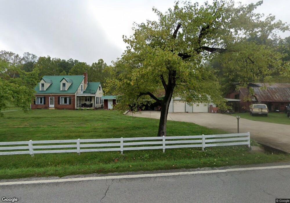
5279 State Route 141 Ironton, OH 45638
Estimated Value: $140,000 - $194,000
3
Beds
2
Baths
1,561
Sq Ft
$104/Sq Ft
Est. Value
About This Home
This home is located at 5279 State Route 141, Ironton, OH 45638 and is currently estimated at $161,587, approximately $103 per square foot. 5279 State Route 141 is a home located in Lawrence County with nearby schools including Rock Hill Elementary School, Rock Hill Middle School, and Rock Hill Senior High School.
Ownership History
Date
Name
Owned For
Owner Type
Purchase Details
Closed on
Aug 12, 2020
Sold by
Scott John A and Adams Cecil E
Bought by
Scott John A and Scott Tiffany Brooke
Current Estimated Value
Purchase Details
Closed on
Feb 1, 2018
Sold by
Scott John A
Bought by
Scott John A and Brooke Tiffany
Home Financials for this Owner
Home Financials are based on the most recent Mortgage that was taken out on this home.
Interest Rate
4.22%
Purchase Details
Closed on
Mar 1, 2017
Sold by
Martin Carolyn Kay
Bought by
John A Scott
Home Financials for this Owner
Home Financials are based on the most recent Mortgage that was taken out on this home.
Interest Rate
4.16%
Purchase Details
Closed on
Dec 22, 2011
Sold by
Hall Orlyn and Hall Kathleen
Bought by
Martin Carolyn Kay and Martin Gary Lynn
Purchase Details
Closed on
Nov 18, 1999
Sold by
Hall Emerson C
Bought by
Hall Orlyn Lowell and Hall Ka
Purchase Details
Closed on
Nov 14, 1996
Sold by
Hall Emerson C and Hall Ann A
Bought by
Hall Emerson C
Create a Home Valuation Report for This Property
The Home Valuation Report is an in-depth analysis detailing your home's value as well as a comparison with similar homes in the area
Home Values in the Area
Average Home Value in this Area
Purchase History
| Date | Buyer | Sale Price | Title Company |
|---|---|---|---|
| Scott John A | -- | None Available | |
| Scott John A | -- | -- | |
| John A Scott | $158,000 | -- | |
| Martin Carolyn Kay | -- | Attorney | |
| Hall Orlyn Lowell | $63,300 | -- | |
| Hall Emerson C | -- | -- |
Source: Public Records
Mortgage History
| Date | Status | Borrower | Loan Amount |
|---|---|---|---|
| Closed | John A Scott | -- | |
| Previous Owner | John A Scott | -- |
Source: Public Records
Tax History Compared to Growth
Tax History
| Year | Tax Paid | Tax Assessment Tax Assessment Total Assessment is a certain percentage of the fair market value that is determined by local assessors to be the total taxable value of land and additions on the property. | Land | Improvement |
|---|---|---|---|---|
| 2024 | -- | $35,320 | $4,950 | $30,370 |
| 2023 | $1,003 | $35,320 | $4,950 | $30,370 |
| 2022 | $999 | $35,320 | $4,950 | $30,370 |
| 2021 | $843 | $29,440 | $4,070 | $25,370 |
| 2020 | $866 | $29,440 | $4,070 | $25,370 |
| 2019 | $863 | $29,440 | $4,070 | $25,370 |
| 2018 | $827 | $27,640 | $4,070 | $23,570 |
| 2017 | $827 | $27,640 | $4,070 | $23,570 |
| 2016 | $517 | $27,640 | $4,070 | $23,570 |
| 2015 | $504 | $26,740 | $3,920 | $22,820 |
| 2014 | $503 | $26,740 | $3,920 | $22,820 |
| 2013 | $365 | $21,830 | $3,920 | $17,910 |
Source: Public Records
Map
Nearby Homes
- 106 County Road 5
- 3894 State Route 141
- 571 County Road 52
- 572 Township Road 145
- 572 Township Road 145 Unit KO-4
- 1165 Kitts Hill Rd
- 0 County Road 181 Unit 24215136
- 0 County Road 181 Unit 11540303
- 2480 County Road 181
- 682 County Road 105
- 859 County Road 53
- 885 County Road 53
- 1917 Woodland Dr
- 1219 Penobscot Trail
- 1222 Osage Ct
- 0 Ora Richey Rd
- 2616 S 13th St
- 2620 S 13th St
- 2001 Liberty Ave
- 2418 S 12th St
- 5338 State Route 141
- 5365 State Route 141
- 5374 State Route 141
- 5153 State Route 141
- 5211 State Route 141
- 5213 State Route 141 Unit IO-6
- 5213 State Route 141
- 121 Private Road 5322 Unit 141
- 121 Private Road 5322 Unit 141
- 5101 State Route 141
- 5101 Ohio 141
- 5090 State Route 141
- 5511 State Route 141
- 5470 State Route 141
- 5063 State Route 141
- 5533 State Route 141
- 5560 State Route 141
- 485 Private Road 688 Unit 274
- 4994 State Route 141
- 4906 State Route 141