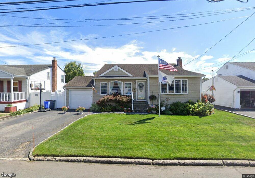
528 Heathcote Rd Lindenhurst, NY 11757
Estimated Value: $545,351 - $689,000
Studio
1
Bath
1,100
Sq Ft
$577/Sq Ft
Est. Value
About This Home
This home is located at 528 Heathcote Rd, Lindenhurst, NY 11757 and is currently estimated at $634,838, approximately $577 per square foot. 528 Heathcote Rd is a home located in Suffolk County with nearby schools including William Rall School, Lindenhurst Middle School, and Lindenhurst Senior High School.
Ownership History
Date
Name
Owned For
Owner Type
Purchase Details
Closed on
Oct 15, 2005
Sold by
Clevenger Raymond
Bought by
Wyatt David L
Current Estimated Value
Purchase Details
Closed on
Nov 5, 1999
Sold by
Sikorski Frank A and Sikorski Rose Marie
Bought by
Clevenger Raymond and Clevenger Katarzyna
Home Financials for this Owner
Home Financials are based on the most recent Mortgage that was taken out on this home.
Original Mortgage
$147,250
Interest Rate
7.81%
Purchase Details
Closed on
Jun 2, 1999
Sold by
Sikorski Frank A and Sikorski Rose Marie
Bought by
Sikorski Frank A and Sikorski Rose Marie
Create a Home Valuation Report for This Property
The Home Valuation Report is an in-depth analysis detailing your home's value as well as a comparison with similar homes in the area
Home Values in the Area
Average Home Value in this Area
Purchase History
| Date | Buyer | Sale Price | Title Company |
|---|---|---|---|
| Wyatt David L | $410,000 | Stuart Moshell | |
| Clevenger Raymond | $155,000 | First American Title Ins Co | |
| Sikorski Frank A | -- | Commonwealth Land Title Ins |
Source: Public Records
Mortgage History
| Date | Status | Borrower | Loan Amount |
|---|---|---|---|
| Previous Owner | Clevenger Raymond | $147,250 |
Source: Public Records
Tax History
| Year | Tax Paid | Tax Assessment Tax Assessment Total Assessment is a certain percentage of the fair market value that is determined by local assessors to be the total taxable value of land and additions on the property. | Land | Improvement |
|---|---|---|---|---|
| 2024 | $9,975 | $3,180 | $260 | $2,920 |
| 2023 | $9,975 | $3,180 | $260 | $2,920 |
| 2022 | $8,133 | $3,180 | $260 | $2,920 |
| 2021 | $8,133 | $3,180 | $260 | $2,920 |
| 2020 | $8,658 | $3,180 | $260 | $2,920 |
| 2019 | $8,658 | $0 | $0 | $0 |
| 2018 | $8,048 | $3,180 | $260 | $2,920 |
| 2017 | $8,048 | $3,180 | $260 | $2,920 |
| 2016 | $8,080 | $3,180 | $260 | $2,920 |
| 2015 | -- | $3,180 | $260 | $2,920 |
| 2014 | -- | $3,180 | $260 | $2,920 |
Source: Public Records
Map
Nearby Homes
- 1012 N Ontario Ave
- 87 Kellum St
- 0 Tenety Ave Unit 3461459
- 334 Robbins St
- 90 Winchester Dr
- 45 Farber Dr
- 139 Farber Dr
- 166 & 170 Woodrow Pkwy
- 702 6th St
- 224 Farber Dr Unit 224
- 633 7th St
- 266 Kellum St
- 802 Tooker Ave
- 839 7th St
- 669 East Dr
- 690 N Hamilton Ave
- 48 Farmers Ave
- 231 3rd St
- 583 Straight Path
- 916 N Clinton Ave
- 534 Heathcote Rd
- 524 Heathcote Rd
- 249 Farmers Ave
- 538 Heathcote Rd
- 518 Heathcote Rd
- 527 Heathcote Rd
- 533 Heathcote Rd
- 521 Heathcote Rd
- 253 Farmers Ave
- 537 Heathcote Rd
- 542 Heathcote Rd
- 241 Farmers Ave
- 509 Heathcote Rd
- 551 Heathcote Rd
- 508 Heathcote Rd
- 259 Farmers Ave
- 242 Farmers Ave
- 324 Tremont Rd
- 246 Farmers Ave
- 505 Heathcote Rd
Your Personal Tour Guide
Ask me questions while you tour the home.