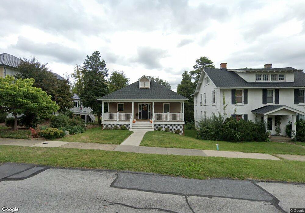
528 Maple Ave Waynesboro, VA 22980
Estimated Value: $359,000 - $379,000
3
Beds
3
Baths
1,792
Sq Ft
$206/Sq Ft
Est. Value
About This Home
This home is located at 528 Maple Ave, Waynesboro, VA 22980 and is currently estimated at $369,539, approximately $206 per square foot. 528 Maple Ave is a home located in Waynesboro City with nearby schools including Berkeley Glenn Elementary School, Kate Collins Middle School, and Waynesboro High School.
Ownership History
Date
Name
Owned For
Owner Type
Purchase Details
Closed on
Jun 28, 2023
Sold by
Toomas And Judith Rikken Living Trust
Bought by
Split Rail Properties Llc
Current Estimated Value
Purchase Details
Closed on
Feb 21, 2017
Sold by
Tallman Nancy M and Spradlin Linnea Jane Tallman
Bought by
Toomas Rikken Trustee Of The Toomas And
Create a Home Valuation Report for This Property
The Home Valuation Report is an in-depth analysis detailing your home's value as well as a comparison with similar homes in the area
Purchase History
| Date | Buyer | Sale Price | Title Company |
|---|---|---|---|
| Split Rail Properties Llc | -- | None Listed On Document | |
| Toomas Rikken Trustee Of The Toomas And | $30,000 | Court Square Title |
Source: Public Records
Tax History
| Year | Tax Paid | Tax Assessment Tax Assessment Total Assessment is a certain percentage of the fair market value that is determined by local assessors to be the total taxable value of land and additions on the property. | Land | Improvement |
|---|---|---|---|---|
| 2025 | $3,086 | $376,400 | $60,000 | $316,400 |
| 2024 | $2,713 | $352,300 | $57,500 | $294,800 |
| 2023 | $2,713 | $352,300 | $57,500 | $294,800 |
| 2022 | $2,415 | $268,300 | $55,000 | $213,300 |
| 2021 | $2,415 | $268,300 | $55,000 | $213,300 |
| 2020 | $2,200 | $244,400 | $55,000 | $189,400 |
| 2019 | $2,200 | $244,400 | $55,000 | $189,400 |
| 2018 | $356 | $39,500 | $39,500 | $0 |
| 2017 | $344 | $39,500 | $39,500 | $0 |
| 2016 | $316 | $39,500 | $39,500 | $0 |
| 2015 | $316 | $39,500 | $39,500 | $0 |
| 2014 | -- | $37,200 | $37,200 | $0 |
| 2013 | -- | $0 | $0 | $0 |
Source: Public Records
Map
Nearby Homes
- 645 Maple Ave
- 314 13th St
- 315 W 12th St
- 842 Maple Ave
- 833 Jefferson Ave
- 1215 W 12th St
- 1305 13th St
- 373 S Magnolia Ave
- 220 Elizabeth Ave
- 1133 Club Rd
- 948 S Delphine Ave
- 252 Port Republic Rd
- 315 Dupont Cir
- 701 Western Rd
- LOT 2 Port Republic Rd
- 1124 S Winchester Ave
- 222 James Ave
- 222 King Ave
- 600 E Main St
- 1637 Mulberry St