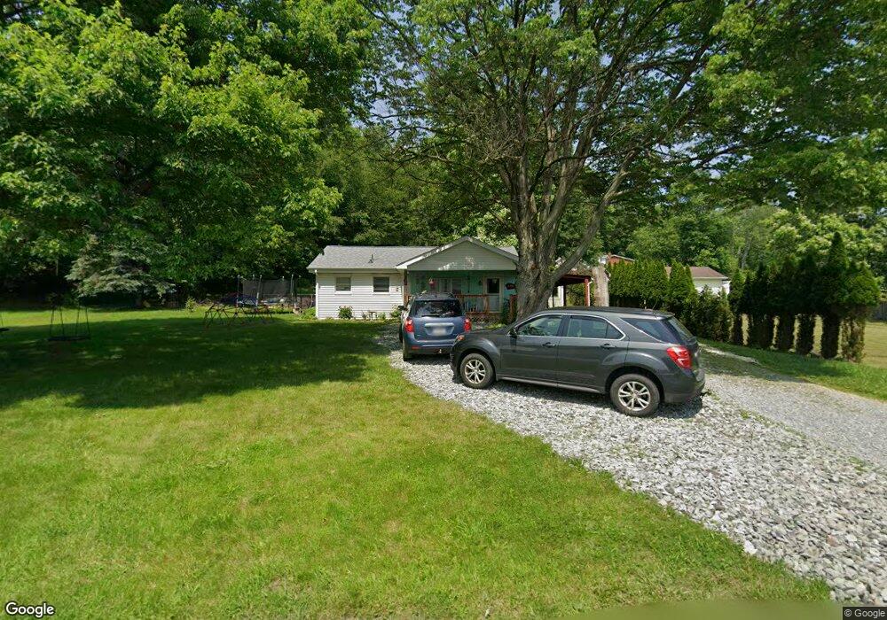
528 Mcfarland Rd Latrobe, PA 15650
Estimated Value: $124,313 - $322,000
--
Bed
--
Bath
1,058
Sq Ft
$189/Sq Ft
Est. Value
About This Home
This home is located at 528 Mcfarland Rd, Latrobe, PA 15650 and is currently estimated at $199,578, approximately $188 per square foot. 528 Mcfarland Rd is a home located in Westmoreland County with nearby schools including Grandview Elementary School, Derry Area Middle School, and Derry Area Senior High School.
Ownership History
Date
Name
Owned For
Owner Type
Purchase Details
Closed on
Mar 16, 2017
Sold by
Hauser Andrew J and Hauser Crystal M
Bought by
Hauser Andrew J and Hauser Crystal M
Current Estimated Value
Home Financials for this Owner
Home Financials are based on the most recent Mortgage that was taken out on this home.
Original Mortgage
$80,000
Interest Rate
4.15%
Mortgage Type
New Conventional
Purchase Details
Closed on
Dec 1, 2010
Sold by
Arbore James W
Bought by
Hauser Andrew J
Home Financials for this Owner
Home Financials are based on the most recent Mortgage that was taken out on this home.
Original Mortgage
$77,972
Interest Rate
3.5%
Mortgage Type
FHA
Create a Home Valuation Report for This Property
The Home Valuation Report is an in-depth analysis detailing your home's value as well as a comparison with similar homes in the area
Home Values in the Area
Average Home Value in this Area
Purchase History
| Date | Buyer | Sale Price | Title Company |
|---|---|---|---|
| Hauser Andrew J | -- | None Available | |
| Hauser Andrew J | $80,000 | None Available |
Source: Public Records
Mortgage History
| Date | Status | Borrower | Loan Amount |
|---|---|---|---|
| Previous Owner | Hauser Andrew J | $80,000 | |
| Previous Owner | Hauser Andrew J | $77,972 |
Source: Public Records
Tax History Compared to Growth
Tax History
| Year | Tax Paid | Tax Assessment Tax Assessment Total Assessment is a certain percentage of the fair market value that is determined by local assessors to be the total taxable value of land and additions on the property. | Land | Improvement |
|---|---|---|---|---|
| 2025 | $1,439 | $11,580 | $2,740 | $8,840 |
| 2024 | $1,439 | $11,580 | $2,740 | $8,840 |
| 2023 | $1,358 | $11,580 | $2,740 | $8,840 |
| 2022 | $1,347 | $11,000 | $2,160 | $8,840 |
| 2021 | $1,279 | $11,000 | $2,160 | $8,840 |
| 2020 | $1,257 | $11,000 | $2,160 | $8,840 |
| 2019 | $1,230 | $11,000 | $2,160 | $8,840 |
| 2018 | $1,175 | $11,000 | $2,160 | $8,840 |
| 2017 | $1,144 | $11,000 | $2,160 | $8,840 |
| 2016 | $1,094 | $11,000 | $2,160 | $8,840 |
| 2015 | $1,094 | $11,000 | $2,160 | $8,840 |
| 2014 | $1,094 | $11,000 | $2,160 | $8,840 |
Source: Public Records
Map
Nearby Homes
- 29 E 2nd Ave
- 307 Debora Dr
- 316 W 2nd Ave
- 229 5th Ave
- 323 Oak St
- 135 Cramer Rd
- 360 W 1st Ave
- 104 Miller St
- 342 Mckinley Ave
- 201 Thompson St
- 340 Weldon St
- 1306 Roger Drive Lot 54 B
- 145 Easy St
- 213 Chestnut St
- 712 Weldon St
- 1300 Ridge Ave
- 139 Ice House Rd
- 121 Eleanor Dr
- 274 Derbytown Rd
- 701 Fairmont St
- 520 Mcfarland Rd
- 522 Mcfarland Rd
- 521 Mcfarland Rd
- 896 Twp Rd
- 525 Mcfarland Rd
- 0 Mcfarland Rd
- 524 Mcfarland Rd
- 517 Mcfarland Rd
- Rr 2
- 511 Mcfarland Rd
- 508 Mcfarland Rd
- 510 Mcfarland Rd
- 565 Mcfarland Rd
- 132 Fern Rock Ln
- 400 Ligonier St
- 400 Ligonier St
- 21 N Ligonier St
- 21 W 4th Ave
- 27 W 4th Ave
- 3 W 4th Ave