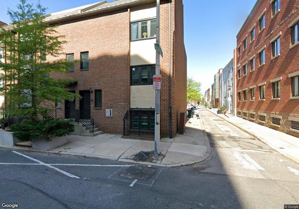
528 S 19th St Unit B Philadelphia, PA 19146
Rittenhouse Square NeighborhoodEstimated Value: $279,000 - $476,000
2
Beds
1
Bath
770
Sq Ft
$439/Sq Ft
Est. Value
About This Home
This home is located at 528 S 19th St Unit B, Philadelphia, PA 19146 and is currently estimated at $338,267, approximately $439 per square foot. 528 S 19th St Unit B is a home located in Philadelphia County with nearby schools including Albert M Greenfield School, Benjamin Franklin High School, and Independence Charter School.
Ownership History
Date
Name
Owned For
Owner Type
Purchase Details
Closed on
Mar 17, 2017
Sold by
Allen Sally E and Allen James F
Bought by
Allen James F
Current Estimated Value
Purchase Details
Closed on
Jun 10, 2015
Sold by
Allen H Franklin and Allen Sally E
Bought by
Allen Sally E and Allen James
Purchase Details
Closed on
Aug 16, 2004
Sold by
Yonekawa Patricia J and Yonekawa Patricia
Bought by
Inzinna Barbara
Purchase Details
Closed on
Dec 11, 2003
Sold by
Yonekawa Patricia J
Bought by
Yonekawa Patricia J
Home Financials for this Owner
Home Financials are based on the most recent Mortgage that was taken out on this home.
Original Mortgage
$150,000
Interest Rate
5.86%
Mortgage Type
New Conventional
Create a Home Valuation Report for This Property
The Home Valuation Report is an in-depth analysis detailing your home's value as well as a comparison with similar homes in the area
Home Values in the Area
Average Home Value in this Area
Purchase History
| Date | Buyer | Sale Price | Title Company |
|---|---|---|---|
| Allen James F | -- | None Available | |
| Allen Sally E | -- | None Available | |
| Inzinna Barbara | $295,000 | -- | |
| Yonekawa Patricia J | -- | First American Title Ins Co |
Source: Public Records
Mortgage History
| Date | Status | Borrower | Loan Amount |
|---|---|---|---|
| Previous Owner | Yonekawa Patricia J | $150,000 |
Source: Public Records
Tax History Compared to Growth
Tax History
| Year | Tax Paid | Tax Assessment Tax Assessment Total Assessment is a certain percentage of the fair market value that is determined by local assessors to be the total taxable value of land and additions on the property. | Land | Improvement |
|---|---|---|---|---|
| 2025 | $2,878 | $215,800 | $34,500 | $181,300 |
| 2024 | $2,878 | $215,800 | $34,500 | $181,300 |
| 2023 | $2,878 | $205,600 | $32,900 | $172,700 |
| 2022 | $2,822 | $205,600 | $32,900 | $172,700 |
| 2021 | $2,822 | $0 | $0 | $0 |
| 2020 | $2,822 | $0 | $0 | $0 |
| 2019 | $2,822 | $0 | $0 | $0 |
| 2018 | $0 | $0 | $0 | $0 |
| 2017 | $2,766 | $0 | $0 | $0 |
| 2016 | $16,787 | $0 | $0 | $0 |
| 2015 | $16,787 | $0 | $0 | $0 |
| 2014 | -- | $171,800 | $17,180 | $154,620 |
| 2012 | -- | $23,872 | $4,177 | $19,695 |
Source: Public Records
Map
Nearby Homes
- 1905 Rodman St
- 1917 Rodman St
- 1924 South St
- 1934 Lombard St
- 1815 Bainbridge St Unit 1
- 2005 Kater St
- 705-07 S 20th St Unit A
- 1740 Naudain St
- 719 S 19th St
- 726 S 19th St
- 2002 Waverly St
- 725 S 19th St
- 2004 Waverly St
- 1725 South St
- 1811 Fitzwater St Unit E
- 1731 Bainbridge St
- 2033 Naudain St
- 1727 Fitzwater St Unit B
- 1716-18 Addison St
- 511 S 21st St Unit 102
- 528 S 19th St Unit A
- 530 S 19th St Unit B
- 530 S 19th St Unit A
- 532 S 19th St
- 1907 Rodman St Unit 9
- 1906 Rodman St Unit B
- 1906 Rodman St Unit A
- 1906 Rodman St Unit C
- 1909 Rodman St
- 1906 Rodman St
- 1907-9 Rodman St
- 1908 Rodman St Unit 2 (B)
- 1908 Rodman St Unit 1
- 1908 Rodman St Unit 3
- 1908 Rodman St Unit 2
- 1908 Rodman St Unit C
- 1906 Naudain St
- 1904 Naudain St
- 1910 Rodman St
- 1911 Rodman St Unit 13